Sunday, May 23, 2010

Best Laid Schemes...?

But Mousie, thou art no thy lane,
In proving foresight may be vain:
The best laid schemes o' mice an' men
Gang aft agley,

An' lea'e us nought but grief an' pain,
For promis'd joy!

Robert Burns, To a Mouse, 1785

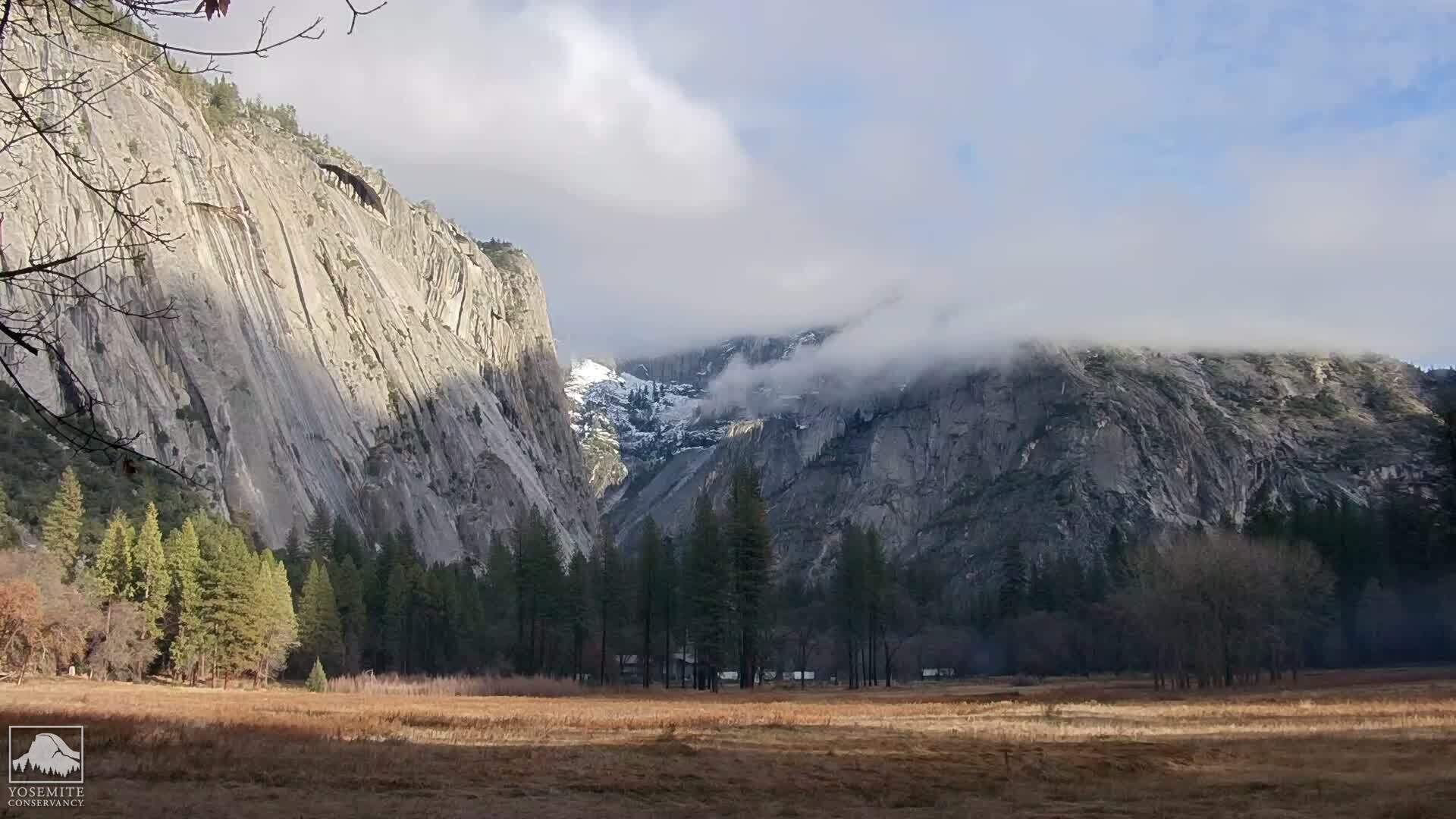
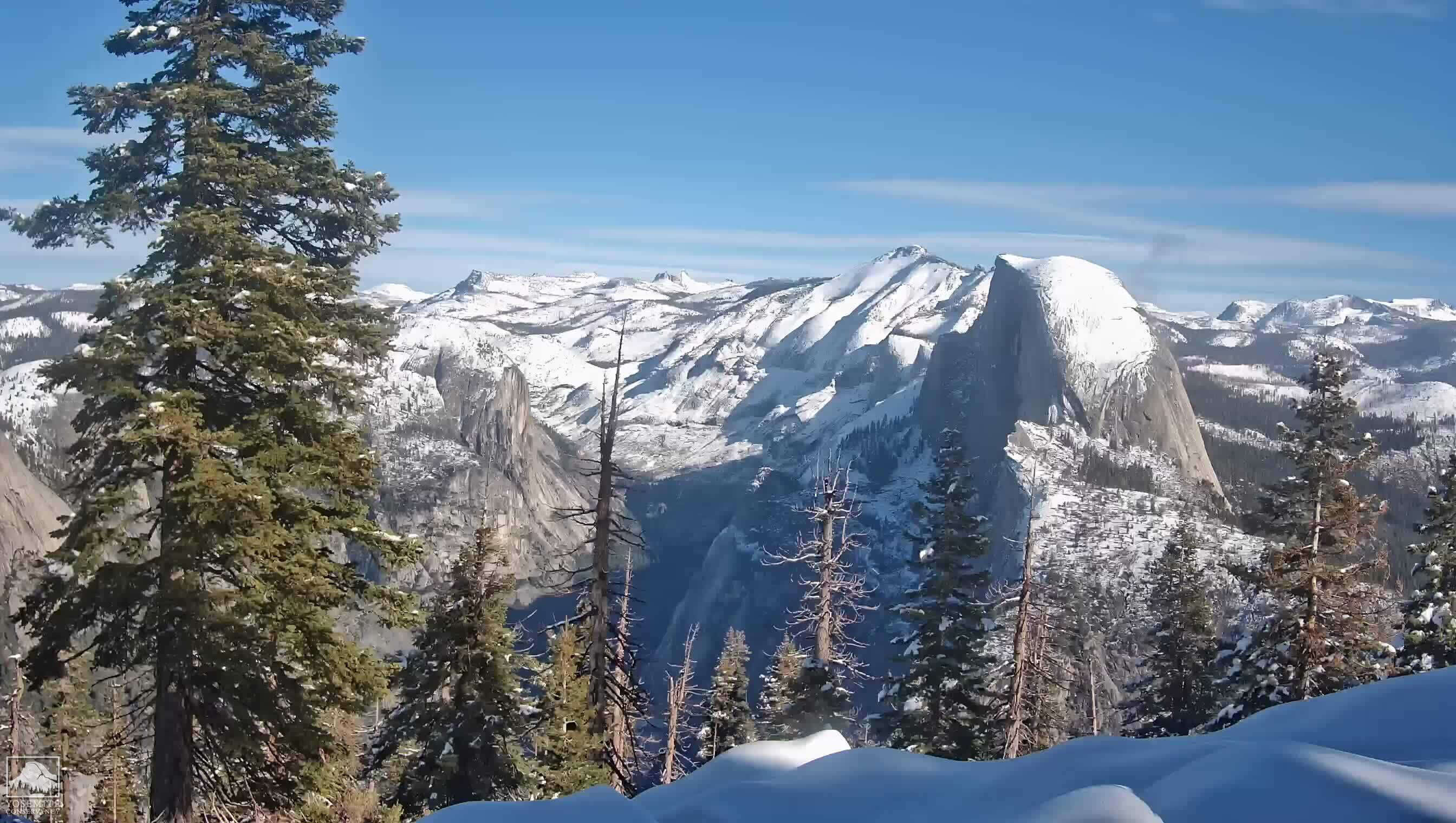
Sometimes you can't win for losing. No matter how much you prepare and get ready, there will always be circumstances out of your control. There is currently no access to Glacier Point, or the trailhead for the Panorama Trail, which is still under snow. Subdome is still covered in snow - not even the rangers can pass to put the Half Dome cables up. The cables will not be up over Memorial Day weekend and that's the weekend before we are supposed to hike into Little Yosemite Valley.

2010 has seen record levels of snow in the Sierra Nevada, currently at or above 150% of normal. I have come to the conclusion that even if the cables are up and the snow on subdome melts and the road to Glacier Point is open, it's going to be downright cold.

Do I really want to go backpacking, camping and hiking in the snow and freezing cold?

Update 8:34 pm: Snow is now forecast for Tuesday, Wednesday and Thursday of this next week:

A STORM IS FORECAST TO DEVELOP AND MOVE SOUTHEAST TOWARD CENTRAL CALIFORNIA LATE TUESDAY NIGHT... AND CONTINUE INTO WEDNESDAY AND POSSIBLY THURSDAY.

SNOW MAY BEGIN AS EARLY AS TUESDAY EVENING IN YOSEMITE PARK... AND SPREAD SOUTH ACROSS THE REST OF THE SIERRA WEDNESDAY. THE SNOW LEVEL WILL INITIALLY BE NEAR 8000 FEET... BUT LOWER TO 6000 TO 7000 FEET LATER WEDNESDAY AND THURSDAY.

SIGNIFICANT SNOW ACCUMULATIONS ARE POSSIBLE AT AND ABOVE 7000 FEET... AND COULD RANGE FROM A HALF FOOT IN SEQUOIA AND KINGS CANYON PARKS... TO OVER ONE FOOT FARTHER NORTH IN YOSEMITE PARK. BELOW THE SNOW LEVEL... PERIODS OF COLD RAIN ARE LIKELY.


This means that it is likely that Little Yosemite Valley will see at least some snowfall, as it is at 6100 feet elevation. Glacier Point, however, is at an elevation of 7214 feet, which means there will likely be significant snowfall there. This will delay the opening of the Glacier Point Road and access to the Panorama trailhead, from which we have been planning to start our hike.

Friday, May 21, 2010

Leaves of Three... Let Them Be

I guess I didn't let them be.

One of the hazards of hiking is poison oak. I must have brushed up against some during our hike in the Pinnacles. It's Spring and since the leaves are still green, I may not have noticed them among the rest of the verdant foliage.

A couple of days after our hike, while I was in the shower, I noticed a rash on the underside of each elbow, a patch on the back side of my shoulder, and one patch on my upper arm. Unfortunately, by the time I noticed it, I had already had a couple of hot showers, letting the urushiol - the chemical that causes the allergic contact dermatitis - sink deeper into my open pores.

Fortunately, there are treatments, but they aren't a panacea. Tecnu or Zanfel are probably the best products on the market, but they should be used immediately and with cold water so that the urushiol oil doesn't sink deeper into the pores. After that the only thing you can do is treat the symptoms with a hydrocortisone cream to decrease the swelling and/or a Benadryl cream to reduce the itching.

I've used them. I'm still itching. It's been almost two weeks. Time to visit the doctor and see if there is something stronger to stop this dead in its tracks.

Meanwhile, I suspect my backpack may also be infected. I used hot soapy water, with Dawn detergent, to wash my backpack thoroughly. I've also ordered some Ivy Wipes, which are supposed to help clean off equipment. Urushiol is found in poison oak, but also in poison ivy and poison sumac.

I really don't want to do this again. And I sure don't want to reinfect myself just before attempting Half Dome for the second time.

Sunday, May 9, 2010

Wildflowers and Caves at Pinnacles National Monument

It was an extremely busy day yesterday. Brunch with mom and dad in Half Moon Bay, our son's Little League game, and later the Stanford Pow Wow. We were fairly well exhausted last night, but still when we got home, we readied our packs for today's hike at Pinnacles National Monument. We got our packs ready, bought some deli sandwiches from the grocery store, and put our clothes out. Duane was not feeling well with a worsening cold, so even though he got his pack ready, he wasn't sure he would go.

Along with my Thermarest pad and tent, I also added an extra 7 pounds to my pack for a total of 35 pounds of weight. What kind of insanity causes me to add barbells to my backpack? I'm conditioning to give Half Dome another try. I need to develop muscles that are capable of carrying 35-40 pounds without flinching by simulating the weight I would carry on the day we backpack into Little Yosemite Valley.

Because the drive to this hike from San Jose is about an hour and 45 minutes, we needed to get up really early in the morning. My alarm went off at 5:00 am. Yuck. Definitely not enough sleep last night. After determining that Duane wasn't going to go because his cold was worse than yesterday, I tried to convince our son to go with me. No dice. If Daddy wasn't going, he wasn't going. The lure of caves, lizards, wildflowers, big rocks to climb on, and possibly California Condors was not strong enough to get him out of bed at 5:00 am. So I showered, got dressed, and took off by myself to our carpool rendezvous at Santa Teresa Village Shopping Center, right in front of the Nob Hill Grocery Store. I made sure to check that it had coffee and was open at 6:00 am.

Unbeknownst to me, however, the invitation that I wrote up for posting to Deb's Evite hiking list, got slightly changed. She set the carpool rendezvous time for 7:00 am. So when fellow hiker Angela called me the night before to make arrangements to be picked up in Gilroy, she didn't understand why I wanted to pick her up 15 minutes before I was supposed to leave the parking lot in Santa Teresa. And when I texted fellow hiker Chris at 6:00 am, asking if he was up yet, he just about had a heart attack thinking he was late and high tailed it out of his house. (I've got to give him kudos for getting to the parking lot at 6:15 am. I don't think I could have done it!) We didn't figure this out until we were all in the car and on our way to Pinnacles.

I had time to buy some juice, coffee, and a cinnamon breakfast roll while waiting for Chris, and we shared this in the car on the ride down. Poor Angela had to put up with two amateur radio operators in the car, but hopefully we weren't too bad and didn't bore her. The ride was free of traffic and we made great time. We got to the Visitor Center on the east side of the park, which was then closed. We thought this would be a good time for a bathroom stop, but even that was closed. So we drove on to the Old Pinnacles trailhead. I stopped at the entrance gate and purchased a new National Parks pass as mine had expired eight days previously.

After finally making our bathroom stop, we readied our packs and hit the trail at about 8:30 am. The first part of the hike was over level terrain on the Old Pinnacles trail, which follows the West Fork of Chalone Creek. The Creek was mostly dry now, but what was immediately evident was the number and variety of wildflowers in bloom. Spring came late, but it has most definitely sprung! The first thing I noticed was a new variety of monkeyflower, Notch-petaled Monkeyflower, with bigger paler blooms than the regular variety. Among the most beautiful flowers we saw early on was Elegant Clarkia - just before a coyote crossed our path.

After the first mile, we began to have incredible views of the craggy rock formations that are the Pinnacles. We began to climb a rocky trail that all but disappeared into the boulders, then followed a creek bed right into the Balconies Cave. Had I know ahead of time what I signed us up for, I might have thought twice about taking a backpack in here. There were some low and tight spots which made getting through with a backpack exceedingly difficult. I took the pack off in several places in order to get through. Although flashlights are absolutely required, the trail inside the cave is well marked with numbered sign posts and, in a few places, railings.

After emerging from the cave, we continued on the Balconies Trail until we reached the Chaparral Ranger Station. As one might expect from the name, this area is a chaparral microclimate. Views of the craggy peaks were much better on this west side of the range. From here, we hiked onto the Juniper Canyon Trail, which would take us into and up the side of the canyon traversing multiple switchbacks. From the base of the peaks, the climb looked very intimidating and even more so with me carrying my heaviest backpack to date. I wondered if it would be like the Half Dome trail out of Little Yosemite Falls with its seemingly interminable switchbacks. It was. We continued to see many beautiful wildflowers, including the Venus Thistle, Western Wallflower, Blue Dicks, and Cream Cups

About halfway up the side of the mountain, we turned onto the Tunnel Trail. This would take us up to the High Peaks Trail, avoiding the steep and narrow section while at the same heading in a direction that would complete our loop. Just before passing through the tunnel, we saw a bunch of California Condors, with their signature white beneath the wings, riding the rising air currents as they pushed up against the Pinnacles. Beautiful!

The terrain along this trail was also some of the most spectacular that I have seen on a local hike. As we rose higher and higher in the canyon, the views, both of the canyon and the Pinnacles themselves, became ever more grand. These grand rock formation are actually what remains of an ancient volcano. We had an excellent panorama view of the valley to the West towards Hollister.

The weather couldn't have been better. The average temperature for May 9th is 78 degrees, with the record high being 98 degrees. The Pinnacles is really a Spring hike as temperatures here can be as high as 110 degrees in the summer. As I planned this hike, I knew I would need to keep an eye on the weather and cancel if it got too hot. As it turned out, I didn't need to do that at all, since we've had an unseasonably cold and long winter. The temperature never got over 70 degrees. It was cloudy and overcast for much of the day. There was a small chance of rain, but so far the weather had held. We were very blessed!

Several switchbacks later after the tunnel, we reached the High Peaks trail and the ridgeline where we could see for miles in all directions. Here we sat down and ate our lunch and rested for a while. I took off my boots. My liner socks which were bunched up against my toes and causing some pain. What I needed was some Glide, but that had unfortunately been left at home. I decided to try using some chapstick instead, and that actually worked, though I think that tube is now a goner!

After lunch we continued on down the High Peaks trail towards the Old Pinnacles Trailhead. Although this trail runs through the High Peaks, it is fairly level to gently sloping in this area as it runs along the ridge line. We continued to see many beautiful wildflowers, including the Butterfly Mariposa Lily (isn't that redundant?), Indian Paintbrush, Bitter Root, the Blue Fiesta Flower and the Spreading Larkspur, which reminded me of an iris, although quite small.

Eventually, we reached a trail junction and had to decide whether to hike down the Condor Gulch Trail or keep hiking down the High Peaks Trail. Initially, I had planned to take the Condor Gulch Trail, but since Chris had a commitment after the hike and we had already seen several Condors, we opted to continue along the High Peaks trail. This shaved about one mile off the total distance of our hike, turing what would have been a nine mile hike into an eight mile hike. Given that we'd all acquitted ourselves admirably on the 1500 foot elevation change up those switchbacks, I wasn't too concerned.

The other consideration was that it was starting to sprinkle, and at times more than that. Fortunately, I had my rain poncho with me and I put it on. I still don't have a lightweight, waterproof backpacking jacket for which I've been contemplating another trip to REI.

Just as we were almost at the end of the High Peaks trail, who should we run into but Deb and her friend Roger! What a surprise! They hadn't planned to go on this hike because they had dome some very strenuous hiking the day before. What a hoot to run into them at the end of our hike.

About 200 more yards and we were back down to the flat, off the High Peaks trail and back onto the Old Pinnacles Trail that would take us back to the parking lot - and the bathroom! We stopped at the Visitor Center on the way out where I purchased a patch and book on Condors for our son.

What a magnificent and beautiful hike!

Sunday, March 28, 2010

Sore, but Determined

I woke up in the wee hours of this morning quite sore. I finished the Mud Run yesterday and I have found muscles I never knew I had. Still, I didn't want to miss today's hike to Point Reyes National Seashore, so I made my preparations last night and took an Alleve so I wouldn't feel too bad. I haven't been to Point Reyes in about four years and I've never been hiking there. So our entire family was up at 5:00 am to make the carpool rendezvous at El Paseo de Saratoga at 6:00 am for the approximately two hour drive.

We left the house a bit late but, as it happened, our friend Deb left her hiking boots at home and had to retrieve them. Thankfully, we didn't miss our carpool. Le Boulanger wasn't open yet, so I walked to Peets and got a coffee for me and some pastries for Duane and the kiddo. It was so early, I didn't have time to eat like I usually do before I left.

For this hike, we used our new backpacks. I put my new Thermarest sleeping pad and ultralight two person tent in my backpack, as well as a can of pumpkin, for added weight. I have yet to buy a sleeping bag. After adding all of the usual things in my backpack, it weighed about 25 pounds. I normally carry about 15 pounds in a loaded day pack, so I figured that was about right for today. I have about two months to get up to 40-45 pounds. I also didn't want to push it, given that I am as of yesterday a Mud Run survivor!

We took the Mill Valley exit off of Highway 101, which was the scenic route out to the seashore. I hadn't planned ahead, so I took the route my GPS offered without question even though I remembered that it probably would have been faster to go out through San Anselmo. The drive was beautiful winding roads over the back of Mt. Tamalpais down past Stinson Beach, the scene of many happy childhood and family memories.

Our two carpools met at the Estero Trailhead parking lot. We readied our packs and set off through a grassy meadow. The weather was pleasant and the temperature, mild. About 15 minutes into the hike, we entered a pine forest for a short distance, before beginning to head down sandstone hills towards the water's edge. Spring wildflowers are now out in full bloom, gracing our trail with their beauty, and causing me to fall further and further behind the pack as I stop to take photographs. Of particular note, were the many beautiful wild purple irises, pink fringed checker mallow and ice plant blossoms.

The trail conditions, however, were among the worst I have ever seen. There has evidently been no trail management for years. No diagonal boards have been placed on the trail to control run off and erosion. I had to be very careful where to put my feet in several places, for fear of twisting an ankle. Whether this negligent maintenance of the trail is due to some poorly reasoned pseudo-ecological policy, or whether it's a funding issue, I have no idea, but the sad result is the same.

The Estero Trail is aptly named, as it follows a finger of Drake's Estero or Estuary, called Home Bay. We descended to sea level, crossing Home Bay on a wooden bridge, before climbing once again over another small hill. We reached the junction of the Estero Trail and the Sunset Beach Trail and then had to make a decision: would we go out to Sunset Beach and have lunch there (a total of 8.4 miles), or would we continue to Drake's Head (for a total of 9.4 miles). Most of the hikers had not been to the Point Reyes lighthouse, so they opted for the shorter hike giving themselves time to see the lighthouse. Since we had already been to the Lighthouse, we thought about taking the longer hike out to Drake's Head, however, given my already sore muscles, we opted for the shorter hike.

By this point, the trail was really mostly a cow pasture and all of us were carefully avoiding cow patties. A couple of cows stood by peacefully grazing, occasionally gazing up at with disinterest. We walked on by. Eventually, we arrived at Sunset Beach, which could only have been named because people have watched the sunset from this spot. We sat down on some large driftwood logs and ate our lunch. The kiddo mostly played in the mud at water's edge. The "beach" was mostly covered in ice plant, which was blooming.


The rest of our group sped back to the parking lot so that they could make it to the lighthouse. We dawdled at the beach and soaked up some warm sunshine before heading back to the parking lot. On the way back, we had a beautiful view of snowy egrets on Home Bay and in the tops of the trees in the pine forest we had crossed at the start. Also visible were the meanders cutting their way through the estuary and which we could now see, their locations being revealed by the sun's afternoon position.

What a beautiful day!

Saturday, March 27, 2010

The Mud Squad

Many months ago, I agreed to do something absolutely ridiculous today. My friend Deb asked me to do the Big Sur Mud Run with her. I immediately responded, "Sure! Why not?"


I should have looked at the video of previous Mud Runs before registering. The videos showed hoardes of runners wading through four mud pits, vaulting six and three foot walls, crawling through mud under camouflage netting for a total distance of five miles. Totally covered in mud. Yuck! On the positive side, there would be cute USMC drill instructors cheering us on (yelling at us, actually) and a beer stop. (A beer stop in the middle of the race? I guess dehydration isn't a big issue...)


But it was too late! I was committed. Worse yet, there is not a single obstacle course to be found in the South Bay on which I could practice. How would I get over a six foot wall? I tried to push it out of my mind. Fortunately, it was January so this was pretty easy.

Nevertheless, I have been going to 24 Hour Fitness several times a week in an effort to lose weight and be more physically fit. But would this help? I'm not a runner. Not even remotely. With a bad Achilles tendon and a bad knee on on my right side, I felt doubtful I could do this. I could definitely walk it. But then there would be no way I would ever keep up with Deb or even Karen, who also registered to run with us.

Making the best of a ridiculous situation, I resolved to make us matching tee shirts, even though we were two people shy of a team. Duane decided we would be the Mud Squad, and it stuck! (Remembering Clarence fondly, I wondered which one of us would don an afro through the mud pits.) Of course, the only available color for our tee shirts was white. Mud. White. Good grief!

I also made reservations to stay in Marina, the night before the race at the Ramada Inn in order to avoid the long drive to Monterey on race day, March 27, 2010. After that, I tried not to think about it for the next three months, more or less successfully.

But time passes and before I knew it, it was the week of the Mud Run. I went to DSW and bought a cheap pair of running sneakers, with webbing instead of canvas or leather so that water would pass through them and they might stay on my feet. I packed some duct tape to tape my shoes on my feet. I had heard that people lost shoes running through the mud pits. Yuck! I packed my nylon/spandex gym pants, a workout bra tank top, extra clothes and a towel. I taped my magnetic clip on sunglasses to my glasses and attached my glasses to a strap in order to keep them on my head. I packed the oldest sun visor I had. It happened to be a Cal Bear visor. It was going to get muddy. Sorry Dad!

Deb drove down ahead of us, and I picked up Karen at the Sons of Norway hall in Los Gatos at 9:00 pm before heading down. That worked out fine as the kiddo had a Little League baseball game at 5:00 pm. We had just enough time to pick Karen up before leaving town. That was probably the most fortuitous part of the event. Duane happens to be Norwegian and in all the years he has lived in the South Bay, he somehow never found his way to the Sons of Norway. (I distinctly remember being promised a lutefisk dinner shortly after we were married, but this somehow never came to pass.) We were pretty tired by the time we got to our hotel, so we went to sleep immediately.

The next morning, I got up and got dressed and ready to go. I skipped the shower. Why bother, given what was to come? I went down to the lobby and had a waffle, a glass of orange juice and some coffee for breakfast. We saw a team of pirates, complete with swords, having breakfast. I wondered how they were going to get through the mud pits with their swords. Some of them had come all the way from Oregon to run this race! That's a long way to come to get muddy.

We drove out to the California State University Monterey Bay campus. The starting gate was in a parking lot just off the highway. It turns out that the orange shoe tag that I received in the mail, along with my bib number, contains some pretty nifty electronics, probably an RFID chip, that identifies start and finish times. And perhaps times at a few other locations as well.

I had only a few minutes to run to the porta potties before proceeding to the starting area, so I took my opportunity. Deb and I were in the first wave of 500 runners. Karen was in the second wave, but she joined us anyway. No one seemed to mind. All of the participants then did warms ups in the starting area. Sit ups, push ups, etc., all to the commands of our drill instructor emcee who didn't hesitate to tell us we were doing it wrong.

3... 2... 1... and our drill instructor fired the starting pistol! Off we went. I started off jogging at a decent clip. I jogged until I ran out of breath and then walked for a while, then started running again. Deb stayed with me and we decided to do intervals: running for a while, then fast walking for a while. The first part of the race was on a paved road over rolling hills. So far so good.

After about a mile and a half, we left the pavement for a trail that wound through scrub and ice plant. We could hear the yells before we even reached the first mud pit, which contained several three foot high, plastic orange road dividers. We had to climb over these and keep going through the mud. As I entered the muddy water, I screamed at the cold temperature!

We continued along this trail, which was very sandy and difficult to jog on, over and down some steeper hills. At times I was looking at the ground so I wouldn't misstep, but there were moments when I would look up and see a gorgeous view of the Pacific Ocean beyond. That was enough to make it all worth it! I continued to do intervals. Drill instructors along the way exhorted us to do better. During one of my fast walking intervals, one Marine drill instructor told me that if I didn't start running he was going to make me do "mountain climbers." I looked at him, picking up my pace as I went past, saying "Sir, I don't even know what those are." But I was sure I didn't want to find out! I kept jogging.

We came to the second obstacle, which was a six foot wall followed by a mud pit. Prior to starting, we had been instructed on how to get over these walls. You put a foot on the step and then lift yourself over, dropping down the other side feet first. Apparently some people were vaulting these walls head first - and landing on their head on the other side. Not very bright. I put my foot on the step, hopped, and didn't really go anywhere. I tried to pull myself up. I tried to lift a leg over. Nope. Too tall. In the couple of seconds that I was pondering just how to do this, someone came up from behind and pushed me over, much to my surprise! I never saw who, but in my surprise I managed to bruise my forearms and left leg going over the wall. Right after the wall was the second mud pit. We were instructed to get down on our knees and elbow and crawl through a foot of mud. I modified this to keep my wrist brace in the air, which resulted in my white tee-shirt not getting quite as muddy as everyone elses. Still I had a good splattering of mud all over.

Now we were back on pavement for a while and near the top of a hill, we reached the "beer stop". Beer on one side, and water on the other. I was really ambivalent about the beer. It was after all only 10:00 am or so. I grabbed some water. Deb grabbed some beer and poured a bunch of it over my head. So I poured some water over hers. At that point, I decided that since I now smelled like beer, I may as well have one. (Mind you, this was not a pint, but a dixie cup of beer!) Not wanting to dehydrate myself, however, I drank another water after that.

We jogged on, leaving the pavement again for another sandy trail. The next obstacle was down a steep hill into some kind of training area with large telephone poles and netting. Whatever this was for, it looked like fun! This obstacle was a 4 inch wooden beam over a mud pit. If you didn't balance, you would fall into the mud. This was followed by another six foot wall. I handled the balance beam in short order, but the six foot wall was a problem. As I stepped up, a very gracious Marine cupped his hands and said "Step here!" I said "Thanks" and did as instructed. This time I made it over the wall and dropped down the other side.

We jogged on and eventually we passed another Marine drill instructor who informed us that we only had about a mile to go. Really!? Wow! I was really going to finish this! I was feeling pretty good and still doing intervals. My ankle wasn't hurting much either. Yeah! Eventually we reached the last obstacle: a mud pit, about a foot deep, with camoflage netting spread across the top of it. We had to crawl underneath the netting in the mud on our knees and elbows, while Marines were scooping up muddy water and throwing it at us. One of them got me pretty good in the face too.

As we came out of this mud pit, there were spectators watching for their friends and family, barely recognizable being covered in mud. I swear I heard Duane laughing, but I wasn't able to find him. We jogged a bit further and did our final lap around the stadium before crossing the finish line and receiving our finishers tee shirts and medallions. My time was 1:21:43. I didn't finish last; there were at least 100 people behind me (and likely more since some people didn't put their shoe tags on correctly and their times didn't register). Karen, who finished about ten minutes ahead of us, found us at the final mud pit and did the final lap again with us, so we finished as a team. Cool!

We ate a few orange slices and a couple of pieces of chocolate at the finish line. I felt a lot better after getting some sugar in me again. Then we found Duane and the kiddo and drove back to the hotel for a nice hot shower - and bath! Needless to say, we were pretty well covered, but of the three of us, I somehow managed to stay the cleanest. There were still several large white areas on my tee shirt. I'm not quite sure how I managed to miss getting mud there too.

We celebrated by going to Fisherman's Wharf in Monterey and having a fabulous lunch at Isabella's, after which we went to the beach for a short while, flew a dragon kite and dipped our feet in the icy cold water.

Sunday, March 14, 2010

It's Downhill All The Way

I haven't been skiing since January 2004, a little more than a year before my brain tumor was diagnosed. It was something I used to love to do. At one point I was getting pretty good at it. I was paralleling and able to do intermediate slopes - and even a black diamond now and then. There's something about the beauty of snow-covered peaks, silver-tipped firs, and the serene quiet of just me and my skis shushing down the slopes that's very compelling.

So when my friend Deb asked me to go skiing with the girls up at Kirkwood, I almost literally jumped at the chance - after asking hubby if I could have a girls weekend off! He kindly agreed and off I went. We stayed at our friend Joy and Lenny's cabin in Pioneer, driving up about 3.5 hours from home on Friday night. What a wonderful pied-a-terre, about a 45 minute drive from Kirkwood. The weather had been stormy on Friday and I wasn't looking forward to a drive to the mountains in bad weather, but we were very fortunate. The rain stopped about halfway through our trip and, although I was carrying chains, I never had to use them. We arrived at the cabin at about 10 pm, after stopping at the grocery store for breakfast items. Soon we were snug in our beds, with the wood stove fired up and sound asleep.

The next morning, we woke up early, admiring the view from the foothills of the Sierra and making a pot of coffee. I made myself some Cream of Wheat with raisins and brown sugar for breakfast. Yum! We got dressed in our ski clothes - some of us looking more fashionable than others - and drove the 45 minute trek to Kirkwood. Although there was a chain check, we never had to put them on. It was a gorgeous clear day with beautiful new powder on the ground. I'm used to skiing in the hard, wet "Sierra cement", so clearly this was going to be a new experience for me.

I rented my skis, poles and boots for two days. Boot technology has obviously improved since the last time I went skiing. The boots were vastly more comfortable than they had been in the past. When I learned to ski, I learned on straight skis. Shortly after that, they came out with parabolic skis which were vastly easier to turn! Deb opted to learn snowboarding and purchased an equipment/lesson package. I had purchased discount lift tickets at Costco, so I didn't have to pay full price at Kirkwood.

At last, the moment of truth had arrived. Would I still be able to ski without falling down? I wondered. It had been a long time and I still am struggling to lose the weight that I gained when I was ill. I slid my boots into my skis until they clicked and away I went, down to the lift. So far, so good. The lift would be the real test: if I could get off the lift without falling, then I would be fine. I did, and I was.

Lenny went off to do the black diamond and double black diamond slopes. He is an expert skier. My only regret of the weekend was that I didn't get to watch Lenny ski down those slopes. I'm sure I would have been in awe! Joy and I stayed on the green runs, just taking our time and enjoying the scenery and some quiet time together. Deb spent the first part of her morning in a lesson on the same run as us. We passed her, usually on her behind in the snow, on the lift several times. We waved and gave her a good "Woo hoo!"

The lodge was, unfortunately, at the other end of the ski area from us, so we were relegated to a makeshift cafeteria that served cold food that got ever colder as we ate it outside. I didn't really care that much. We sat at a metal picnic table that had obviously had so much snow on it, that the metal seats and table edge had bent from the weight of it.

We had a few more runs after lunch, this time with Deb fresh from her lesson. Our last run of the day was on an intermediate (blue) run. This run was quite bit longer than the green bunny runs, and a bit steeper. Deb took a good spill. I don't think I've ever seen anyone fall so many times and keep getting up. I admired her just for that. I really had to focus in order to keep from landing on my own derriere.

We called it a day around 3:00 pm and drove back to town, stopping at the store to pick up groceries for dinner. We decided on some steaks, baked potatoes, and a nice salad. But first, we got to take a nice long dip in the hot tub. This was really nice for our tired, sore and aching muscles. The only difficulty was getting from the back door to the hot tub, as it was really cold outside!

Afterwards, we got dinner ready. Lenny cooked the meat, and I made the salad and baked potatoes. I employed the Duane-method of microwaving potatoes and they turned out perfect! Lenny made his signature melon balls and I made Irish coffee. The melon balls were absolutely wonderful! We watched some television and then called it a night. We had another day of skiing in the morning.

The following morning, we went back to Kirkwood, this time going over to the main area, complete with lodge. The runs here were longer and more interesting, but also more tiring as there were fewer rides on the lift in between. Halfway through my first run, I got a really bad cramp in my calf, right at the place where the boot buckles. It was bad enough that I needed to give it a rest, so I went to the lodge and got a nice hot cup of tea and watched all the athletes ski down the slopes. I really enjoyed this quiet time. I had a wonderful view of the ridgeline and the double black diamond runs coming off the top. I imagined Lenny must going down those and was amazed that anyone at all could do that. It certainly looked impossible.

Pretty soon I was joined by Joy and Deb and later Lenny. We had a really nice gourmet lunch at the lodge before calling it a day. After returning our rental equipment, we drove back to the cabin and, while everyone else had a nice hot tub, I curled up on the couch and watched the end of a movie I had started to watch the night before. I didn't quite nap, but I did have a good rest before leaving for the long drive home.

What a wonderful weekend! My thanks to Joy and Lenny for inviting us up there!

Saturday, February 13, 2010

Backpacks: The Good, the Bad & The Ugly

We returned to the El Paseo de Saratoga parking lot immediately after our hike today. Since I needed a backpack to continue my conditioning, and since REI was right across the parking lot, we walked over. We were all pretty tired, but Jeremy was working tonight and he is apparently the man to see about backpacks.


Duane and I had been in to REI earlier in the week on a rumor that Jeremy was there. He turned out not to be working that night. We tried to have someone else help us. The end result was that the backpack I tried on wasn't fitted correctly and cut off my circulation at my right shoulder so that my entire right arm went numb. Worse yet, the 45 pound sandbags that they weighted down my pack with weren't resting on my hips like they ought to be - and my Achilles was aching from just short walk around the store. If this was what backpacking was going to be like, this was going to be positively grim. After it became clear that this wasn't working, we called it a night and went home.

So I wasn't certain when I walked into REI this evening that this was going to go much better. Was it the backpack or the assistants who were out of their department? Jeremy sized me up, measured my back, and then selected a couple of women's backpacks for me to try. I tried one on, weighted down with 45 pounds, and then another. They were both just a little too small in the wrong places - the shoulder straps. So he tried a men's backpack on me and adjusted the shoulder straps up a bit at the top. This was a vast improvement. My right arm was no longer going numb, the weight was resting comfortably on my hips and my Achilles was not complaining. Maybe I could do this after all! I was certainly feeling more confident about backpacking now that I had a backpack that fit!

The Gregory backpack that I purchased (Duane got the same one, though a different color) is a 60 litre backpack - plenty big enough for a 5 day trip. The most intriguing thing about it is the quantity of straps to pull in order to get it to fit properly. The shoulder straps pull at the bottom. The waist straps pull at each hip. There are load straps to pull at the top of the shoulders that make the weight sit closer to the back. There's a chest strap to pull at the front. There are two straps at the bottom to hold a tent or other gear. There are also two sets of ties and a zipper to close the main compartment. Nothing is going to fall out of this backpack by accident! There's a place to put a large hydration pack, of course, and there's also a small area underneath the main compartment to put the sleeping bag - once I buy one.

Water, Water Everywhere... and Mud Too!

The best time to see waterfalls is, of course, after it's been raining. We decided to take advantage of all of the rain we've been having to hike to several waterfalls in Big Basin Redwoods State Park.

Since I am training to get ready for another attempt at Half Dome, I loaded my day pack up with two large cans of pumpkin from my pantry. Between that and everything else that normally goes in my day pack, including three liters of water and two large bottles of lime-flavored Gatorade, I was up to about 18-20 pounds. I don't yet have a backpack, but I plan to remedy that situation at REI immediately after the hike.

We also decided to take the kiddo with us. After the fantastic job he did hiking to the summit of Mission Peak, Duane and I are both convinced he can do this 11 mile hike. So we packed his fanny pack with some granola bars and a litre of water.

We met in the parking lot at El Paseo de Saratoga and carpooled the final 45 minutes to park headquarters. There, we paid our parking fee and readied our gear. We chose to do the Skyline to the Sea Trail, cutting off to the Berry Creek Falls Trail, and then looping back to park headquarters via the Sunset Trail. This was actually the hike that I missed during Team in Training last year, because I was away at EmComm West, so I was really looking forward to seeing all of the beautiful redwoods and waterfalls.

We started off from the parking lot and it immediately got muddy. Puddles and rivulets to cross over were everywhere. There were also quite a few downed trees, including some large redwoods. Everything was lush, green and wet, but at least it wasn't raining on us. The earth tones were occasionally interrupted by big beautiful banana slugs and bright red mushrooms. About a mile after cross the fire road, we began to follow Kelly Creek, then West Waddell Creek down to the falls, crossing our first bridge of the day. This terrain was mostly down hill, which meant we would be doing the uphill when we were the most tired.

Shortly after the junction, we reached Berry Creek Falls. Here we stopped to eat an early lunch at the overlook and we pondered the strange story of Tilford George Berry, for whom the Falls are named. Berry was a loner who lived in the 1860s, near the creek that would bear his name, as a hermit without even a dog for company. He did, however, take his rifle everywhere. After selling a parcel of land, Berry disappeared into the woods never to be seen alive again. Twenty five years later, a hiker/doctor found Berry's perfectly preserved skeleton with his rifle leaning against it, a single bullet through his skull. Apparently, the doctor put the skeleton back together and it graced his office for many years until it too disappeared. To this day, no one knows what happened to Berry's skeleton.

We continued on up the Berry Creek Falls Trail until we neared Silver Falls. Here there were several stone steps to climb with rivulets of water cascading down the stairs. Halfway through the ascent there was a steel cable rope to hang on to as this part of the trail was practically in the falls. We hung on to the kiddo as we climbed. While Silver Falls was more exciting, it didn't offer quite the majestic views of Berry Creek Falls.

We continued on a short way past Silver Falls, until we reached a series of two falls: the Golden Cascade and Cascade Falls. The Golden Cascade is so named because the water traverses over sandstone, giving it a golden color. Cascade Falls is really more of the same. Shortly after the Falls we reached the muddiest part of our journey. Several yards of muck, just beyond the bridge over Berry Creek and near the junction with the Sunset Trail. Really mucky but great practice fo the Big Sur Mud Run which I am planning to do in March.

We met some of our friends who, being late and having missed us, decided to hike in the other direction. We warned them of about the mud and they took a good long look at our shoes which were, of course, covered.

Berry Creek Trail was all uphill and quite steep in places. So while the Sunset Trail was still uphill in our direction, it wasn't as much of a climb as it might have been. Some ways after climbing out of the mud, we reached a microclimate that was more chaparral than redwood forest. The sun felt nice and warm. We stopped for a few minutes. One of my toenails was bothering me, so I clipped it and retied my shoe. Ahh! Relief!

After passing the junction with Timms Creek Trail, however, we were beginning to tire. The kiddo was beginning to flag as well asking us every minute "When will we be done?" This was not good. I thought about it for a minute and realized that the kiddo had not been eating or drinking as much as he should. We stopped to take a rest and I gave the kiddo the last quarter bottle of Gatorade, some electrolyte beans, and a granola bar. He perked up considerably, so much so that, after reaching the fire road and knowing we were almost back to the parking lot, he started jumping on and off of tree trunks and boulders as if he were a mountain goat. Oh, to be young again and have that kind of energy! Well, it was all downhill from there. On the other hand, just knowing that the parking lot is within reach always does wonders for my energy level!

Sunday, January 31, 2010

Confounding Expectations

The most difficult part about training is motivating Duane. That, and it's January and raining often and neither of us really like hiking in the rain. But today was a beautiful day, so we decided to do a short hike up Mission Peak with our friend Deb. It was perfect hiking weather for Mission Peak - sunny but not too hot. I'm sure that the expected shortness of today's hike was added incentive for Duane.

We didn't expect to summit today. Deb brought a new friend, Donna, who is focusing on weight loss and who has successfully lost over 100 lbs., with several more to go. Today was her first hike. Deb chose the Stanford Avenue side of Mission Peak because of its series of benches along the way, giving Donna chance to rest if she needed it. We figured we would make the second bench and turn around, totally at Donna's option. This was Donna's day.

Since this was to be a short hike, we took our young son as well. We haven't yet taken him on any really long hikes. His attention span isn't yet sufficiently long that we can get through a hike without hearing "When are we going to be done?" or "Can we go home now?" We also haven't been certain that he has the stamina to do longer hikes, even though he is turning out to be quite the athlete. We expected today to be short enough that stamina wouldn't be a problem. Neither of us packed full food and water in our day packs, and didn't require our son to carry his hydration fanny pack either.

All our expectations were confounded.

We got to the first bench and kept going. We got to the second bench and kept going. Donna was doing great and decided she would keep on hiking. We got to the third bench and Donna decided to keep going. At this point we were trying to remember if there was a fourth bench...

Meanwhile, our son found sufficient distractions that he never noticed that the hike kept on going. Ladybugs were plentiful and he collected them in a plastic baggie along the way. There were also plenty of rocks to climb on or throw, and lots of gophers and cows to look at. The biggest problem surprisingly turned out to be that he didn't want to make a "nature" stop behind a tree.

There was a fourth bench and Donna kept going. At this point, we were happily Donna's cheering section. Not that we hadn't been previously, but it was becoming abundantly clear that Donna might actually make it to the top. No pressure, just fun. I was really enjoying Donna's perseverence and success!
Fortunately, it was not a hot day and we still had enough water and electrolyte for a longer hike even though we didn't pack as much as we would have.

We reached the valley just before the summit and stopped at the outhouse where the Stanford Avenue and Ohlone College trails converged. We decided to take the less direct, less steep way to the top, around the back of Mission Peak. We pressed on. Donna, however, was finally beginning to lose steam. When the final slope to the summit came in to view, Donna decided that she had had enough and was going to leave the summit for another day. She did great! She far exceeded everyone's expectations, probably including her own. There is no question that she will conquer Mission Peak, maybe the next time she tries it.

But here we were with our son, just a few hundred feet from the summit. We decided to split up and take our son to the summit, while Deb and Donna hiked back down the mountain. We hiked up the final slope, while our son clambered over rocks like a mountain goat. I envied his abundance of energy!

Since we had forgotten our camera and didn't take our cell phones, this photo was taken by fellow hikers who had also just summitted, on their cell phone. Many thanks to them for emailing us this photo!
Our son is in his first year of Cub Scouts. It turns out that there is a hiking belt loop that can be achieved. He got it in style today!

Saturday, January 9, 2010

Montara Mountain: Three Peaks for the Price of One

Montara Mountain (elevation 1,898 feet above sea level) was my first hike of the year. It's been about three months since my last hike and I was really feeling the winter's slacking off. I packed my backpack last night and got everything in readiness. I wondered if the weather would hold. We had light showers and heavy fog yesterday.

I awoke at 6:30 am to a pea soup fog, not unlike yesterday. Would this hike turn out to be like our Team In Training hike at El Corte de Madera - wet, wet and wetter? I prepared for the worst, taking both a warm fleece and a fleece-lined rain parka with me. Perhaps I wouldn't need them both, but I was determined to be as dry and warm as possible. If necessary, I also had a poncho at the bottom of my pack.

Before leaving the house, I fixed myself some cream of wheat with raisins. My usual hiking breakfast has been yogurt and fresh fruit, but I wanted to see if this change would hold me better than in the past. I got distracted and burned the milk in the first batch, but luckily I had time to start over.

I met Deb at El Paseo de Saratoga for a carpool to the trailhead. This morning it turned out to be just us. We hit the road at 7:45 am, after grabbing a warm cup of decaf coffee at Le Boulanger. The weather didn't look promising, though the fog was beginning to lift by the time we cut over to Highway 92 from Highway 280. We might still have fog, but it wouldn't be quite the pea soup with which the day began.

We reached McNee Ranch State Park and the trailhead at about 8:45 am. We parked by the beach and watched the great rollers come in, listening as they crashed on the shore. The rest of our group of eight hikers would meet us here at the trailhead. The North Peak Access Road - a fire road and our trail for the day - would take us to the top of the mountain.

The first few hundred yards gently winds through tall dark cypress trees, but the forest soon ends and the remainder of the hike is on a fire road that is fully exposed to the elements, rain or shine. There is little to no shade along this fire road, so today's fog was the perfect weather for this hike. This fire road was once paved, but some beauracracy has decided not to continue paving the road, which is crumbling and half deteriorated.

After leaving the forest, the fire road turns sharply up, one of a couple of fairly steep sections along the way. I continued to listen to the rollers breaking for the first few miles of our hike. Eventually, however, we left that somehow calming sound. About one third of the way up, we had a great view of Devil's Slide, which causes so much trouble for commuters on Highway 1, and an old military battery apparently left over from WWII or the Cold War.

I didn't expect to see much in the way of flowers, since it is not nearly Spring yet, however, some of the shrubs of this chaparral microclimate were beginning to flower. The rare Montara Manzanita with its bell shaped clusters was in bloom, in both pink and white varieties. Also beginning to bloom is the orange Sticky Monkey Flower. Only a few flowers in evidence. Pampas grass was also evident along the trail, so ubiquitous that someone had obviously tried to get rid of it.

We continued ever upward. This was the first hike that I have used hiking poles since our attempt at Half Dome and since getting a case of carpal tunnel in my right hand. I wore my wrist brace all day and this did seem to help. At least it didn't get any worse.

The military battery was receding in the distance now with a great view of the ocean and of the fire road we had just travelled behind us. This hike's fire road reminds me of the Mission Peak hike from the Stanford Avenue side - although the Montara Peak fire road isn't nearly as steep, except in a few places.

We reached one of those steep portions just before reaching the summit. Here the pavement is completely gone, and in its place is the yellow dirt of eroded sandstone with pieces of quartz rock emerging. I think some of these steepest portions were entire slabs of breccia, looking almost like granite - except that it was far too soft and the wrong color. I would not expect to see granite here, but breccia is a sedimentary rock which I would expect to find near the ocean. I wondered if we would also see any serpentine, which is usually found near fault zones, but not today.

As we got near the top it became clear that there were actually three tops. We headed for the nearest and shortest one first and found a USGS marker on it - "Pedro". This peak had a cave, as well as a gorgeous view of the ocean, San Francisco, Mt. Tamalpais and Mt. Diablo.

Next, we walked over to the middle peak. This peak not surprisingly contained an antenna installation, with microwave dishes, cellular telephone antennas, and what was likely amateur radio antennas as well. We stopped here and ate lunch, sitting on a few uncomfortable rocks. The night before I had made myself a ham, bacon & turkey sandwich.

After about a half an hour's rest and recharge, we walked over to the highest North Peak. Here there was another USGS marker, but this one was so badly scratched it was partially illegible. Here also was another antenna installation. Here we also had 360 degree views of the ocean to the west; San Francisco, Pacifica, Mt. Tamalpais and Sutro Tower to the North; Mt. Diablo and the coastal range to the East; and the coastline and more of the coastal range to the South. Definitely a view worth the walk.

A few moments here and we started down the mountain again. What a beautiful day!