Saturday, November 6, 2010

Kicking the "New Tires" at Butano State Park

I've hiked only once since the Pinnacles last May and that was a short hike up the Pipiwai Trail in Maui's Haleakala National Park. So I've been eager to "kick the tires" of my new body and try it out on a longer hike. I planned a hike up to the summit of Mount Diablo for tomorrow, but when the forecast came up rain, I decided to go with other friends to Butano State Park today.

I also decided to try out a new pack system: an extremely large fanny pack, with two 1 litre Camelbak bottles with hoses, one on each side. Since today's hike was supposed to be a short hike, about 4-6 miles, it would be a good day to try this out. I packed one litre of water, one litre of G2, and a bag of trail mix. I didn't bother to pack a lunch since we were going to Duarte's afterwards. I still have 18 pounds left to lose and didn't want to screw up my diet even though hiking.

Several of us gathered at my friends' home at 8:15 am, and carpooled over to Butano State Park, which is near Pescadero. We arrived at the trailhead at about 9:15 am and prepared for the hike. A few minutes later a larger group of hikers also arrived. It would be a good group today!

We started out on the Ano Nuevo Trail, which took us immediately up a steep, verdant redwood canyon. 1.3 miles later, we joined the Olmo Fire Road that took us nearly to the top of the park. Everytime you walk on a fire road, you know that it's going to be steep and hard to climb because the fire roads are built and graded for vehicles and also because there is gravel that can make walking difficult. For the most part, we walked through the damp, redwood forest and were privileged to see one of the park's famous newts on the trail.

The fire road took us out of the redwood forest up to the ridge line, redwoods giving way to pines, other conifers, and sandstone bluffs. This portion of the fire road just before reaching the ridgeline was quite steep. From the ridgeline, there were tremendous views of the Pacific Ocean and the Santa Cruz mountains.

We turned off onto the Indian Trail and headed a little over half a mile to the junction to Trail Camp, where backpackers can camp overnight. There is an outhouse, racoon boxes, and some garbage cans, but not much else. Another third of a mile and we reached the abandoned air strip near the top of the park.

This gravel airstrip looked like it might come in handy to the California Department of Forest in the event of a fire. We found a shady spot and sat down to eat lunch. At this point, it was already noonish, and we had covered about six miles and we still had to go back. My friend's calculations about the length of this hike were obviously off. So I ate my trail mix, saving a little for the journey back.

After about half an hour's rest, we headed back down the mountain. When we reached the junction with Indian Trail, this time we turned right, heading the opposite direction. In contrast with the fire road, Indian Trail is quite narrow - in some places no more than 1.5 feet wide. This sometimes made hiking with poles a bit difficult as the mountain dropped off sharply to the left and we were sometimes walking through thick brush. There was poison oak everywhere, though it was easier to identify as it was often shades of yellow and red. Fortunately, this time I was mercifully spared its ravages.

From the Indian Trail, we hiked onto the Jackson Flats Trail. Now we were again deep in redwood forests, hiking alongside the canyon. The trail here began to widen out a bit making the journey a bit less difficult. This trail took us back to the parking lot, which we reached at about 4:15 pm.

I was a bit sore, but none the worse for the 12.5 miles that I hiked today. I slowed down a bit at the end, but I could have kept hiking another couple of miles if I had had to. I was less than thrilled with my large fanny pack. The bottles sit too wide and do not allow my arms to swing freely - they kept hitting the hoses. I may be able to fix this by buying some hose clips. I'll give it another try. It did feel quite different to have my shoulders free. I probably need to reseat the fanny pack properly over my hip, which was suggested by the tightness in my right gluteal muscles. But all in all a very good day.

At this point, however, I was really hungry as I hadn't eaten a proper lunch. We stopped at Duarte's for dinner, but as I was going to go out with Duane for date night, I couldn't eat dinner. I tied myself over with an hor d'oeuvre, then carpooled back home, later than I thought, but still in time for date night.

Friday, September 10, 2010

Running on the Treadmill

I've always hated the treadmill. It's boring. You walk/run going nowhere. It always conjures up visions of a rat running on a wheel. That and I've never really been able to do more than a fast walk.

Nevertheless, I thought I would give it another try. After losing 33 lbs., why not? So I hopped on and set the machine to a speed of 2.5. Too slow. I increased it to 3.0. That was still too slow. I increased it again... and again.... until I reached 5.0 and was running with the maximum amount of incline.

I kept waiting for something to hurt or to get winded, but it never happened. I was still running after a full 30 minutes. Wow!

Thursday, July 29, 2010

The Road to Hana... is Paved With Waterfalls

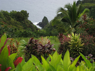
Keopuka RockBesides sunrise over Haleakala, I also missed driving the road to Hana on previous trips to Maui. The first time I was here, the road was still a poorly graded dirt road which was so difficult to drive that people made a living off of selling "I survived the road to Hana" t-shirts. On subsequent trips, it just wasn't something that we made time to do because the drive takes an entire day. Although the distance from Kahului to Hana is only about 52 miles, the road is very curvy with dozens of one lane bridges so it takes at least 3 hours to drive one way - not counting all of the things to stop and gawk at along the way.
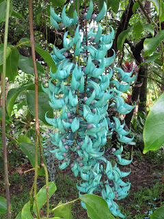
Jade VineNow we had time and my curiosity, having already been piqued, we decided to do it. Fortunately, we didn't have to leave quite so early in the morning as we did for the trip up to Haleakala and were able to go at a more leisurely pace. Once past Kahului, we started on the Hana Highway. Our first stop, at about 10.5 miles and in between Kahului and the Keanae peninsula, was the "Garden of Eden", a botanical garden and our first walk of the day. We roamed the trails here looking at beautiful tropical flowers, Keopuka Rock (which was featured in the opening scenes of Jurassic Park, and Puohokamoa Fall.
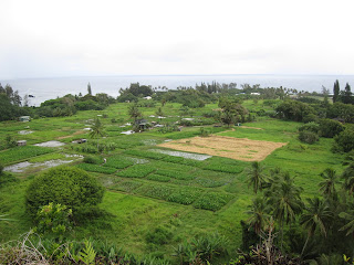
Keanae PeninsulaA short distance further, around Mile Marker 12, we reached the Keanae Peninsula. The views here are incredible, and we found a spot to pull over so we could gawk and take photographs of the high surf hitting against the black aa. This peninsula was created by massive lava flows from Haleakala crater. There was a small village located here, which is now much smaller due to the tsunami that hit here on April 1, 1946, killing 24 people. The only building to survive was the Congregational church, still standing. Besides beautiful views of the surf, we also saw many lush taro fields.
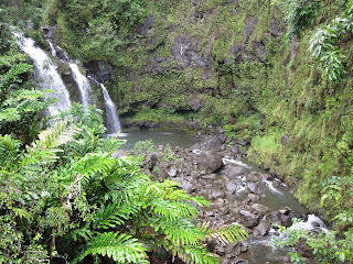
Waikani FallsOur next stop was halfway between mile markers 19 and 20, at the beautiful Waikani Falls, also known as Three Bears Falls. We stopped by the side of the road, to view the lower falls and took a look at the steep trail before deciding against clambering down all of the slippery rocks. We would look for better hiking further on.

We drove on until reaching Pua'a Ka'a State Wayside Park, around mile marker 22. This park was actually more promising for a real hike. After viewing the lower falls, our guide book said that if we climbed up a short trail on the other side of the river, we would find another, more beautiful waterfall.
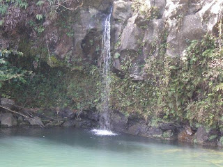
Lower Pua'a Ka'a FallsThat trail had, since the book's printing, obviously washed out. You could see where the pavement ended rather abruptly into mud. We started climbing what initially looked like a dirt trail, however, it became clear about halfway up that we were actually in the creek bed. While climbing, one of my feet came out of its shoe. Fortunately, I managed to put it back in the shoe before stepping in the mud. We all got very muddy here, nevertheless. At the top of this small hill, we reached a dirt road.
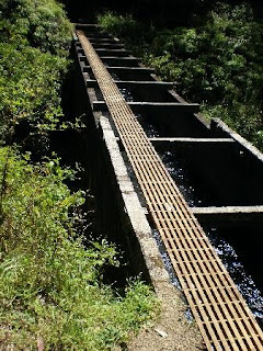
aqueductWe continued down the dirt road to the left and, almost immediately, came to a small, steel footbridge over an aqueduct. This area gets most of the rainfall on the island and is prime watershed. A series of pipes carry water from this part of the island to the rest of the island. This small footbridge was the most difficult portion of our hike, and somewhat dangerous, but we all made it over. We resumed the very muddy trail on up the hill and a short time later arrived at Upper Pua'a Ka'a Falls.
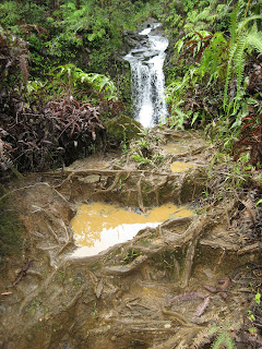
Upper Pua'a Ka'a Falls and mudIt was worth it! This waterfall cascades over the precipice into what must have once been a lava tube, but has eroded away leaving the harder shell, leaving only a beautiful, round pool of water. The beauty of this setting was definitely worth the copious quantities of mud we had to endure to get here.

On the way back down, we decided to follow the dirt road to see if there was another way down to the road, instead of taking the same muddy way back. This dirt road apparently belongs to the East Maui Irrigation company, so we figured they must have a way down. Shortly past the turn off to the muddy way we had come up, we found a nice - dry - dirt road that took us almost directly back down to the road. If only we had known on the way up, we could have avoided the mudding that we all got!
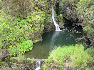
Upper Hanawi FallsWe continued on until just past mile marker 24, when we reached Upper Hanawi Falls. This particular waterfall is spring fed so it runs year round, though it is at its most impressive after a good rain. Although not the rainy season, we had had some rain the day before and it was threatening to rain more today, so the pool was full of water and a relatively good flow could be seen. We declined to take the steep downhill trail to Lower Hanawi Falls, as we wanted to continue on to Hana ... and beyond.

Our next stop was at Kahanu Garden, a short drive just off the Hana Highway at mile marker 31. Kahanu Garden has the world's greatest collection of breadfruit, and more beautiful flowers, but this isn't its main attraction. The centerpiece of Kahanu Garden is the Piʻilanihale Heiau, the remains of the largest ancient temple in the Hawaiian Islands. It was begun in the 14th century, about the same time that the great cathedrals of Europe were being completed, and was finished in the 16th century by Chief Pi'ilani after he unified the island of Maui. This massive temple is built on top of a lava flow out of basalt and takes up about 3 acres. It's hard to grasp the immensity of this building from the ground. Fortunately, aerial photos of the temple give us a better idea of its scope.

Pi'ilanihale Heiau
PlumeriaAfter about 45 minutes of walking through the gardens and seeing the ancient temple and many beautiful wildflowers, we continued on to Hana, reaching it a short time later. It was about 1:00 pm and we decided that it was time to stop for lunch. Hana is a fairly small town and there isn't a great selection of restaurants. We had lunch at the Hana Ranch Restaurant. The food was fine, though it took over an hour to arrive and didn't come as ordered. That said, the bathrooms were a welcome respite and gave us the opportunity to wash off some of the mud we had been accumulating over the course of the day. After lunch, we went down to the black sand beach and walked around a bit, while the kiddo played and tried to catch more sand crabs. We considered walking to a red sand beach just around the point from the beach, but the trail was washed out, making the way impassable for all but mountain goats. This was, however, much more of a delay than we had planned for in Hana and we needed to move on.
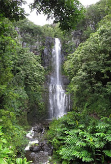
Wailua FallsAfter lunch, we continued on past Hana, reaching the last waterfall - Wailua Falls, near mile marker 45 - that we would see before our final destination. This is a truly great waterfall, descending almost 200 feet off a lava precipice, with a beautiful view from the road. Fortunately, there was a parking lot at this stop, as well as several vendors selling their wares to the many passersby. We didn't stay long. We still hadn't reached our final destination - the Ohe'o Gulch - and it was already 2:30 pm.

Our plan was to finish up the day with a proper hike up the Pipiwai Trail to see Ohe'o Gulch, also known as the "Seven Sacred Pools". The name was an invention for tourists, there aren't seven pools and they aren't sacred. Nevertheless, it's one of the most spectacular hikes on the island. If you're going to go all the way out to Hana, you need to go a little further because this is a must see. By the time we reached the portion of Haleakala National Park that contains the Ohe'o Gulch, it was already 3:00 pm. The Pipiwai Trail being only 4 miles round trip, we decided we still had enough time to do the hike and make it back to the car before dark. We put on our hiking gear and off we went.
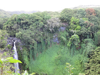
Makahiku FallsAfter the first half mile, we reached the overlook for Makahiku Falls. This spectacular waterfall plunges hundreds feet over a cliff into a pool below, so far down that it is unseen from the overlook above. Like many of the places we have seen today, water running down the side of Haleakala erodes out the lava tubes until they collapse, leaving a bowl shaped channel/canyon for the water to run in.

There is no diving allowed in the pools off the Pipiwai Trail. People have tried this in the past, with sometimes fatal results, not just from the submerged rocks that can't be seen from above, but also from flash floods originating from rain farther up the mountain. Swimming is still allowed, but only when there hasn't been such rain that flash floods are possible. Signage to this effect is posted at the entrance to the park at the Kipahulu Ranger Station. Because it had been raining today, albeit lightly, we kept to the main trail after taking in the tremendous view.
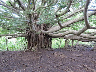
poopy banyan treeWe continued on up the slopes of Haleakala, past a gate, until we came to a large banyan tree. Not quite so neatly trimmed as the one in Lahaina, but massive nevertheless. While our son was exploring the banyan, he accidentally discovered that cows had also previously discovered this spot. Yuck! We wiped him off the best we could and moved on.

At this point, the trail became quite muddy but since we were still pretty muddy from our earlier adventures, this didn't really bother us. What's a few more layers of mud? We slogged on until we reached another waterfall, difficult to see, but what could be seen was a good view of the eroded lava tube into which it flowed.
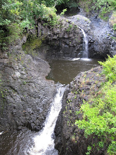
Ohe'o Gulch waterfalls off the Pipiwai TrailAt about the one mile mark, we entered an open area and crossed over two bridges. This gave us a good opportunity to look at the Ohe'o stream and more waterfalls beneath us. But the best was yet to come!

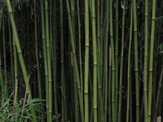
After the bridges, we entered a bamboo forest. This was by far the most fascinating part of the hike. Daylight receded far behind us as we moved into the forest. The bamboo rose so high - at least 20 feet above us - that it blocked out most of the light, so much that we almost needed flashlights. The bamboo was so dense here that, if there wasn't already a trail, you wouldn't be able to get through without several sharp machetes. Here too, the path was so muddy that the trail was actually a platform made out of Trex planks. We continued this way for the last 0.7 miles until we came back to the Ohe'o streamBamboo Forest

At this point, we could hear the roar of a waterfall getting louder and louder. We knew we were getting close, but we couldn't tell quite how close. The last section of the trail required us to fjord a shallow, but swift, stream. We walked very carefully through the stream until, a minute or two later, we came to another stream. This one was more difficult to cross, but all of the hikers there helped each other which made it much easier.
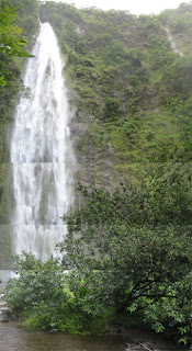
Waimoku FallsAt this point, it was raining pretty heavily, or at least that's what we thought until we realized that this wasn't rain, but the waterfall coming down on top of us. We looked up and there was Waimoku Falls, our final destination on this hike, towering above us. This time, instead of looking down on the Falls from above, we were looking almost straight up out of the lava tube. It was an incredible sight! We stayed for several minutes to take it all in, and then hurried back down the trail, so that we would get to our car before dark. This we did, and then the long drive home, back the way we had come.

I drove most of the way back on the mostly unlit Hana highway, grateful for the fact that I was following another car's red taillights to show me the way. We were very muddy, and by this time hungry, but very happy.

Tuesday, July 27, 2010

Sunrise Over Haleakala

We woke up at 3:00 am this morning. No, we weren't completely insane. We wanted to get to the summit of Haleakala by sunrise, which this morning was at approximately 6:03 am. I had heard that this is an absolutely spectacular sight and a must see. Although I had been to the summit of Haleakala once before, I had never seen a sunrise there.

Since the summit of Haleakala is at an elevation of 10,023 feet, we knew we would need some kind of jacket. It was likely to be very cold in the wee hours of the morning. We had parkas and our son had a hoodie - not quite warm enough so we each threw on an extra tee shirt. This would have to do.

It was pitch black when we left the hotel at Kaanapali, on the other side of the island from Haleakala. We grabbed some drinks and some breakfast foods, and started our two plus hour drive.

As we rounded the point and Kahului came into view, we noticed a huge fire on the plain. We figured it must be one of the sugar cane fields, which are burned right before harvest. The fire got much larger as we got closer and we soon realized that we would be driving right past it. Quite spectacular. We certainly don't see this everyday in California!

As we left the sugar cane fire, we began our ascent up the slopes of Haleakala. We had noticed that the summit was covered in clouds and we wondered if we had gotten up so early in the morning for nothing. Only time would tell.

At last we reached the turn that would take us up the final series of switchbacks to the summit, at which point we ascended into a thick cloudbank. This wasn't looking promising, but just before reaching the summit, we popped out of the cloudbank and into the clear night sky.

We didn't hit much traffic. I think we underestimated the amount of time it would take us to drive, and most people had probably already arrived before we did. That theory was confirmed when we got to the nearly full parking lot, just before sunrise, as the Haleakala National Park ranger was beginning his talk. We waited, all watching the sky above the cloud covered horizon begin to brighten. Soon, those same clouds had a golden lining for a few short minutes before the sun's golden globe finally peaked above.

The most amazing thing about experiencing a Haleakala sunrise is the knowledge that you will never again see the same sunrise. The clouds will never be in just the same position or shape. The sun will never again make quite the same patterns of light in the sky. It was a uniquely personal experience.

But what to do when you've driven over two hours to the summit of an over 10,000 foot mountain? Go hiking, of course!

This wasn't exactly hiking, but we did every short walk that was available. We hadn't packed the necessary equipment to do a full scale hike; only two Camelbak water bottles, a large fanny pack and some snack bars. We had hoped to do a horseback ride on the Sliding Sands trail, but one telephone call confirmed for us that our son was too young. So we walked up White Hill just past the Visitors Center and took in the view. Then we walked up to the summit and took in an even better view. Another short walk up to Magnetic Peak gave us a good view of the Observatory, which is off limits to the public.

We also saw several good examples of the Haleakala Silversword ("ahinahina") in all stages of its life cycle. Haleakala is the only place in the world where this plant grows. Walking around the parking lot were some juvenile Hawaiian Geese ("nene").

Since I had taken the drive up, Duane took the drive down. Unsurprisingly, I slept most of the drive.

Monday, July 26, 2010

Needle and Eyes

Our first adventure of the day was a visit to the Iao Needle and Botanical Gardens. The area is lush and verdant, making it difficult to believe that the battle of Kepaniwai, the "Battle of the Damned Water," was once fought here. On this ground, Kamehameha I fought for control of the island of Maui, defeating Kalanikupule, the Chief of Maui, in battle. So many people were killed, that the Iao Stream was choked with bodies causing it to run red with blood. The Iao Valley is also associated with the Hawaiian god Kane, the giver of life, and it was here, therefore, that Maui's chiefs and nobility were buried.

It's difficult to imagine such a horrific battle scene in such a beautiful place. This spot is now a popular tourist attraction because of the Iao Needle itself and because of its lush vegetation.

The hike is relatively short - only half a mile from the parking lot and it is paved the whole way. But the overlook at the top has a tremendous view of the Iao Needle. On the way down, we took the alternate path through the botanical gardens, which have been planted by a local association. It was fascinating how the Iao Stream had been diverted through an intricate series of pipes to get water to the various terraces for growing. Native plants as well as some plants brought from Polynesia have been grown - bananas, taro and ginger among them.

After this short walk, we decided to do a couple more short walks, but decided to drive the direct way instead of all the way around the West side of the island. This involved traveling on an extremely narrow one lane road for about a mile. If you meet someone on this stretch of road, you have to back up as there is no where to pull over. Our destination was the Nakalele Blowhole and the Olivine Pool.

Just before the narrow spot, we stopped at Kahakuloa Village. Anyone who's willing to paint lava rocks pink in order to attract customers to their shaved ice shop deserves some business! After leaving Kahakuloa we proceeded up the very narrow, cliffside road. We were blessed, despite the fact that we ignored our travel guide's advice on direction of travel, not to meet any cars coming the opposite direction and so did not have to back up.

A short while later we reached the Olivine Pool near mile marker 16. The first part of this unofficial trail is almost non-existent and you find yourself scrambling down jagged lava rocks.

The pool and geologic formations. however, make the risk of cutting your legs on the jagged lava worth it. While we did not bring swim suits on this trip, it is possible to swim in the pool and many people do so. The water is a beautiful shade of olive green and from there you have a beautiful view of the waves crashing over nearby lava.


Next to the pool is another blowhole, though not quite as spectacular as the Nakalele Blowhole that we were above to visit. Most interesting, however, is the interaction of the wind, water and lava. Wind and salt water have eroded the lava, giving it the look of a beautiful, albeit sharp, lace. From the Nakalele Blowhole, our next stop, there is a trail named the Acid War Zone trail, which runs along many formations similar to these.

Despite the jagged lava rocks, wind and salt water, lest anyone think that this is a barren wasteland, beautiful green succulents can be seen growing in the crevices between rocks and the upper portion of the trail was littered with brightly colored flowers. The total length of this portion of our day's hike was no more than 45 minutes. About 20 minutes down and another 25 minutes up. Needless to say, this is not a trail for flip flops. Good hiking shoes, or at a minimum hiking sandals, should be worn on this trail.

After reaching the trailhead once more, we proceeded on to the Nakalele Blowhole, our last destination for the day. We timed our arrival as close as possible to high tide, because a strong surf and high tide make for the best viewing. We were not disappointed.

The water was blowing up in great, powerful jets. Blowholes are created when the surf undercuts the rock along the shoreline, eventually eroding a hole through the top. The wave action and high tide cause an impress geyser-like effect. Don't get too close though! This is not something you want to fall into. It is likely you'd never get back out and the surf would pound you into a pulp against the sharp lava. People have also been known to get sucked into the hole by the retreating water (think vacuum), so it is best to keep a respectful distance.

This trail was similar to the trail to the Olivine Pool, a bit longer although somewhat less challenging. Also interesting are the geologic strata that can be seen where the lava has eroded away. A red layer, indicating that the volcano belched lava rich in iron, can be seen sandwiched in between different layers of aa.

The Nakalele Blowhole is accessible either via the Acid War Zone trail or by the shorter half mile trail which we took. This hike will take about an hour and a half, giving yourself plenty of time to look around at the blowhole and adjacent tide pools.

Sunday, July 25, 2010

Uleoli Beach

This morning, we went to Mass at the beautiful Maria Lanakila church where they have a wonderful choir. Afterwards, we had lunch in Lahaina and walked around Banyan Tree Park. I kept to my diet and had the seared tuna.

After lunch, we visited the Maui Ocean Center, where we saw lots of sharks, fish, sea horses and turtles. Afterwards, we visited the highlight of our day, Uleoli Beach, also known simply as the Black Sand Beach.

Here the beach, instead of being made out of seashells by the pounding action of the surf, is made out of black lava or a'a. I'd only visited a black sand beach once before many years ago, on the island of Lanai and found it very coarse under my feet. Uleoli's black sand was much finer and softer to walk on. The wind blew warm and gentle on us. What a beautiful day!

We had much fun chasing sand crabs all over the beach. My husband and son worked at scooping them out of their holes and catching them so that they could hold them in their hands for a few brief moments before letting them go again. Fortunately, they weren't big enough to pinch!

Saturday, July 24, 2010

Hawaiian Ramblings

We took off to Hawaii today for a much needed vacation. A little fun in the sun, rest and relaxation.

We arrived in Maui this afternoon in time to fetch groceries, check in to our condo, and get some beach time.

This photo was taken from Napili, where we had dinner. Little did I realize - until we arrived - that this was the same restaurant that we had eaten at many years ago for a New Year's Eve party. (I had made the reservations by telephone.)

I managed to keep to my diet all day, until dinner. I forgot and ate the mashed potatoes that came with my fish. Oops. I guess the Mai Tai wasn't on my diet either, but that was intentional.

Monday, July 19, 2010

Nike!

My day of reckoning has come and gone - three times over now. By the end of week one, I had lost nearly 10 pounds. By the end of week two I had lost another 7 pounds. By the end of week four, even being on vacation and missing a weigh in, I had lost yet another 5 pounds. I'm currently down about 23 pounds and am now at my pre-brain tumor weight. That was my first goal.

I've also shed two dress sizes. I don't have to shop in the "plus" department any more. I went shopping this afternoon, bought a bunch of clothes and didn't even try them on. When I got home, I gave my husband a fashion show and everything fit. Whooppee!

Hawaii is going to be really fun next week. I might even buy a swimsuit!

Wednesday, June 23, 2010

One More Day...

I had difficulty sleeping last night. Every once in a while, I just can't get to sleep. Apparently, this is one of perimenopause's symptoms. So I worked on Field Day plans through half the night, and then went back to bed and slept for a few hours. It wasn't great, but I grabbed a nap later in the afternoon.

For breakfast, I ate 3 oz. of ham steak. After dropping the kiddo off at science camp, I headed for the dentist and a teeth cleaning. Then back home to prepare for Field Day grocery shopping. I need to get supplies for about 40 people. Off to Costco! Lunch was a Muscle Milk Light Chocolate Shake. Yum! It was nice to have something sweet in my mouth after all of this meat. Dinner was some herb roasted turkey.

Tomorrow is the end of the first week. My next appointment and the day of reckoning! I think my weight loss has been pretty good, but tomorrow morning I face the scale!


Calories In: 615

Protein: 72.09%
Carbohydrates: 12.1%
Fats: 15.79%

Tuesday, June 22, 2010

Hope Is a Very Thin Diet

It's important to have structure in any of life's undertakings. Structure makes it possible to discipline yourself to stick to a plan, and supports the plan's execution. You can start a diet with great hope for pounds shed, but if you don't have a plan, you likely won't achieve your goal. Hope will be extinguished. Hope is not enough.

Although this diet is severe for the first week, there is a structure to it. This is making it easier for me to stay in compliance. I know what I have to aim for and I just do it.

This morning's breakfast was 3 oz. of ham steak. Lunch was 3 oz. of turkey breast.

Today was consumed with more Field Day preparations. I've been plenty busy and this has helped keep my mind off food. I also slept better and more last night so it was a better day all around.

By the time dinner rolled around, I still had enough calories left to have 3 oz. of hamsteak, 3 oz. of turkey, and 1 slice of Canadian bacon! I stuck to the diet a little too well.

Calories In: 640

Protein: 83.72%
Carbohydrates: 3.72%
Fats: 12.56%

Monday, June 21, 2010

Caution: Hungry Dieter - May Bite If Provoked

Today is Day 4 of my diet and the first day that I'm supposed to test my urine for ketones. I did so and the strip turned a medium shade of brown. This means I'm definitely in the moderate range of ketosis and burning ketones. Ketones are a byproduct of fat metabolism. They are produced by the liver from fat to be used as fuel when your body doesn't have enough carbohydrates. Any excess ketones are excreted in the urine and not converted back to fat. The scale also shows significant improvement. In part, this is probably the loss of some water weight, but now we know I'm starting to shed fat too.

This morning I ran out of the house with 3 oz. of Canadian bacon in my hand. It was the kiddo's first day of science camp and I didn't want to be late. We made it on time.

It's hard to describe how I'm feeling right now. I guess the closest I can get is that I feel both lighter with a slightly lower energy level than usual. I mostly ignored it.

Today was workout day. I grabbed 3 oz. of smoked turkey on the way to the gym. I was wondering if that would hold me through my workout. It did. By the time I finished the workout, I was actually feeling somewhat better. I also drank a full 32 oz. of Powerade Zero Lemon Lime.

However, after getting home, I was voraciously hungry. Since I had worked out for 70 minutes, I decided to treat myself to one slice of turkey (about 1 oz.) That helped and prevented me from eating everything in sight. Dinner was 3 oz. of halibut and some Vitarain Raspberry Green Tea. When I added everything up after dinner, I was still about 80 calories under my minimum calorie goal. So I had another slice of Canadian bacon.

So far so good, even if I'm hungry.

Calories In: 653
Calories Out: 375

Protein: 73.38%
Carbohydrates: 7.19%
Fats: 19.42%

Sunday, June 20, 2010

"Our Bodies Are Our Gardens...

...our wills are our gardeners." William Shakespeare

Day three and I'm still managing to stick to this diet, though it isn't easy. It does seem to be paying off, even at this early stage. Today was the first day I got on the scale and it appears that I've lost close to 6 pounds. That's a good start, keeping in mind that my scale and the doctor's scale undoubtedly don't quite jive.

This is the first day I haven't had a "cheat". This morning I ate 3 oz. of ham steak for breakfast. Lunch was a forgettable vanilla whey protein shake. Can't someone make these things taste any better? The chocolate one I had a few days ago was pretty bad too. Dinner, though, was really tough. We went to my mom and dad's house for dinner, which was roasted chicken, mashed potatoes with pesto, fritata, and my brother's pineapple upside down cake for dessert. I ate a miniscule piece of the chicken. Giving up the pesto was tough, so I put a dot of pesto on my chicken - maybe a quarter of a teaspoon, just for a taste. Fortunately, pineapple upside-down cake isn't one of my favorites, so that was easy to pass up, though I was really curious to taste my brother's cooking.

Truly, this is a contest of will power. All things being equal, that would probably be fine, but I am a "stress eater". I'm also busy enough that I tend to eat on the run and it's hard to find healthy options on the run. So I need structure to be successful, and a whole lot of grace!

I'm entering all of my food and exercise into the Livestrong.com MyPlate application. They have a great database of food and I can enter it anywhere that there is internet, so I can keep doing this while I'm on vacation. When I got home tonight, I entered dinner and discovered I was about 200 calories shy of my goal, so I was able to eat a little more. That was not at all what I expected, and a pleasant surprise.

Calories In: 586

Protein: 75.65%
Carbohydrates: 10.36%
Fats: 13.99%

Saturday, June 19, 2010

Blessed Are Those Who Hunger...

.. and thirst, for they are sticking to their diets!

Day two went pretty well. For breakfast, I had two scrambled eggs and 2 slices of Canadian bacon. Lunch was 3 oz. of ham steak. This was perhaps a mistake as I didn't realise that the yolk contains so much fat (cholesterol). Dinner was more problematic, since I went to a party tonight. The party was at 7:00 pm, so I decided to skip dinner at my regular time and eat at the party. Dinner was approximately 3 oz. of grilled steak and grilled seasoned pork. As this was a "Moms and Margarita" party, I did allow myself one small margarita, but that was all. I didn't nibble anything else, despite the fabulous looking, most tempting guacamole. The party was fabulous! Many thanks to our hosts!

I am hydrating quite a bit, which is necessary with this diet. Lots of water and some diet sodas. My favorite water is Hint, though it can be hard to find. If you have a Whole Foods nearby, they carry it and sometimes, Costco. No calories, carbonation, or synthetic sweeteners - just water with the essence of some fruit, such as watermelon, blackberry, pear, and lime. Yum!

Even so, the margarita put me over my calorie limit by the amount of the margarita.

Calories In: 795

Protein: 49.7%
Carbohydrates: 12.42%
Fats: 37.92%

Friday, June 18, 2010

Today is the First Day...

...of my new high protein diet. I've been exercising for months and no weight loss has happened.

I've had it. This is WAR!

I've signed on to a medically supervised diet regimen. For the first week, I'm allowed to eat 6-700 calories of protein a day. Because this is a very low calorie diet, I have to take some high quality dietary supplements. Nothing outrageous, just lots of vitamins and minerals. The idea is to burn up all the energy from carbs in my body, so that I start burning fat, while at the same time maintaining muscle mass.

I had a chocolate whey protein shake for breakfast. It was okay, but only just. Then I did my usual one hour boot camp workout at 24 Hour Fitness. For lunch, I had 3 ounces of Canadian bacon.

I managed to get through most of the day without blowing it. Almost, but not quite. When I put away my son's remaining Mint Milanos, I "sneaked" one.


By dinner, I was really hungry. But it's date night, the night Duane and I usually go out for dinner and a movie. We met at the mall and I had 3 ounces of grilled chicken and a Diet Coke for dinner. I then went shopping while Duane finished his dinner. If I was thinking I wouldn't have to see his food, I was right about that, but wrong in that there was food everywhere else. Even the corndogs, which I despise, looked good. Sort of. Well, not really. I walked away quickly.


We went to see Prince of Persia: The Sands of Time tonight, which was excellent, but without the popcorn. Thankfully, Duane spared me and he didn't get any either.


Total Calories In: 651
Total Calories Burned: 589


Protein: 64.33%
Carbohydrates: 19.8%
Fat: 15.79%

Friday, May 28, 2010

Into Every Life, A Little Snow Must Fall

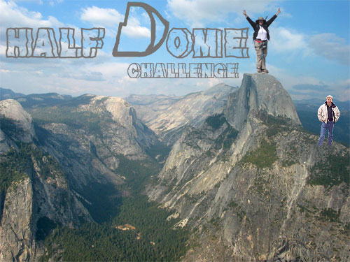
It hasn't rained on my parade. It has snowed on my parade. This photo of Half Dome was taken on the morning of May 28th. There are several feet of fresh snow on top of Half Dome, as you can see. This means that the granite steps of subdome are also covered in snow.

This is a good lesson. You can prepare to the Nth degree. You can do your utmost to be strong and in shape to hike this mountain. But even on your best day, you won't conquer Half Dome. You may conquer your inner demons, but it will only be because Half Dome lets you pass.

From the National Park Service:

The Half Dome cables will not be in place over the June 4-6 permit period.

The combination of heavy winter snows and continuing spring snow storms has kept the snow pack from melting along the trail to Half Dome, including the portion of the trail on the subdome, below the Half Dome cables. A slip and fall from the subdome's steep snowfield could cause serious injury or death. For the safety of hikers and the employees setting up the cables, the cables will not be put up until conditions improve. We will monitor conditions over the next two weeks and issue an expected opening date as soon as possible.

If you have a Half Dome day-use permit for May 21-23, or May 28-31, or June 4-6, you will receive a refund.

It's doubtful I'll be able to get another permit this year. Maybe next year?

Sunday, May 23, 2010

Best Laid Schemes...?

But Mousie, thou art no thy lane,
In proving foresight may be vain:
The best laid schemes o' mice an' men
Gang aft agley,

An' lea'e us nought but grief an' pain,
For promis'd joy!

Robert Burns, To a Mouse, 1785

Sometimes you can't win for losing. No matter how much you prepare and get ready, there will always be circumstances out of your control. There is currently no access to Glacier Point, or the trailhead for the Panorama Trail, which is still under snow. Subdome is still covered in snow - not even the rangers can pass to put the Half Dome cables up. The cables will not be up over Memorial Day weekend and that's the weekend before we are supposed to hike into Little Yosemite Valley.

2010 has seen record levels of snow in the Sierra Nevada, currently at or above 150% of normal. I have come to the conclusion that even if the cables are up and the snow on subdome melts and the road to Glacier Point is open, it's going to be downright cold.

Do I really want to go backpacking, camping and hiking in the snow and freezing cold?

Update 8:34 pm: Snow is now forecast for Tuesday, Wednesday and Thursday of this next week:

A STORM IS FORECAST TO DEVELOP AND MOVE SOUTHEAST TOWARD CENTRAL CALIFORNIA LATE TUESDAY NIGHT... AND CONTINUE INTO WEDNESDAY AND POSSIBLY THURSDAY.

SNOW MAY BEGIN AS EARLY AS TUESDAY EVENING IN YOSEMITE PARK... AND SPREAD SOUTH ACROSS THE REST OF THE SIERRA WEDNESDAY. THE SNOW LEVEL WILL INITIALLY BE NEAR 8000 FEET... BUT LOWER TO 6000 TO 7000 FEET LATER WEDNESDAY AND THURSDAY.

SIGNIFICANT SNOW ACCUMULATIONS ARE POSSIBLE AT AND ABOVE 7000 FEET... AND COULD RANGE FROM A HALF FOOT IN SEQUOIA AND KINGS CANYON PARKS... TO OVER ONE FOOT FARTHER NORTH IN YOSEMITE PARK. BELOW THE SNOW LEVEL... PERIODS OF COLD RAIN ARE LIKELY.


This means that it is likely that Little Yosemite Valley will see at least some snowfall, as it is at 6100 feet elevation. Glacier Point, however, is at an elevation of 7214 feet, which means there will likely be significant snowfall there. This will delay the opening of the Glacier Point Road and access to the Panorama trailhead, from which we have been planning to start our hike.

Friday, May 21, 2010

Leaves of Three... Let Them Be

I guess I didn't let them be.

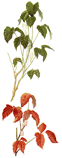
One of the hazards of hiking is poison oak. I must have brushed up against some during our hike in the Pinnacles. It's Spring and since the leaves are still green, I may not have noticed them among the rest of the verdant foliage.

A couple of days after our hike, while I was in the shower, I noticed a rash on the underside of each elbow, a patch on the back side of my shoulder, and one patch on my upper arm. Unfortunately, by the time I noticed it, I had already had a couple of hot showers, letting the urushiol - the chemical that causes the allergic contact dermatitis - sink deeper into my open pores.

Fortunately, there are treatments, but they aren't a panacea. Tecnu or Zanfel are probably the best products on the market, but they should be used immediately and with cold water so that the urushiol oil doesn't sink deeper into the pores. After that the only thing you can do is treat the symptoms with a hydrocortisone cream to decrease the swelling and/or a Benadryl cream to reduce the itching.

I've used them. I'm still itching. It's been almost two weeks. Time to visit the doctor and see if there is something stronger to stop this dead in its tracks.

Meanwhile, I suspect my backpack may also be infected. I used hot soapy water, with Dawn detergent, to wash my backpack thoroughly. I've also ordered some Ivy Wipes, which are supposed to help clean off equipment. Urushiol is found in poison oak, but also in poison ivy and poison sumac.

I really don't want to do this again. And I sure don't want to reinfect myself just before attempting Half Dome for the second time.

Sunday, May 9, 2010

Wildflowers and Caves at Pinnacles National Monument

It was an extremely busy day yesterday. Brunch with mom and dad in Half Moon Bay, our son's Little League game, and later the Stanford Pow Wow. We were fairly well exhausted last night, but still when we got home, we readied our packs for today's hike at Pinnacles National Monument. We got our packs ready, bought some deli sandwiches from the grocery store, and put our clothes out. Duane was not feeling well with a worsening cold, so even though he got his pack ready, he wasn't sure he would go.

Along with my Thermarest pad and tent, I also added an extra 7 pounds to my pack for a total of 35 pounds of weight. What kind of insanity causes me to add barbells to my backpack? I'm conditioning to give Half Dome another try. I need to develop muscles that are capable of carrying 35-40 pounds without flinching by simulating the weight I would carry on the day we backpack into Little Yosemite Valley.

Because the drive to this hike from San Jose is about an hour and 45 minutes, we needed to get up really early in the morning. My alarm went off at 5:00 am. Yuck. Definitely not enough sleep last night. After determining that Duane wasn't going to go because his cold was worse than yesterday, I tried to convince our son to go with me. No dice. If Daddy wasn't going, he wasn't going. The lure of caves, lizards, wildflowers, big rocks to climb on, and possibly California Condors was not strong enough to get him out of bed at 5:00 am. So I showered, got dressed, and took off by myself to our carpool rendezvous at Santa Teresa Village Shopping Center, right in front of the Nob Hill Grocery Store. I made sure to check that it had coffee and was open at 6:00 am.

Unbeknownst to me, however, the invitation that I wrote up for posting to Deb's Evite hiking list, got slightly changed. She set the carpool rendezvous time for 7:00 am. So when fellow hiker Angela called me the night before to make arrangements to be picked up in Gilroy, she didn't understand why I wanted to pick her up 15 minutes before I was supposed to leave the parking lot in Santa Teresa. And when I texted fellow hiker Chris at 6:00 am, asking if he was up yet, he just about had a heart attack thinking he was late and high tailed it out of his house. (I've got to give him kudos for getting to the parking lot at 6:15 am. I don't think I could have done it!) We didn't figure this out until we were all in the car and on our way to Pinnacles.

I had time to buy some juice, coffee, and a cinnamon breakfast roll while waiting for Chris, and we shared this in the car on the ride down. Poor Angela had to put up with two amateur radio operators in the car, but hopefully we weren't too bad and didn't bore her. The ride was free of traffic and we made great time. We got to the Visitor Center on the east side of the park, which was then closed. We thought this would be a good time for a bathroom stop, but even that was closed. So we drove on to the Old Pinnacles trailhead. I stopped at the entrance gate and purchased a new National Parks pass as mine had expired eight days previously.

After finally making our bathroom stop, we readied our packs and hit the trail at about 8:30 am. The first part of the hike was over level terrain on the Old Pinnacles trail, which follows the West Fork of Chalone Creek. The Creek was mostly dry now, but what was immediately evident was the number and variety of wildflowers in bloom. Spring came late, but it has most definitely sprung! The first thing I noticed was a new variety of monkeyflower, Notch-petaled Monkeyflower, with bigger paler blooms than the regular variety. Among the most beautiful flowers we saw early on was Elegant Clarkia - just before a coyote crossed our path.

After the first mile, we began to have incredible views of the craggy rock formations that are the Pinnacles. We began to climb a rocky trail that all but disappeared into the boulders, then followed a creek bed right into the Balconies Cave. Had I know ahead of time what I signed us up for, I might have thought twice about taking a backpack in here. There were some low and tight spots which made getting through with a backpack exceedingly difficult. I took the pack off in several places in order to get through. Although flashlights are absolutely required, the trail inside the cave is well marked with numbered sign posts and, in a few places, railings.

After emerging from the cave, we continued on the Balconies Trail until we reached the Chaparral Ranger Station. As one might expect from the name, this area is a chaparral microclimate. Views of the craggy peaks were much better on this west side of the range. From here, we hiked onto the Juniper Canyon Trail, which would take us into and up the side of the canyon traversing multiple switchbacks. From the base of the peaks, the climb looked very intimidating and even more so with me carrying my heaviest backpack to date. I wondered if it would be like the Half Dome trail out of Little Yosemite Falls with its seemingly interminable switchbacks. It was. We continued to see many beautiful wildflowers, including the Venus Thistle, Western Wallflower, Blue Dicks, and Cream Cups

About halfway up the side of the mountain, we turned onto the Tunnel Trail. This would take us up to the High Peaks Trail, avoiding the steep and narrow section while at the same heading in a direction that would complete our loop. Just before passing through the tunnel, we saw a bunch of California Condors, with their signature white beneath the wings, riding the rising air currents as they pushed up against the Pinnacles. Beautiful!

The terrain along this trail was also some of the most spectacular that I have seen on a local hike. As we rose higher and higher in the canyon, the views, both of the canyon and the Pinnacles themselves, became ever more grand. These grand rock formation are actually what remains of an ancient volcano. We had an excellent panorama view of the valley to the West towards Hollister.

The weather couldn't have been better. The average temperature for May 9th is 78 degrees, with the record high being 98 degrees. The Pinnacles is really a Spring hike as temperatures here can be as high as 110 degrees in the summer. As I planned this hike, I knew I would need to keep an eye on the weather and cancel if it got too hot. As it turned out, I didn't need to do that at all, since we've had an unseasonably cold and long winter. The temperature never got over 70 degrees. It was cloudy and overcast for much of the day. There was a small chance of rain, but so far the weather had held. We were very blessed!

Several switchbacks later after the tunnel, we reached the High Peaks trail and the ridgeline where we could see for miles in all directions. Here we sat down and ate our lunch and rested for a while. I took off my boots. My liner socks which were bunched up against my toes and causing some pain. What I needed was some Glide, but that had unfortunately been left at home. I decided to try using some chapstick instead, and that actually worked, though I think that tube is now a goner!

After lunch we continued on down the High Peaks trail towards the Old Pinnacles Trailhead. Although this trail runs through the High Peaks, it is fairly level to gently sloping in this area as it runs along the ridge line. We continued to see many beautiful wildflowers, including the Butterfly Mariposa Lily (isn't that redundant?), Indian Paintbrush, Bitter Root, the Blue Fiesta Flower and the Spreading Larkspur, which reminded me of an iris, although quite small.

Eventually, we reached a trail junction and had to decide whether to hike down the Condor Gulch Trail or keep hiking down the High Peaks Trail. Initially, I had planned to take the Condor Gulch Trail, but since Chris had a commitment after the hike and we had already seen several Condors, we opted to continue along the High Peaks trail. This shaved about one mile off the total distance of our hike, turing what would have been a nine mile hike into an eight mile hike. Given that we'd all acquitted ourselves admirably on the 1500 foot elevation change up those switchbacks, I wasn't too concerned.

The other consideration was that it was starting to sprinkle, and at times more than that. Fortunately, I had my rain poncho with me and I put it on. I still don't have a lightweight, waterproof backpacking jacket for which I've been contemplating another trip to REI.

Just as we were almost at the end of the High Peaks trail, who should we run into but Deb and her friend Roger! What a surprise! They hadn't planned to go on this hike because they had dome some very strenuous hiking the day before. What a hoot to run into them at the end of our hike.

About 200 more yards and we were back down to the flat, off the High Peaks trail and back onto the Old Pinnacles Trail that would take us back to the parking lot - and the bathroom! We stopped at the Visitor Center on the way out where I purchased a patch and book on Condors for our son.

What a magnificent and beautiful hike!