Sunday, October 25, 2009

Angel Island

It was the morning after the night before.

My cousin Danny and his bride Noelle's wedding of yesterday was both beautiful and a blast! Great food, music and dancing. Much fun was had by all. A little too much fun. Well, a lot too much fun. We got home around midnight and I needed to make a decision:

To go or not to go?
That is the question.
Whether tis nobler in the mind to suffer
The slings and arrows of outrageous hills,
Or to take arms against a sea of trails,
And by opposing conquer Angel Island?

To snooze: to sleep;
No more; and by a sleep to say we end
The foot-ache and the thousand natural shocks
That flesh is heir to, 'tis a consummation
Devoutly to be wish'd!*
Of course, I decided to go. So I quickly packed my gear and laid out my clothes for a very early morning start on Sunday.

The alarm went off at 6:30 am. About 6 hours after I had finally gotten to sleep. Definitely not enough sleep. Definitely had too much fun last night.

Did I really want to go? My husband said yes, and kicked me out of bed.

Yeah, right. He gets to sleep in! What a slug. Nevertheless, I remained envious. But he knows me well, as he should, after 11 years of marriage.

I quickly showered and dressed, then I grabbed a vitamin water and drove to our carpool rendezvous at a local shopping mall. There I grabbed a coffee and a sandwich from Le Boulanger before we left at 7:30 am. What a wonderful invention is coffee! Deb, our mentor from Team in Training, drove us up to the Pier 39 parking lot, where we were to catch the Blue & Gold Ferry to Angel Island. It was still early enough that a human being wasn't in attendance at the ticket booth, but fortunately there was a ticket vending machine nearby.

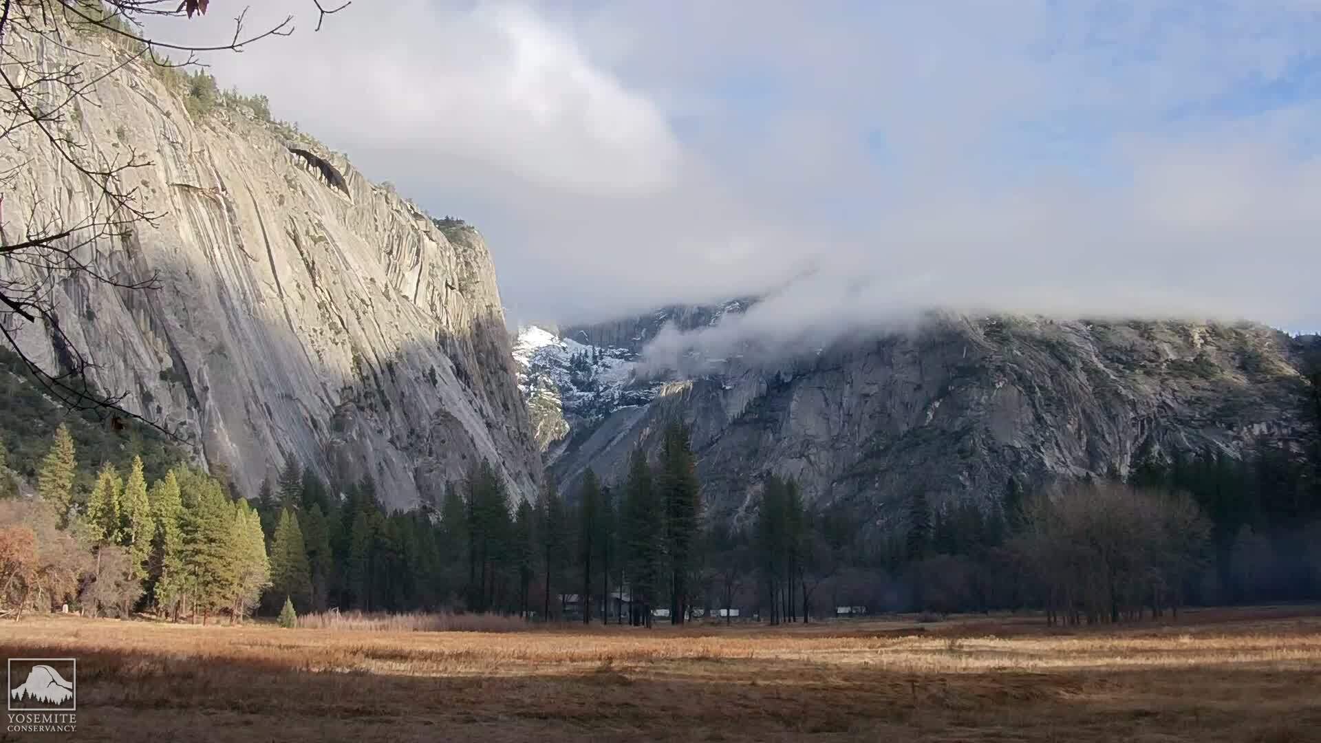
It had probably been at least twenty years since I was last on Angel Island. My karate dojo had a picnic at Ayala Cove, right before I left to go to law school. It was the last time I saw our sensei, as he died a few years later. My family had also been there many times when I was a child. It was a favorite place to take a weekend picnic and bicycles. My brothers and I biked all over the island, but it was my brothers who did most of the hiking with my dad. During the 20 minute ferry ride, I wondered if it would still look like I remembered it.

The weather was absolutely gorgeous, even while on the ferry. Not too much wind, and plenty of sunshine. I was too warm, so I took off my jacket. It was shaping up to be a picture perfect day, as we passed Fort McDowell, and then rounded the lighthouses at Point Blunt and Point Stuart. Finally, we pulled into Ayala Cove at about 9:20 am - right on time. I was impressed at the number of new buildings - mostly concessions - and the vastly improved dock facilities. There wasn't much more than a bathroom and a dock when we came here as children years ago. No restaurants and no bike rentals - we had to bring our own.

We used the restrooms at the dock, regathered the "troops" - a collection of mostly Team in Training alumnae - and then we were off. Today's destination: Mount Livermore - the very top of Angel Island. We began our hike along the North Ridge trail, which begins with a series of near vertical stairs right behind the docks. We ascended the first set, passing Perimeter Road, then the second set. We reached and crossed the fire road, continuing on along the North Ridge Trail.

At this point, we had a pretty good view of the U.S. Immigration Station, although there was no direct route from where we were. We planned to visit the Immigration Station later in the day, before our ferry ride home.

By this time, the view was becoming quite beautiful - and I was finally rid of that groggy feeling from the night before. It was also quite warm and I decided that I needed to take off my outer shirt. This posed a minor problem since I had forgotten to put the short sleeve shirt on under the long sleeve shirt. Since we were primarily a group of women, and since we asked the lone gentleman to please turn his back for a minute, a few of us exchanged our long sleeve shirts for short sleeves at a convenient bend in the trail. Ahh! Much better.

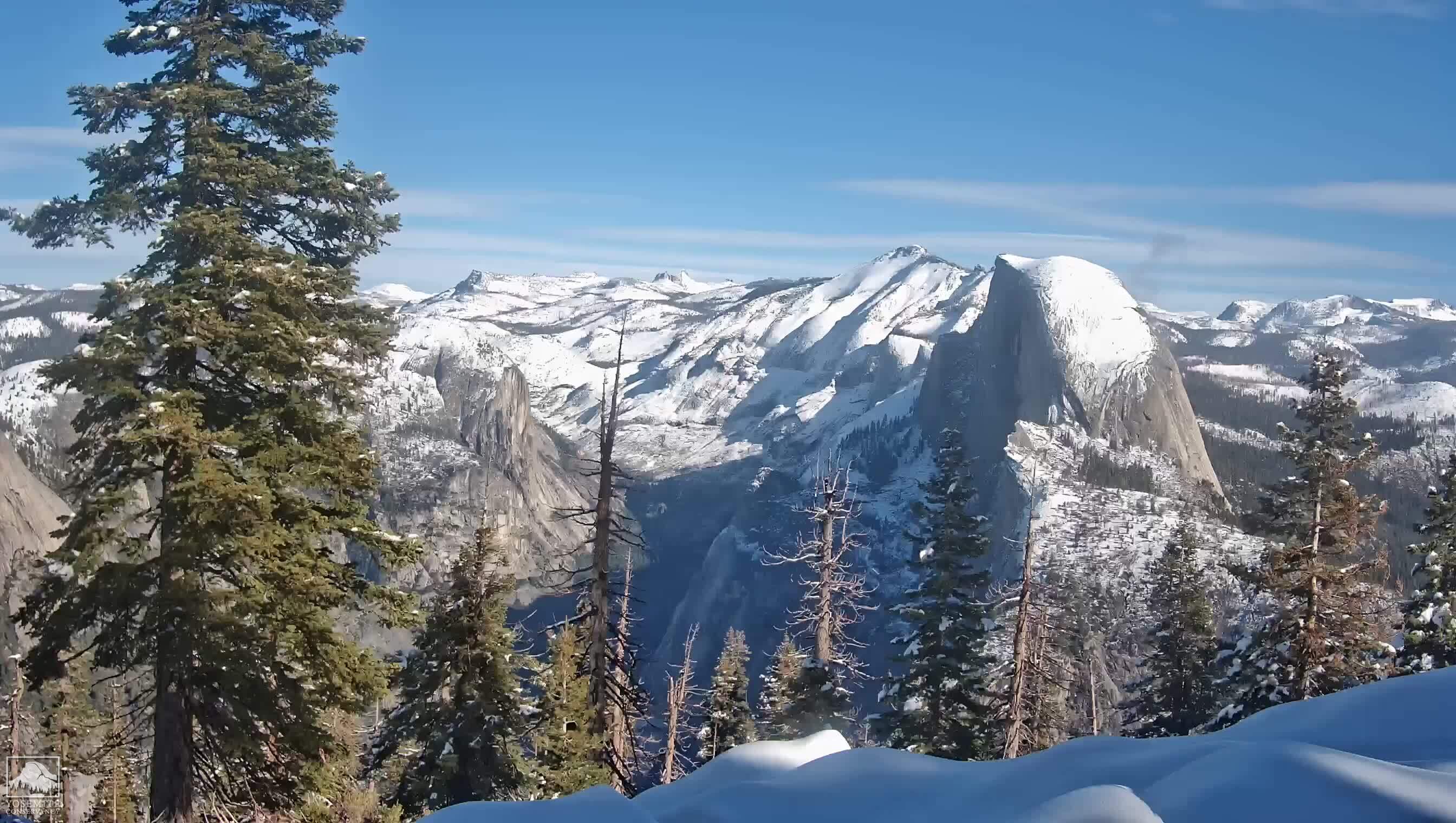
We kept hiking up the North Ridge trail, gaining altitude until at last we emerged from oak woodlands and into grasslands and manzanita during the last half mile to the summit. The flowers are mostly gone now. But what this hike lacked in flowers (at this time of year), it more than made up for in sweeping panoramic views of the San Francisco Bay. We arrived at the top at about 11:45 am. At the summit were some benches and a couple of picnic tables. We sat down and ate our lunch and chatted for a while. Then we snapped this group photo with bay vistas and the Golden Gate Bridge in the background.

After lunch we descended via the North Ridge trail, but this time took the Sunset Trail at the first junction. The Sunset Trail would take us around the island though via a somewhat shorter path than the fire road. We needed to do this if we were going to make it to the Immigration Station in time to visit it and then catch our ferry back to San Francisco. The Sunset Trail has some very pretty views of Ayala Cove.

We made it back to Perimeter Road, just above the Ayala Cove Vistor Center by 1:20 pm. We had about an hour before it was time to rendezvous at the docks, so we immediately walked another twenty minutes to the Immigration Station at China Cove via the Perimeter Road.

The U.S. Immigration Station had not been restored at the time of my previous visits to Angel Island. Then, it was a only group of decrepit and crumbling buildings that we could see through a chain link fence. My brothers and I wondered what it had been, only having some vague notions of its previous use. Now that several of the buildings have been restored, it is possible to walk into the barracks where would be immigrants were once housed.


Enticed by promises of gold and a better life, Chinese began immigrating to the United States in 1848. Soon after, however, discriminatory legislation prevented the Chinese from mining for gold. In addition, the Chinese Exclusion Act was passed in 1882 and essentially froze Chinese immigration. However, this legislation could not keep sons and daughters of U.S. citizens out of the country. People attempting to emigrate from China often bought documentation claiming that they were children of U.S. citizens, and therefore citizens themselves.

Proving the validity of these claims was difficult, and an interrogation process was developed. The Department of Immigration needed a place to detain immigrants until the interrogation could be complete. In 1905, construction of the U.S. Immigration Station began. It became a detention facility, where Asian (primarily Chinese) immigrants were detained until they could prove they were joining relatives already in the country.

Angel Island State Park, About the United States Immigration Station

Here we were able to see Chinese graffiti covering the walls, and also a more rare Japanese graffiti. I thumbed through several photo albums, which contained many hideous photographs of Chinese women who had had their feet bound. Apparently, foot binding was a status symbol among wealthy Chinese as it represented their freedom from manual labor. But the practice is abhorrent to the Western Christian mind precisely because of the deformity and disability that it inevitably causes. While I had learned about the practice of foot binding in a high school history class years ago, what I had not understood previously is that binding the feet does not actually prevent the foot from growing. Rather the foot continues to grow, but curls under such that four smaller toes wind up grafted to the bottom of the foot. Whatever pain I felt in my feet after today's hike must have been nothing compared to the pain felt by these Chinese girls suffering from the pain of foot binding.

We exited the barracks and walked further down the hill towards the bell. This was the original fog-warning bell at the station, which had disappeared from the island after it ceased being used. Most likely it was replaced by a compressed air foghorn, as many of the bells and lighthouses were. When the original bell was later rediscovered in a San Diego junk yard, it was restored and returned to Angel Island, eventually to the U.S. Immigration Station from whence it first came.

By this time it was about 2:00 pm. It was time to hike back to the docks. Then along came the shuttle. Three of us climbed on board the shuttle and the rest of our group hiked back to the docks at Ayala Cove. We sipped some cold diet Cokes at the cafe while waiting for the ferry, and the rest of our group, to arrive.

The breeze began to pick up around 3:00 pm and our ferry ride back to San Francisco was more windy than it had been that morning. This corresponded to my memories of windy afternoons on Angel Island. Even so, I barely needed a jacket. What a glorious day it was!

* With all due apologies to William Shakespeare

Sunday, September 27, 2009

24 Hour Fitness ... or As Much As I Can Stand

I was shopping at Costco this afternoon. It turns out that they offer a two year flat price membership to 24 Hour Fitness for about 50% off the regular fee. And it's not even January yet!

How cool is that!?

So, I decided to take advantage of it. I checked out the local 24 Hour Fitness, which has a gym, a pool, a basketball court, a sauna, a jacuzzi, a cycle room and an exercise classroom. Nice! I'm going to try to go every day.

This might make Half Dome a little easier...

Wednesday, September 23, 2009

Not Iron Man

I may have found the answer to the reason for my decreased appetite. I did my final blood test on Monday after the hike and found out today that my anemia is probably related to iron deficiency, in turn caused by a hormonal imbalance. Iron is the precursor that the body needs to form hemoglobin. Hemoglobin, in turn, is the oxygen carrying molecule contained in red blood cells.

Fatigue and weakness are symptoms, because the body's tissues aren't getting enough oxygen. Apparently, decreased appetite is also one of the symptoms of iron deficiency anemia. So this may be the reason why I've been having to force myself to eat while hiking.

How annoying that this happened right before our Half Dome hike!

I thought it was weird that I couldn't keep up with Duane last Saturday. I have never been unable to keep up. I'm usually in the lead. I wasn't having a problem during our final conditioning hikes, though I wasn't at as high an altitude either.

Feather Falls is somewhere around 2900 feet elevation. Black Mountain is at about 2800 feet. Saratoga Gap is lower at around 2400 feet. Mission Peak, which we did earlier in the Spring - twice in one day - was 2517 feet. We did the Panorama Trail down to Happy Isles last June and I had no problem at all and had plenty of energy left at the end of the hike. I was at the front of the pack the whole way. During our Half Dome hike I was anywhere from 7200 feet elevation at Glacier Point, down to about 6000 feet at Nevada Fall, and back up to 7300-7500 feet elevation where we finally turned back.

The only surprise for me is the relationship between iron deficiency anemia and appetite. I expected that the anemia could be a problem. I'm nevertheless annoyed.

Half Dome FastPass

Hiking to Half Dome has become increasingly popular in recent years, and that has led to increasing congestion at the bottom of the cables on the most popular days. The long waits and pressure to pile on actually makes the cable slower for everyone and less safe, much like an overcrowded freeway. So experienced visitors schedule the day and time of their hike to avoid these peak periods.

After last June's fatal and non-fatal accidents, some people have again argued for instituting a permit system to limit the total hikers on peak days. The National Park Service has such permits in place for strictly rationing all overnight use of backcountry trails and also all day trips to the top of Mount Whitney. Some hikers vehemently hate the idea of adding any new rules onto Half Dome day hikes. If a permit system is instituted, here is how I suggest it could be done in a minimally-burdensome way.

This particular method below assumes no ranger on post at Sub Dome and none at lower trail junctions, and no government mandate to strictly limit access to Half Dome. The weakest element is social; whether frustrated hikers with no pass will ignore all fancy rules and just cut in front anyhow. They now stay in their place in the waiting line largely because there are no visible exceptions; no one is passing others.

The new cable reservation system would be modeled after Disneyland's FastPass, and called CablePass. It would be a voluntary online reservation to have first priority for going up the cable with minimal waiting during your selected hour of your selected day. Outside of that hour, hikers would have second priority access up the cable for the rest of the day, ahead of hikers without any CablePass.

Any hiker could continue to use the cables at any day or time without a pass, waiting in the usual first-come first-up order, except they would now be expected to allow all pass holders to go ahead of them. (On peak afternoons, they might then wait so long that they don't get up before their personal deadline to turn back.) There would be no ranger on site to manage this. The waiting hikers would just work this out by comparing their passes. (I hope!)

The total bookable reservations for any particular hour would be set to 80% or so of the cable system's highest flow rate in uncrowded conditions. There would be no reservations for late-afternoon hours in mid summer when thunderstorm activity is common, since the park should not appear to guarantee that those hours are a smart bet. There would be no reservations for low-demand hours like night time. (Otherwise, I could buy an always-available dummy 2:00 am pass just to get around all non ticket holders that day.)

Seventy-five percent of the reservation slots would go on sale online 60 days in advance for $20 per person. These could be switched (just once) to another available time and date without additional cost. You would re-confirm your intention and print a physical ticket by checking into the online website again in the week prior to the hike date. Two days before the hike date, any reservations still unreconfirmed are cancelled without refund and re-sold to someone else. The price is set to discourage wasteful speculative booking without adding much to the total costs of a hike visit (travel, lodging, food, gear). All profits would go to some non-profit related to Yosemite or Half Dome, e.g., YOSAR.

Twenty-five percent of the total reservation slots would be held back until two days before the hike date. They would sell for $5 per person and not need further re-confirmation.

No visit to any park office is necessary; planners would be able to do all this from home. People could also do this at the park at many existing ranger-staffed help desks.

The reservation software would remind hikers of the additional basic safety needs for this hike: non-slip shoes, water, gloves, and watching out for weather. The site could also require viewing of a safety video.

The software would remind hikers of the park's recommendation that they sleep locally before they begin the hike. (A permit system could enforce this by requiring all hikers to pick up their physical ticket in Yosemite itself during office hours in the days before the hike. However, this office visit would inconvenience lots of people and cause more car trips within in the valley.)

This system would not strictly cap the traffic during peak periods. But everyone would soon learn that hiking up there at peak times without a pass would usually result in multi-hour waits (significantly longer than now) and sometimes not summiting at all. Knowing that, most people would then choose a better time or day if they can, or plan some other Yosemite hike instead if their date is inflexible. But no one would ever be told "No, you can't go there today", including our foreign guests.

In practice, none of this ticket stuff will matter during non-peak periods. During peak periods, nearly everyone will have a ticket. People will stagger their starting times so they arrive a bit before the time on their ticket, so there will no longer be a single rush of everyone racing to the cables at dawn. Average waiting times should go way down. If a few hikers do not get to the cables by the time they targeted , they still have a very good prospect of going up within one hour.

This system would not aim to reduce total visits to Half Dome or satisfy some government-imposed strict cap requirement. This non-strict capping of popular non-work days will deter some visits and reduce the total visits somewhat. That (plus lowered waiting times) could lower the cumulative environmental impact on the trail and summit.

The setup costs and maintenance costs for this reservation system would be very low, and those costs would be covered by the fees. The main barrier is political, getting it approved and backed by the various interest groups of Yosemite.

Monday, September 21, 2009

Lessons Learned

Lessons Learned, in no particular order:

1. I need to be in much better physical condition to ever try this again. I'm in better shape than when I first started our Half Dome Challenge, but that's still not good enough. I need to develop both more stamina and muscle.

2. I still need to take off some of the weight I gained during my brain tumor year. I've lost ten pounds of that, but I need to take off at least another twenty. Thirty would be even better.

3. The Stairmaster needs to become my friend. My best friend.

4. Never again will I attempt Half Dome on a weekend, if ever at all. Hiking on such a crowded day makes the Half Dome hike more dangerous than it has to be. The throngs of hikers that we encountered from Nevada Fall onwards were quite a shock after the serenely quiet Panorama Trail.

5. I'm not the fastest hiker on the planet, but I'm pretty steady. It's mentally distressing to be passed by so many people. This is another reason why hiking on a weekday would be a better idea.

6. I will never again forget to check that the hiking pants I pack are actually mine.

7. I need to learn to pack lighter. I don't need two hydration packs. I never needed or used the smaller one liter pack.

8. A brighter headlamp would be good, if I ever do this as a one day hike again.

9. Doing the hike as one of my friends does, overnighting in Little Yosemite Valley, is not a bad idea. But my day pack may not be large enough, and I'm sure I don't have the right kind of sleeping bag and mat.

10. I need to better understand how to manage my energy level on the trail and how to control the appetite suppression that happens as a result of exercise.

11. When packing a ham radio into the wilderness, have the Wilderness Protocol frequencies pre-programmed into the right radio.

12. Anemia makes a difference at high altitudes, as I expected it would. As it is, women already have a lower red blood cell count than men generally. We need to keep every red blood cell we can hang on to - and those need to be replete with iron!

Saturday, September 19, 2009

Unfinished Business (Her Story)

The alarm went off at 3:00 am and the wake up call came shortly after - a real human being on the other end of the line. How nice to hear a human voice wake us up instead of a computer, but how awful for the person who has to be up at that hour to make those calls. Despite being tired the night before, I didn't sleep well. I probably got about 5 hours of sleep - not enough. Too many anxious thoughts running through my head.

I called the valet service to ask them to have our car ready in half an hour. Then I jumped in the shower and then got dressed. I put on my pants and immediately knew something was wrong. They were a tad too tight and then I realized - with horror - that I had accidentally packed Duane's hiking pants and not mine. They are exactly the same color - the only difference being the belt loops and the lack of a boot zipper at the bottom of the pant. Fortunately, we're about the same height and size, so they fit. Unfortunately for me, however, men's pants are cut narrower in the thigh. Although the pants fit, with every uphill step I would be fighting these pants. Subdome wouldn't just be difficult. It would be awful. I briefly considered wearing my jeans and quickly discarded that idea for a multiplicity of reasons. Duane's pants would have to do.

I was ready to go by 3:30 am, as we had planned. Duane was still packing his pack, which he hadn't done the night before. Grrr! By the time we left our room, it was 3:45 am. We were now 45 minutes later than I had wanted to be. I didn't get out of the parking lot, before realizing that I had left my National Park Pass in the hotel room. I ran back up to the room to get it. And then we were on our way to Glacier Point and the Panorama Trail trailhead.

It took us about 40 minutes to drive to Glacier Point. The road is currently gravel and torn up from Highway 41 to the turn off for Badger Pass ski area - about six miles. Fortunately, the road is graded well and is not badly washboarded. I was able to maintain between 20-30 mph on the dirt portion of the road, just under the regular speed limit. We arrived and parked near the outhouse. There were more cars than I expected - about eight vehicles - at that time of the morning. We parked and prepared our hiking poles, tied our hiking boots and put on our packs. Duane spent precious minutes repacking his backpack. I really didn't understand why this wasn't already done the night before. By the time he was ready to go, it was nearly 5:00 am, almost a full hour after we should have been on the trail.

One of the best things about being up at the wee hours of the morning at Glacier Point, was the heavenly view of the sky. We could easily see the Pleiades, Cygnus, Orion and the Milky Way. The sky was so full of stars that it was difficult to pick out familiar constellations. We could also see Venus just to the right of the black lump that had to be Half Dome. A beautiful sight, but we couldn't really stop at length to enjoy it, already being so late.

We found the trailhead and away we went. I wore two headlamps on my visor, but even though I was able to see, the lack of depth perception made hiking slower and more difficult. I didn't want to take a misstep and fall and hurt myself in the dark. Duane seemed to have better luck carrying his headlamp, but I knew that wouldn't have worked for me with both hands gripping my hiking poles. About halfway to Illilouette Fall, we could see the thin band of morning's first light breaking over the eastern horizon. About this same time, we saw pinpoints of light as if floating in the distance and lower across the canyon. This must have been other hikers on their way to Half Dome. It didn't get light enough to hike without head lamps until we reached Illilouette Fall, around 6:45 am.

For a while, we played the question game. Duane pulled a Reggie "Val Kilmer" moment. Marilyn Monroe was not appearing in films made in the 1970s (she died in 1962), nor was she as well known for her dramatic roles as she was for romantic comedies. No way I would have gotten that with the clues given.

After a short break to eat a trail bar at Illilouette Fall, we continue on across the bridge, up and out of Illilouette Canyon and to the Panorama Cliffs. At this point, rosy fingered Dawn was finally hitting the western peaks of Yosemite Valley. Beautiful! We decided to pass up a short trip to Panorama Point overlook. We had already been there in June and we were already very late. We continued on.

We reached the junction for the John Muir, and Mono Meadow at about 7:30 am. This was the first time we had seen any people at all since we started. One group of three passed us, followed shortly thereafter by two more hikers. The two hikers asked us if we were on our way down from Half Dome. What?!?!?! We pointed across the Canyon and told them that Half Dome was on the other side of the Merced River and pointed towards it. Half Dome, at this point, was mostly hidden behind Liberty Cap. We turned them around and set them on the right path. The group of three that we had passed earlier, came running down the switchbacks to Nevada Falls shortly thereafter. Apparently, they had also taken a wrong turn.

Why would anyone take on a hike as long and strenuous as the Half Dome hike without a good trail map? Inquiring minds want to know...

We reached Nevada Fall at about 8:15 am. We stopped at the restroom so Duane could use it. I tried to eat my sandwich, but was attacked by several yellowjackets. The last time I ate a lunch at Nevada Falls, the only critters that wanted my sandwich were squirrels. They were much cuter than yellowjackets! I gave up and put my sandwich away. I was amazed that there were so many people here at Nevada Falls this early in the morning. Oh what a difference that hour would have made!

A few minutes later, we continued on, past the restroom and up the stone steps around Liberty Cap, until the trail leveled out and followed the Merced River for another mile. Here the trail was so full of sand, it was like walking on a beach. It was actually much easier to walk just off the trail. There was actually a fresh trail cut by hikers, right next to the main trail, for this very reason. I used it.

Shortly before the junction for the Half Dome trail, we stopped at riverside to refill our water bladders for the grueling 3.5 mile trek to the top. After reaching the Half Dome Trail junction, we turned left and headed up the saddle between Half Dome and Cloud's Rest. We were about a mile past this junction, when we heard the loud distinctive sound of helicopter rotors chopping air. It had to be nearby. We looked up at Half Dome just in time to see the helicopter take off. Being out of communication, we weren't sure what had happened, but we knew that it couldn't be good. Flying a helicopter to the top of Half Dome is not done unless there is some kind of emergency.

I pulled out my small handheld transceiver (HT) thinking that I would use it to find out what was going on, but had forgotten that the Wilderness Protocol frequency - 146.52 on 2 meters - was programmed in my other HT and I couldn't remember the frequency. I put the radio back in my pack. Without that frequency, that hunk of plastic and metal was useless and I may as well not have brought it at all. We hiked on, though now a question mark had been cast over the day. What had happened on Half Dome?

At the same time, we were being passed by many hikers. Duane was getting more and more nervous and made up his mind at one point that he was not going to go on. He didn't want to try the cables in a crowd. I didn't either, but without knowing what was happening at the top, I didn't want to quit. I was angry with him. I had not come this far to beat myself mentally - or let him do the same. If there is one thing I have learned over this past year of training, it's that any endurance activity is as much a mental contest as it is a physical contest. My body might not hold up, but my mind wasn't going to give in. What I didn't read correctly was his sense of concern.

I reasoned with him that many of the people passing us would probably already be on their way back down by the time we got there. We estimated we would reach the cables by 12:00 pm, at our current, slower pace. I agreed that if it became clear that we could not get to the top and descend by 3:00 pm, we would turn back. He agreed to continue on.

At the same time, the weather was taking an interesting turn. The weather had been forecast to be 85 degrees and perfectly sunny. We checked my hiking thermometer and it was 80 degrees, though it didn't even feel that warm. But clouds were gathering over Half Dome, coming in from the west. We couldn't be sure, from this direction, what kind of clouds they were because they were partially hidden. Were they the beginnings of the dreaded cumulonimbus - thunder clouds that could immediately put an end to our hike? We weren't sure, but we paid attention.

We reached the two mile sign and the junction to the John Muir and Cloud's Rest trails. There were many people loitering, snacking and resting here. It was easy to find someone to take a photo of us. At this point, I zipped off my (actually Duane's) pant bottoms figuring it would be easier to do all the uphill. We hiked on. About ten minutes and a half mile later, we reached the spring. If we hadn't already known that it was a spring, we would have thought it was a puddle and hiked right on by. We hiked on for another several hundred feet up this series of interminable switchbacks.

By this time, we were beginning to see some hikers on their return. We stopped some of them to ask if they knew what had happened at the top. This was when we found out that it was a suicide. A few hikers later and we discovered that the cables had been closed and would be closed for approximately two hours. Hundreds of hikers were pooling at the Saddle between Subdome and the beginning of the cables. At this point, I knew that our Half Dome attempt was over. Even if we got to the top of Subdome by 1:00 pm, we would never get up and down the cables to Half Dome in the time that we had planned with throngs of people ahead of us at the Saddle.

At the same time, I was beginning to run out of gas and my appetite was so suppressed that I was finding it difficult to eat. I knew I needed to eat - I just didn't want to. I had to force myself to eat trail bars. My sandwich was out of the question. Duane had also tried to eat his sandwich, but was immediately attacked by five to six yellowjackets. He also gave up trying to eat his sandwich. I'm not sure whether my slight anemia played a part in this, but I'm sure it didn't help.

We were almost at the top of the ridge line, where we would have been at the tree line. We could see sky above the final switchbacks on the hill. We could see hikers going up the granite switchbacks on Subdome right in front of Half Dome. We could see hikers climbing up - or perhaps only down - the cables. So near and yet so far. We were disappointed. But I knew that in my current state of exhaustion, I would not be able to get up, let alone down, the cables safely. Neither of us wanted to hike back down tired and in the dark. So we turned around, going back over the ground we had so recently traversed.

The only constructive thing I could do at this point was to say a decade of the Rosary for the deceased (though I was so tired it was difficult to hike and count Hail Marys at the same time). It's difficult for most people to know what can drive a person to despair so deep that they see no value in their own life and no hope in the future. But I have known someone who killed himself. In his case, he had chronic depression, a kind of mental illness. Others I have had a passing acquaintance with had financial or family problems. None of them were bad people, but all of them were too proud to seek help. In their weakness they chose to throw away their lives.

Suicide is inherently a selfish act. One can never commit suicide without having an impact on the family and friends left behind. Sometimes that impact is a financial one. More often it is an emotional impact. It also impacts strangers, such as the hiker who found today's suicide or the postman who found my ex-boyfriend hanging from a rope off the balcony of his house in the middle of the forest five days after he had killed himself. It impacted the helicopter pilot who had to make a risky flight to the top of Half Dome to retrieve the body. It impacted all of the hikers trying to reach the summit, causing a dangerous logjam at the cables. And it impacted the deceased who will never again see another sunrise, another sunset, or another smile. So I prayed that, whatever his situation, God would have mercy and compassion on him and would help him sort this all out.

We returned to Nevada Fall, where we took off our boots and socks and, standing on the slick granite soaked our feet in the cool river water. It felt so wonderful. My feet were so hot, but fortunately not even a hint of a blister. Thank God for REI's generous boot return policy! It took four pairs of boots before I finally found the right size and this paid dividends today. We put fresh socks on and continued on down the mountain.

The next decision was whether to take the faster, steeper Mist Trail down the mountain or to take the longer, gentler John Muir Trail. We opted for the safer, surer John Muir Trail. Along the way down, we met two ladies who were both having knee problems. Duane gave them his extra knee strap and they gave us a bar of chocolate. That was wonderful and probably really saved me. I would never have thought to bring chocolate on a hike for fear of it melting and making a mess all over my backpack. But this was dark chocolate with less likelihood of melting. I wasn't hungry for much of anything, but I was still able to eat electrolyte beans and the chocolate was wonderful! My energy level picked up a bit. Even so, I was moving like an automaton over the rocky trail at this point. The last mile or two down the John Muir Trail was the most difficult, not because of the downhill which is harder, but because my energy reserves were so depleted.

At one point between Clark Point and the Vernal Fall footbridge, Duane fell down. I heard him start to go down close behind me, so I stopped and planted myself like a tree. He grabbed my leg and this stopped his fall, but not before he got a skinned calf and bumped elbow. We stopped, I pulled out the first aid kit and we disinfected his scrape and applied a bandage. We continued on.
We reached the Vernal Fall footbridge at about 5:15 pm. It was at this point that I drank the last of my water. Duane's hydration pack had run out about half an hour earlier, higher up on the John Muir Trail. Here, I made a much needed stop at the restroom and splashed cool water all over my head. (We still each had 32 ounce bottles of water remaining, however.) It felt wonderful! It was here that we met the curly, blond haired teenager and his friends who found the suicide's body and who called 911 on his cell phone from the top of Half Dome. He didn't seem too shaken up, but we were both sorry that this had happened to him.

We continued on, arriving at Happy Isles at a couple minutes past 6:00 pm - just after the snack stand had closed. Drat! But we were in time for the shuttle, which meant we didn't have to hike the last half mile to the Curry Village parking lot. Yeah! We reached the "welcome car" and changed our shoes and used the restroom at Curry Village. We decided to eat in Curry Village rather than wait until we arrived at Tenaya Lodge. We still had to pick up our other car at Glacier Point, so it would be at least two hours before we got to the hotel. We each had a hamburger at Curry Village. Yum! Then we hobbled to the "welcome car".

Neither of us were inclined to buy the we-made-it-to-the-top-of-Half-Dome tee shirt. So we took a pass. At this point, we both wanted a hot shower and bed.

It did indeed take another two hours to get back to Tenaya Lodge. I dropped Duane off at Glacier Point, traversing the six miles of gravel road once again though this time with much more traffic. He took some final photographs of Half Dome in the last light of the day.

We arrived back at Tenaya Lodge at a little past 8:00 pm. Duane showered and I soaked in a hot bath. I didn't have the energy to put on my swimsuit and head down to the hot tub. I could have fallen asleep in the bath. We ordered room service - we were both still a little hungry - and I ordered a margarita. We wound down a little bit before finally going to bed, sleeping like the dead.


Even though we didn't make the summit of Half Dome, we both felt that this was a big accomplishment. We hiked a further distance, over more time, at higher elevation than we had ever hiked before. We came within a mile to a mile and a half of the summit of Half Dome. Neither of us are twenty-something any more. Neither of us ever thought, in all the years that we have been visiting Yosemite, that we would ever have attempted to hike to the summit of Half Dome.

Our Half Dome Hike (His Story)

On Saturday Sept 19, Christina and I hiked for 13 hours and about 15 miles with Half Dome as our goal. We didn't quite make it to the top. Hundreds of hikers were thwarted this day when the summit cables were closed for hours to investigate a suicide on the summit. But we were too tired and too late to have succeeded that busy day, even if the cables had remained open.

The standard, quickest way to do Half Dome as a day hike, is to start from and return to the floor of Yosemite Valley. But this involves hauling yourself up about 4800 vertical feet, requiring lots of strength and stamina. We decided to help ourselves by starting from a much higher starting point: the parking lot up at Glacier Point, on top of a nearby mountain facing Half Dome. And then ending our one-way hike at the usual place down at the Valley floor. This required bringing two cars to Yosemite. Leaving one at Curry Village the night before. Using the second car to get to our lodging, and then to Glacier Point before dawn on hike day. Hiking all day to get to the first car. Then driving back to retrieve the second car. We got this complicated notion from a friend who camps up at Little Yosemite Valley (above Nevada Falls) to do Half Dome over several days. Packing all his gear to and from the campsite is much easier with mostly-downhill hikes from high parking lot to campsite to low parking lot.

The Ranger lady at the entrance station was nice to not charge us for the second car. Don't tell the Sierra Club!

Our one-way day hike trimmed off lots of the up-slogging, but added more distance and time to the total hike, and added to the total amount of knee-jamming downhills. Luckily, my knee problems of May-June did not reoccur. But we totally blew our time budget.

The road to Glacier Point is long and remote and is currently torn up by a repaving project. The available lodging closest to Glacier Point was at Tenaya Lodge, outside the south entrance to the park. We had also stayed there for our Team-in-Training Yosemite event in June.

The dinner before a long hike should have lots of carbohydrates and not much greasy stuff. So I picked a chicken pesto pasta dish at the cold & slow outdoor restaurant at the lodge. This oily meal immediately gave me diarrhea, so I got no nourishment at all from any of my meals that day. Maybe I could compensate with more trail bars the next day?

We planned to wake up at 3am and hit the trail head at 4:00 am, three hours before sunrise. But we actually started this hike at 5:00 am. I had refused to consider any wake-up time earlier than 3:00 am. But I was actually mostly awake, just waiting for the alarm, from 2:00 am onwards. The drive took longer than we estimated, and I did not fully pack the night before, and we had to return back to our room to get our park entrance annual pass. (My excuse for not pre-packing was I wanted lots of ice in my water bladder.)

Christina discovered at 3:00 am that the hiking pants she had packed for herself, were actually my alternate pair. They fit too tightly in the thighs but did stay on. Our revised packing list now reads "hiking clothes (not his, yours!)"

We knew from our June hike, that this Panorama Trail has knockout views of Half Dome, looking very close, but also thin, steep, and seemingly impossible. At 5:00 am we could see nothing but the trail itself via our tiny headlamps. After awhile, I noticed a dim chain of 5-10 points of light out across the black canyon. I now think this was people doing predawn hikes along the Mist Trail up towards Half Dome.

With my bright light fixed to my hat, the rocks and bumps in the trail looked exactly the same as the flatter dirt of the trail. The light was too close to my eyes to give any parallax. But if I held the light lower, in my hand, each rock and bump threw a shadow that made them much easier to see. So I stowed away one pole, held the other pole in one hand, and held the light low for Christina and me in the other. I tried fastening the light to a chest strap but it didn't point in the right direction. If I night hike again, I want to arrange some way to fix it to my waist or chest.

At around 6:15 am, the pre-dawn light was now enough to see the trail clearly without lamps. And there was our looming goal, Half Dome! Sunrise itself was at 7:00 am.

Illilouette Creek was much diminished but still running at this late dry point in the year. We could not see its falls.

At Panorama Cliff, the dawn views of Half Dome, Liberty Cap, and the valley were stunning. Yosemite Falls appeared totally dry.

We had no clear idea what mph speed our normal hike pace is. I had estimated we would reach the top of Nevada Falls at 7:30 am. Our actual pace this morning turned out to be 1.6 m/h. This Panorama trail is fast: mostly gentle downhill and in good condition. But we were slowed by working carefully in the dark, and breathing harder at this unaccustomed altitude. We actually got to Nevada Falls at 8:15 am.

Before joining the main John Muir Trail, we met three different groups of unprepared Half Dome hikers from below who mistook the Glacier Point trail as the trail towards Half Dome. They were clueless, but very fast!

Above Nevada Falls, I was surprised and appalled by the crowds of people we found massed around the restrooms and streaming up the trail towards Little Yosemite. I hate crowds and long lines everywhere, but this was very bad news for us. This was about a third of the crowds I saw back in June. Better, but still hopeless. Our strategy of leaving from Glacier Point and arriving later at the cables, could only work on a day with very light traffic and no congestion backup on the cables. Saturdays are always worst. I had hoped that a Saturday in late September would be good enough. But no. Every minute, we were being passed by ten or so young speedy hikers who would all be queued up before us when we finally reached the cables. This rate was far more than the ~100 people/hour rate that the cables can sustain, so I knew that severe traffic backup was inevitable, just like on rush-hour freeways. Christina hoped that they would all be up and down again before we got there.

I suggested to Christina that we immediately abort this Saturday attempt, conserve our energy, and then do the complete hike over again on the very next day, Sunday. We had to return to San Jose by Sunday evening. So this plan B maybe was almost practical, if we were really fit. But probably not. Christina said no, understanding that our bodies would not recover in the time necessary. We continued on through Little Yosemite Valley and then slogged up through the forests towards Sub Dome. We had occasional views of Half Dome and the people already pulling themselves up by the fixed cables and the people already waiting on the ridge line below the cables.

At this point, we heard the distinctive wup-wup-wup of a helicopter. It seemed to be coming from Half Dome, and I immediately knew that someone was in really severe trouble this day. Then I spotted the helicopter right at the summit. I thought it was arriving, but then it departed perhaps one minute later. (We now think it had been there for hours, and was leaving.)

Everyone on the trail began speculating about what all this meant for the people up there, and for our own hikes. And whether the summit and cables would be closed by this emergency. Thirty minutes later, we met descending hikers who explained that someone had died at the top and that rangers were now stopping all ascent on the cables. One hiker reluctantly explained that it was a suicide. And not by some fall or jump, but by gunshot. In our occasional views of the summit, we continued to see lots of people on the cables despite reports of it being closed. I'm now guessing that we were seeing people descending, and the cables were only closed for ascenders.

Our hike up the mountain switchbacks was now slower and we needed frequent breaks. It was obvious that we could not reach the cables until 1:00 pm at the earliest. All of our mentors had strongly urged reaching that point by 11:00 am at the latest, or else the congestion would be hopeless and (in my opinion) dangerous. The summit is deadly during late-afternoon thunderstorms. Luckily, this day's weather was perfect so far, clear and cool in the low 80's. But we always planned to be back down from the cables by 2:00 pm at the latest. The cables themselves are potentially deadly when overcrowded or when the granite is wet.

I became extremely pessimistic about this day's hike turning out well. I stopped, and argued with Christina for fifteen minutes against going any further. Other passing hikers must have been quite entertained. I knew from twelve years experience that I could not get her to change her mind by talk. The only way to stop us was to be equally, absolutely stubborn in not going another inch upward, no matter what. If she went on, I would wait for her back at the Little Yosemite ranger station. She became as angry as I've ever seen her. I was betraying her and our year-long shared goal, by deciding to give up just from pessimism.

I did eventually give in. I would not be the cause of our failing this hike. I would accompany her as far as the Sub Dome summit and the beginning of the cables. But only if she agreed that we would indeed turn back from there if it became too late to get up and down and clear the cables by 3:00 pm.

So we continued slogging upwards. We tried to eat lunch. But six persistent bees wanted my not-so-fresh ham sandwich, and Christina had no appetite. By this point, we were being passed by only five hikers per minute, so the main body of pre-dawn speedy hikers was now well above us.

A half mile beyond the junction with Clouds Rest trail, we found the perennial spring, right next to the trail but behind the upturned roots of a fallen tree. If you did not expect it, or see someone pumping away there, you would pass right by without noticing this little pool, even after a dozen hikes. Today it looked fine with clear running water, a really nice resource. But our bladders and spare bottles were still full from our refill at Nevada Falls. (Thanks Deb, for loaning us your filter!)

A hiker refilling at the spring was in cellphone contact with friends up on or near the summit. Cable traffic was shut down, with no word on when it might reopen.

Our slogging upwards was getting slower and slower. I was okay and somewhat slow. But Christina could no longer keep up at all. Normally we are equal on the trail. We think Christina was weakened by anemia and by not eating well. After another half mile, she announced that she could go no further today. And so we turned around to begin our long descent.

We think this was about 1.5 miles from the summit. This was just below the tree line. We had not yet reached any of the hardest points of the trail: the many steep steps of Sub Dome, and the cables.

Our worrying was now over, replaced by disappointment. Neither of us thought we would ever attempt this mountain again, in any year. Christina announced that she was definitely Done. Our Half Dome Challenge was over. No T-shirts for us!

We met some hikers coming down from above. One family said that they got to the blocked cables, and touched the cables as something to remember before turning back. Later, another hiker said they had gotten to the top of Sub Dome, but the ridge line saddle between it and the cables was now so jammed full of waiting people that it was impossible to get near for even a brief touch.

We again got occasional glimpses of the cables and saddle portion of Half Dome summit. The silhouette of people crowded together on the saddle was now solid black. Probably hundreds.

We watered our feet at Nevada Falls and changed socks. I discovered two torn toenails. I had trimmed them very closely, but apparently my socks snagged on some corners.

We thought we had enough pep and knees left to take the steep Mist Trail down from Nevada Falls. But one look at it and I said we'd take the boring gentle John Muir trail yet again. I stumbled four times but avoided getting banged up. Christina insisted on applying a bandage on my pimple-sized knee scrape. Aww, Mom!!! No schoolyard boy would bother. We then got stuck behind a slow dusty horse train carrying tourists.

Halfway down from Nevada Falls, and I had finally used up the initial three liters of hotel ice water in my main bladder. I didn't use my still-full summit bottle of filtered river water. On a hotter day and a full hike, re-filling the main bladder at Nevada or spring on the way up and again on the way down would be about right.

When we reached the bridge and delicious water fountain below Vernal Fall, we met and talked with the young man who discovered and reported the suicide's body. He and his friends began their hike at midnight, so they had had a very long day.

We got to the Happy Isles trail head at 6:00 pm, and Christina was now quite stiff and tired and could now barely walk anymore. If we had tried to continue upward beyond Sub Dome, we would have reached that point of exhaustion up on the mountain and would had struggled in returning to the valley floor. If we had started from the valley floor instead of Glacier Point, we would have burned out even earlier, just in getting up to Nevada Falls.

We got a passable hamburger meal at Curry Village, drove back to a near-dark Glacier Point to retrieve my car, then returned to the lodge, and crashed into bed at 9:00 pm.

The next day we were both very stiff. Hiking a little bit might have been possible, but not a major hike. We drove both cars home, and could barely move when we finally got out of our cars.

When I unpacked, I wondered if we would ever use the safety harness and clips and sticky gloves that we had carried for doing the Half Dome cables. Will we re-train and try again some future year?

---------------

Lessons learned:
1. Too fat. We weren't fit enough or physically prepared enough for very long hikes and lots of steep uphill at altitude. We had regressed since May instead of getting stronger.

2. My knees do not limit me now; that was much better since May.
3. I would never again consider doing Half Dome on a weekend mob day.
4. A one-way day hike from Glacier Point is only practical on weekdays when there is no race to the cables.
5. This hike is difficult, but the worst problems are due to this one mountain being so very popular.

I now think a low-fuss voluntary day and hour reservation scheme for this one trail could spread arrivals, reduce crowding for the cables, and make them safer on peak days. E.g., ticket holders go to the front of the line of people waiting to go up on the cables. Style the ticket as a desirable memento so they don't get discarded on the trail.

A Suicide at Half Dome

On July 29 2008, an unnamed 27-year old man ended his life by deliberately doing a swan dive off the cliff top of Half Dome in Yosemite. There were no reports about this in the press. His body came to rest somewhere on the top of the tall talus slope below that cliff. To remove the body, the park service's YOSAR rescue squad had to put themselves at high risk and make two helicopter drop passes to a steep location where no landing is possible.

Sometime before dawn on Saturday, September 19 2009, another 30-something man went up to the Half Dome summit to die alone, alone except for his handgun. He sat alone on a small ledge below the cliff top, near the famous 'Visor' but away from the cave. Perhaps he watched a final sunset. And then waited until everyone else was gone. Sitting alone in darkness, watching the stars above and lights of people in Yosemite valley far far below. Then he shot himself in the head -- somehow without rolling off the ledge.

At midnight, several teenagers started out on their long overnight hike up to Half Dome. They arrived at dawn on Saturday. One young man spotted the man's body below the edge. He initially thought the guy was just sleeping, but then spotted the blood. They called the park rangers via cell phone. A park ranger arrived, perhaps by helicopter. The summit was investigated as a possible crime scene, just in case it was actually a murder. Some hikers waiting for the cables thought that foot traffic to the summit via the cables was shut down for about two hours or so on this busiest day of the week. (Others say it remained open.) The body was moved from the ledge and then taken off the mountain by helicopter around midday. I snapped this photo just as the helicopter was taking off.

The man's name is Steve. He loved the outdoors and this mountain. He came back here from Oregon for this ending. His friend Megan describes a little bit of his life and recent family and job troubles. That site also has other information from hikers closer to the scene. There are apparently no reports about this in the newspapers, so far.

It was a busy day on the trail with many hikers queuing up to use the cables. Some hikers turned back after reaching the cables or saddle, thinking that it was closed or would be a very long time for their turn. Lower on the trail where I was, these descending hikers told us that the cables were closed. But it was all very confusing, with no one agreeing about when the closure started or when it would reopen.

Lower on the trail, the first hint of trouble was the sound of a helicopter circling the summit. We all immediately feared for some major accident up on top, perhaps involving many people, and perhaps a fatality. I was reminded of the book 'Shattered Air', about the men struck by lightning in 1985 and how difficult it was to rescue them by helicopter at night. Luckily this was mid day in perfect weather, and cell coverage now makes communication easy and certain. And Yosemite's rescue squad has accumulated a lot of practice.

A descending hiker then explained that it was about a suicide. And by gunshot, not by jumping. We were relieved that there was no accident, and only one person involved, and there was no crisis. The use of a gun was surprising and puzzling to everyone, with everyone guessing about motivations.

We soon gave up our own hike (our first time for Half Dome) before reaching Sub Dome. We were not strong enough that day or early enough to succeed on our planned timetable. The cable backlog and confusion about closures merely made it easier to accept that turnaround decision.

My impression was that quite a few families gave up, who would have certainly persisted to the summit if there had been no suicide delays. (We were not in that group.)

On our long drive home, I stewed about the suicide incident and became angry at the man's choice of venue for this final drama. Initially, just for "mis-using" this mountain and for inconveniencing so many people and wasting YOSAR resources. My anger then shifted to a more serious issue: Did he risk putting responders in danger? Was he securely wedged so that his dying body could not fall over the edge, or was it just luck that his body remained on the ledge? Had he fallen (or jumped), YOSAR would have then needed to apply much riskier procedures to retrieve the body from rocks below. I imagined and assumed the worst, that this not-falling was just luck and not something arranged in Steve's plan.

My first version of this article on Sunday was angry, harsh, and offensive to many people. I imagined I was scolding Steve and future imitators, trying to deter them from picking Half Dome for their ending. Not useful.

I hope that in the future, any troubled hikers looking to maybe follow Steve's course and example will similarly give some thought to the following:
  • Will I potentially be putting fellow hikers, climbers, responders, or SAR teams at risk?
  • Will I leave the mountain as peaceful and clean as the way I've enjoyed it?
  • Will memories of my end detract from this place?
(From details now becoming available five days later, it appears that Steve was quite careful about those things; there was absolutely no chance for his body to fall over the edge.)

Rest in peace, Steve.

Friday, September 18, 2009

The Night Before the Morning After

We began the three plus hour drive to Half Dome on Friday at about 11:00 am, after stopping for In-n-Out burgers. We were mindful of the temperature as we drove to Yosemite. Our car thermometers both read 100 degrees on the drive over. We had been watching the forecast with interest for the past week, ever last Sunday's rain. The forecast had been for 90 degree weather at Yosemite, but that had been revised downward to 85 degrees as of today. Neither of us wanted to do this hike in 90 to 100 degree heat.

Because we were doing our hike one way from Glacier Point to Happy Isles and because the shuttle from Happy Isles to Glacier Point doesn't run frequently in the evening, we decided to pre-position a car at Happy Isles. This involved driving two cars into the valley floor, leaving the "welcome car" at Curry Village, and then taking the second car to Tenaya Lodge, an additional hour's drive.

But how would we communicate between cars on this long drive? We had the option of using FRS/GMRS walkie talkies, cell phones or, since Duane and I are both ham radio operators, our ham radios. Since we didn't want to pay cell phone charges and since the range and battery life of FRS/GMRS radios are rather limited, we decided to use our ham radios. From my perspective, this was actually one of the best outcomes of this trip because Duane, although licensed, isn't as interested in the hobby and doesn't practice his operating skills. By day's end he had memorized his call sign (at last!), was more familiar with his handheld transceiver (HT), and was beginning to be more comfortable operating a radio.

We left a change of comfortable shoes, an ice pack, an ice chest with cold drinks, some spare (hidden) cash, and a warm sweatshirt in the welcome car at Curry Village. We then asked someone in the parking lot at Curry Village to take a photograph of us in front of Half Dome. Then we headed out in the other car towards this evening's destination - Tenaya Lodge.

We arrived at 6:00 pm, checked in, and ate dinner. We did some carb loading. Both of us had pasta and a salad, and I drank several glasses of water - as much as I could hold. Dinner was good, but the the staff was short-handed so the service was poor.

The next big decision was what time to set for our wake up call. I wanted to set the wake up call for 2:30 am, while Duane wanted 3:00 am. Against my better judgment, I deferred to Duane. We also set the alarm clock as a back up. It would take us about 30-45 minutes to drive from Tenaya Lodge to Glacier Point and the trailhead for the Panorama Trail. We needed to leave Tenaya Lodge by 3:15 am at the latest for a 4:00 am start. I didn't think we could get dressed, etc., in less than half an hour.

We set out our hiking clothes, and I prepared my pack, filled my 3 liter hydration bladder, soaked my neckerchief, and got it ready to go. Duane had everything set out to put in his pack, but didn't actually pack it.

We've been adjusting our sleep schedules for days, getting up ever earlier each morning. This morning we were up at 3:40 am. So we were both very tired and we expected it would not be difficult to get to sleep at such an early hour. We were hoping that all of this preparation would pay off tomorrow.

Preparations

I can't believe that I'm awake at 3:40 am. I can't believe that I'm awake at 3:40 am and coherent! Duane and I have been adjusting our sleep schedules to wake up progressively earlier and earlier this past week. We started at 5:30 am and we're now up to 3:40 am. Tomorrow we will arise at 3:00 am, quickly dress, and hopefully be at the Panorama trailhead by 4:00 am.

Tomorrow is the big day! We will attempt to summit Half Dome. We're not going to take the usual trail from Happy Isles. We're leaving from the Panorama trail - we're trading an extra mile and a half for 2000 feet of elevation gain. And of course, much more beautiful vistas!

One of the most important preparations I made was to get my annual physical completed yesterday morning. I am healthier now on nearly all counts than I was a year ago. My HDLs are betters, my triglycerides and blood pressure are down and my weight is lower by about ten pounds. The only cause of concern is a bit of anemia, likely the result of a hormonal imbalance causing too lengthy menstrual bleeding. While that hormonal imbalance had already been addressed, I'm still a bit anemic. Red blood cells, the cells that carry oxygen through the body, take a week or longer to form. This may have an effect at higher altitude, but I can't be sure what stresses my body will be able to withstand until I get there.

I packed my backpack before going to bed last night. I made a trip to REI yesterday to stock up on some electrolyte beans, trail bars and a better trail map of the Half Dome hike. We also have some extra gear with us this time. We each have a climbing harness, a runner, and two carabiners for clipping on to the cable during the last section of the hike. And an extra pair of sticky gloves for gripping the cable.

The last loads of laundry are running now. Now all I need to pack are a change of clothes, some toiletries and a swimsuit. (The swimsuit is for when we get back to Tenaya Lodge and the hot tub!)

Unfortunately, none of the people that we asked to go with us were able to make it, so we will have to take both of our cars and drive separately. We'll park one car at Curry Village the night before, using the other car to take us to Glacier Point the next morning. We'll pick up a deli sandwich for tomorrow on the way to the Lodge. The radios are charging for inter-car communications.

We had dinner last night at a friend's restaurant with mentor Deb for some last minute coaching. As it turns out, our friend, the owner of the restaurant, had also hiked Half Dome with his wife last weekend. So he treated us to photos of his hike. Wow!

I think we're ready. We're as ready as we'll ever be this season. Our coach thinks we're ready.

It's Half Dome or bust!

Sunday, September 6, 2009

Feather Falls

We hit the road early this morning, so that we could get on our way before the heat of the day. We stopped at the local grocery store and deli to pick up our sandwiches, which we had ordered the day before. They were ready and waiting for us! We drove around one arm of Lake Oroville, then up a small road towards the village of Feather Falls, and finally down the short road to the trailhead. We put our packs on and took off.

The first mile of the trail runs across the top of a ridge, at which point you reach a junction. There the trail diverges, offering a shorter, steeper 3.3 mile hike to the Falls or a longer, less steep 4.5 mile hike to the Falls. Most people take the shorter path to the Falls and the longer path back, so we did too. Almost immedialy, the trail descends via a series of steep switchbacks.
What is most noticeable about this part of the trail, however, is the fragrance. This portion of the ravine is forested, in part, with the rare California Nutmeg tree. The evergreen has needles which are flat and pointed and apparently, like the Pacific Yew, is one of the few natural sources of Taxol, a substances that is useful in treating cancer. As we walked through the forest, I drank in the smell as if I was walking through a spice factory. It was wonderful!
Next we reached a set of granite rocks, which the Maidu Indians had used as mortars to crush acorns. The indentations in the rock are still there. Acorns can be made into a nutty flour, though the acorn meal has to be leached with water in order to remove the bitter tanic acid. When I was in elementary school, I took a nature class in which we made acorn pancakes, making the flour from scratch. They were very rich and yummy!
We continued along the bottom of the ravine along Frey Creek until we reached a bridge and crossed the creek. Here, the ladybugs were beginning to gather for their annual winter migration. A few month later and this area will be covered with ladybugs. After crossing the Creek, we continued following the creek for another mile or so and then began a gradual climb out of the ravine. We reached a clearing about a mile later - with a park bench! Here we stopped and applied some suntan lotion and drank some Gatorade before moving on. This clearing is also the place where the two trails meet up again.
The last mile climbs steeply out of the ravine and follows the top of a ridgeline. We had tremendous views of the Fall River, the tributary of the Middle Fork of the Feather River which feeds into Lake Oroville. Across the ridge, we had a great view of Bald Rock Dome, which is a granite formation similar to Yosemite's Half Dome, though Half Dome looks more bald than Bald Rock Dome.
After climbing over the ridge, we descended down to the overlook platform from which we could view the falls. Given that it was Labor Day weekend, the trail was busy and we shared the platform with about ten to fifteen people. We ate our sandwiches and drank in the gorgeous view! After spending about half an hour eating and looking around, we decided to hike over to the top of the Falls.

We climbed the steep switchbacks up from the overlook to the main trail and then continued to climb up granite stairs until we reached a ridgeline that follows the rim of the canyon around to the Falls. From there, we scrambled down to the river bank, clambering over huge granite boulders. The granite here was smooth and slick from the weathering forces of wind and water. The trail here is not well defined and it was a miracle that I didn't get poison oak, which was growing out of the cracks and crevices of the boulders.

After a few minutes looking at the river, we departed the way we came, first heading back to the Falls overlook junction and then back down to the clearing. Here we took the longer, more gradual trail back up to the trailhead and parking lot. We passed two smaller waterfalls on Frey Creek, which was lined with lovely clusters of Woodwardia ferns. After 4.5 miles of gradual though relentless climb, we eventually reached the trail junction once more and travelled the last mile to the parking lot.

What a beautiful way to start the day!

Are we ready for Half Dome?

Saturday, September 5, 2009

Bumpass Hell

We arrived at the Lake Oroville Bed and Breakfast last night - three miles or so up a dirt road on top of a mountain overlooking Lake Oroville. Given the horrible traffic snarls at Cordelia Junction (where Interstates 680 and 80 meet) and the fact that we had to detour through Napa, we made amazingly good time.

Today is our 11th wedding anniversary - and the anniversary of the beginning of many adventures! We decided to catch our bearings and do our big hike at Feather Falls tomorrow. But what to do today?

We decided to drive up to Mt. Lassen, the southernmost volcano in the Cascade Range, and so a short hike to Bumpass Hell, an area with much geothermal activity. I had not been to Bumpass Hell since I was about 10 years old on one of our family camping trips. Duane had never been there. But after our recent trip to Yellowstone National Park, we though it would be interesting to see more geothermals.

Since we didn't want to do a long hike today - the big one being tomorrow - we decided to start from Lake Helen. In this direction it's a short three mile hike, but with a good bit of elevation change (near Bumpass Hell) for the distance. There are longer ways to include Bumpass Hell in a hike, if you include Cold Boiling Lake or Crumbaugh Lake, but that was a significantly longer hike and we wanted to save ourselves for tomorrow.

The trail follows a fairly level ridge line for about the first mile. Then it begins to descend in a series of steep switchbacks down to Bumpass Hell, where there are several mudpots, one of the world's largest fumeroles, and a couple large hot springs. The geothermal area is named after Kendall Vanhook Bumpass, who used to guide people on tours of the area until he lost his leg:

Our guide, after cautioning us to be careful where we stepped, that the surface was treacherous, suddenly concluded with Virgil that the "descent to Hell was easy" for stepping on a slight inequality in the ground he broke through the crust and plunged his leg into the boiling mud beneath, which clinging to his limb burned him severely. If our guide had been a profane man I think he would have cursed a little; as it was I think his silence was owing to his inability to do the subject justice...

Editor, Red Bluff Independent, 1865

I think I would have cursed a lot (and asked forgiveness later)! The National Park Service has provided boardwalks for a safer experience and this is now a good family hike. Indeed, we saw several families with toddlers, a few of whom were crying because they either didn't like the smell or the incline back up the hill and out of Bumpass Hell.

We arrived back at the parking lot a couple of hours after we started, all warmed up and ready for tomorrow's hike to Feather Falls!

Tuesday, September 1, 2009

Saratoga Gap

We dropped our son off at school at 8:15 am this morning and by 8:45 am we had reached the trailhead for Saratoga Gap. The trailhead was a little ways past the junction of Skyline Boulevard (Highway 35) on Big Basin Way (Highway 9). We hiked from Skyline Boulevard down about 2.7 miles down to the junction of the Table Mountain Trail and then continued for a few more miles to the Canyon Trail. Much of this part of the trail was a chapparal microclimate with plenty of manzanita scrub and followed along a ridge line with views of the opposite ridge before descending into the valley.

From there we turned left onto the Grizzly Flat Trail and hiked down a series of short switchbacks to Stevens Creek. Here we found signs that the trail was closed - when flooded! The creek was down to only a trickle now, but it was still gurgling along and we found a nice log to sit down. We ate our sandwiches, some trail mix and drank some Gatorade before continuing on.

We hiked out of the canyon continuing along the Grizzly Flat Trail for 2.5 miles before crossing Skyline Boulevard and walking over to Long Ridge Open Space Preserve. From there we took the Peters Creek Trail along a ridge line just South of Skyline Boulevard. While along the Peters Creek, we had some nice shade, but before and after we were hiking in open grassland and it was pretty hot, though not as hot as it would have been had we hiked last weekend as originally planned.


As with last week's hike, Spring's wildflowers were pretty much gone, with the exception of some tired looking Farewell-to-Spring blossoms and one group of beautifully large thistles. We continued on reaching the junction with Long Ridge Road, where we turned left for .1 miles before turning left onto Ward Road and the last .75 miles back to Skyline Boulevard. It was another .75 miles along Skyline Boulevard before we reached the car once more, around 2:30 pm and after having hiked approximately 12 miles.

Are we more ready for Half Dome?

Saturday, August 29, 2009

Scorcher

It was a scorcher today. The temperature got all the way up to 104 degrees Fahrenheit.

Duane and I decided to put tomorrow's hike off for a few days in hopes of cooler weather. He's going to work tomorrow and we're going to take Tuesday off and go hiking while our son is in school.

Sunday, August 23, 2009

Black Mountain Revisited

Duane and I decided to do a much longer hike with significantly more elevation gain this morning. I had hiked Black Mountain once before with mentor Deb and fellow hiker Matt. It was a nice hike, but Duane was unable to join us that Sunday morning. So I thought this would be a good hike for him. He would get to see something new, and next week, he would take me someplace new. (We're planning to do the Saratoga Gap hike that I previously missed next week.)


We got to the trailhead, which is located near the end of Rhus Ridge Road, by 7:45 am. We readied our hiking poles and packs to go and took off. As before, there was a few hundred feet of a short warm up, before we started to climb 600 feet in less than a mile. It was a beautiful day. Warm, though not terribly hot. The trail had plenty of shade for most of the way. We reached the trail junction at the Duveneck Windmill pasture area: left towards Rancho San Antonio and left towards the top of Black Mountain and Montebello Road. We turned left and started on a series of gentle switchbacks up the mountain underneath woodland oak forests. The wildflowers are mostly gone now, though we saw plenty of spider webs.


The last mile or so of the Black Mountain trail is quite steep. But at last we reached Montebello Road and the antenna farm that sits next to the junction of the trail and road. We had planned to turn back, as before, when a couple of hikers told us that there was a nice place to sit down with 360 degree views a few hundred feet ahead. So we pressed on and were glad that we did.

We found an outcropping of jagged rocks, where we found a rock to sit on, ate our sandwiches and enjoyed the 360 degree views of the Santa Cruz Mountains and Santa Clara Valley. We also found the USGS summit marker in that outcropping of rocks. Oddly, it doesn't state the elevation as we would have expected, and uses the Latin word for Black - Niger - to name the mountain.

We also seem to keep bumping into people who are training for Half Dome. We met a couple of men who were training for Half Dome lower down on the trail, and then again at the summit, we met another couple who were also training.

After about a half an hour break at the summit, we headed back down the mountain. By the time we began our descent the temperature was quite a bit hotter, and on the unshaded portions of the trail I sometimes felt like a hot dog in a solar cooker. Still it was a beautiful day and the views from many parts of the trail as well as the summit are stupendous. We arrived at the bottom of the trail, nine plus miles later, feeling pretty good and not much worse for wear.

Saturday, August 15, 2009

Returning to Castle Rock

Will we ever summit Half Dome?

I don't know, but I do know that if we don't get some longish hikes in, we'll never be prepared to go.

So, in order to keep our options open, we hiked Castle Rock State Park this morning. We traveled the same path that we had when we hiked with Team in Training. First out to the Castle Rock Falls Overlook via the Saratoga Gap Trail. Then, once we reached Castle Rock Trail Camp, we turned back on to the Ridge Trail and headed towards Goat Rock, and then back to the parking lot.
We took our son with us and he did very well and enjoyed climbing on all of the rocks along the way. Spring, of course, is long gone so there were very few wildflowers to see. The temperature was definitely hotter than in the Spring, but it was not overwhelmingly hot. There was, of course, plenty of shade to be had, except in a few spots.
This was not a long hike, but it did get us back in the game. We did feel that we had lost a bit of our edge since last Spring, but I think if we persist, it will come back.

Sunday, June 21, 2009

Mariposa Grove

On Sunday, we hiked for three hours at Yosemite's Mariposa Grove of giant redwoods, and still had lots of energy and no stiffness. On Monday we finally started feeling some minor muscle aches from Saturday. Duane had a final visit to his physical therapist Naraj. Everything was fine, and he got some additional strengthening exercises 'to go'.

Today's hike around the Mariposa Grove was reminiscent of the times we have visited Calaveras Big Trees, Sequoia National Park and Henry Cowell Redwoods State Park. This grove of big trees, however, I had missed depsite the many times Duane and I have been to Yosemite.

Wild flowers were in abundance in this part of Yosemite. We saw wild irises, goldenrod, wild strawberries and some kind of wild rose. We also saw a beautiful butterfly, which we believe to be a Sagebrush Checkerspot.

Our son came with and got a chance to explore the trees, climb some rocks, take photographs of deer, and check out all of the sticks. He had a good time! One of our mentors, Deb, also came along as did Vivian, one of our fellow hikers.

We've begun scheming for how and when we can scale Half Dome ourselves, this year or next.

To be continued?

Saturday, June 20, 2009

Awesome Hike!

On Saturday, our big Team in Training event day, we had an awesome 8-hour, 9-mile hike on Yosemite's Panorama Trail. At 6:30am we took vans to our starting point up high at the Glacier Point overlook. Here we saw the entire valley far below, and Half Dome looming far above us just across a narrow deep canyon. The trail dipped down, rose 800 feet, and descended 4000 feet past three major waterfalls -- Illilouette, Nevada, and Vernal -- and ended low at the valley floor. The views were really stunning along the whole trail. We both found this hike to be relatively easy, compared to many of our recent local training hikes. I had worried that my recovering knee would still have problems with a very long hike with lots more downhill than I have managed recently. But my knees were fine all day long.

We hiked in a group of ten team friends plus Roddy, a professional guide. The weather was perfect, sunny but cool, with lots of shade on the trail. There was a lot more fast water flowing on Illilouette Creek than I expected from our distant view two months ago.

One woman in our group suffered jammed big toes from inadequate, wrong-sized tennis shoes, which slowed us up by over an hour. (She had given up finding well-fitting boots after only one pair; we are on our 7th pair.) She gutted through the last mile of the hike without her shoes, just socks.

Other friends were on the three official and one unofficial TnT groups doing Half Dome this day. The perfect weather gave them ideal safe conditions for the very steep cable section. The slowest group completed well after dark, much later than planned. They were slowed down by a hiker with a undisclosed fear of heights (on Half Dome!!). And by another hiker with pre-existing knee problems. And by long waiting lines at the few toilets along the trail. Their primary guide took on carrying three backpacks -- his own, plus those of the two hikers with problems.

Given how well my knee performed, I think we could have managed Half Dome too. But there was no way to tell without first doing a major hike without pain. I could have been the hiker causing major problems for a Half Dome team.

After the hike, we took an extremely crowded Yosemite free shuttle bus from the trailhead to a gathering point at Yosemite Lodge. The bus could only creep along, but all non-bus traffic was totally gridlocked on this busy Saturday; the worst I've ever seen there. From the Lodge, we escaped from the valley by van.

We both felt great after our Panorama hike, and danced a bit at our celebration dinner event!

Water, Water Everywhere

We set our alarms for 5:45 a.m this morning, but as it turned out it was unnecessary. Our son knocked on our door at 5:00 a.m. Our son and Uncle Dave were up early to see us off!

We showered, dressed and packed the final items in our packs. I packed my sandwich and we both filled our water bladders. I left a little bit of room in my hydration bladder and filled the rest of it with ice. That kept my water nice and cool for much of the day.

In doing all of this, I put my pack on my bed for a moment and when I picked it up a few minutes later, I noticed that there was some water on the bed. It turns out I had put the pack on the valve and released some of the water. I quickly cleaned it up while Duane gave me a hard time about doing this and reminded me to keep the valve closed. (He had done this at home about two months ago, emptying the entire remnants of his bladder onto our kitchen floor.) Duane meanwhile, had also put his pack down on the bed and, only moments later, noticed that he had a HUGE leak. (Uncle Dave named it "Lake Havasu".) Unfortunately, it wasn't just on his bed. The entire contents of his pack were soaked, including his spare socks. Apparently, the lid to the hydration pack had not threaded correctly. He quickly pulled the bedspread off the bed so that at least the mattress wouldn't get soaked, refilled his hydration bladder and this time put the lid on correctly.

Worse yet, he discovered this at 6:25 am, only five minutes before our shuttle was supposed to leave. We went downstairs, checked in for the shuttle and while we waited a few minutes for it to be ready, Duane unpacked his wet pack and dried the contents out and repacked, while I fetched him some dry spare liner socks from our suitcase. Fortunately, Duane didn't have his sandwich in his pack or that would have gotten soggy too.

We loaded our team, the Panorama #4 team, into two shuttles and headed off for Yosemite National Park and Glacier Point. About 40 minutes later, we arrived and, after some photos and an opportunity to use the bathroom, we headed off. Our son and Uncle Dave drove separately to Glacier Point to see us off. It was clear that they were going to have a really fun day together! Ten minutes and a few switchbacks down the side of the canyon and we heard two voices yelling "Bye" at us - our son and Uncle Dave waving at us from Glacier Point. That was really cool!

Almost immediately after we started our hike, we noticed a bush with white blossoms. Our guide Roddy told us that it was Whitethorn. I thought it looked an awful lot like Ceanothus, except that it wasn't blue. It turns out that Whitethorn IS a white Ceanothus.

The view of Half Dome, where several of our teammates were hiking, is much more imposing and intimidating from Glacier Point (seen above with Vernal and Nevada Falls to the right) than it is from the valley floor. I must admit to having mixed feelings about not making the team, especially after what happened last week. Fortunately for our teammates, the weather is perfect. Not too hot and no rain. They will have a good day.

The first stretch of our hike was mostly down switchbacks, not terribly steep. We made it to the first junction and the group was still mostly together. By the time we got to the junction of the Panorama and Buena Vista trails, about 2.6 miles into our hike, one of our teammates was falling seriously behind. We waited about half an hour at that junction for the group to come together before trekking on. This teammate apparently didn't participate in most of our training hikes - so much so that I didn't even realize this hiker was on our team. Apparently, this hiker had an issue with blisters and, to make things incredibly worse, had chosen not to wear the hiking boots that had been left in the car. Instead, this hiker wore ordinary tennis shoes. No hiking poles either.

On a short hike, this might not make much of a difference. But on a longer hike with a lot of downhill, this was a stupendously bad idea. The tennis shoes did not have enough room in them at the toes for all of the downhill we were doing. Consequently, this hiker was jamming toes into the end of the shoe and will probably lose both big toenails and perhaps others as well. This teammate hiked the last paved mile from the footbridge to Happy Isles in stocking feet.

Similar problems had happened to me earlier in the season and I was not unsympathetic towards this hiker. I was unable to finish our Windy Hill hike. That's when I discovered that my boots were too small and that I needed an orthotic to prevent problems with my metatarsal arch. As of today, I am on my fourth pair of hiking boots, but I sorted these issues out months ago and I kept at it until the problem was solved.

There is apparently a requirement that all Team in Training hike participants wear appropriate hiking boots for our last and longest two hikes and also for the event. So why this hiker was allowed to participate with inadequate gear doesn't make any sense to me. Where was our coach who was acting as the sweep on our hike? Didn't she notice? And what about the officials who were taking check ins? Tennis shoes would have been fine for the easy, level Valley Floor hike, but not for a 9.6 mile hike with a 3,179 ft. elevation drop!

The immediate consequence for the rest of the group was that we had longer and longer waits for this hiker to catch up at the trail junctions. By the time we got to the Vernal Fall footbridge, just past the junction of the Mist and the John Muir trails and nearly at the end of our hike, we were waiting about an hour. Our muscles started to cool down and tighten up and we had to keep stretching. Our hike, which should have taken between five and six hours, instead took about eight.

But even that couldn't ruin the glorious day that we had. The weather was perfect and the temperature never rose above 80 degrees. We hiked down to Illilouette Creek and crossed the bridge, reaching Illilouette Fall a few feet later. Illilouette Fall can not be seen from the bridge or even from just above the Fall - we had to view it on our way down to the bridge. We dawdled a bit at the bridge before hiking our one incline of the day (about 700 feet) out of Illilouette Canyon and on to Panorama Point. Panorama Point has incredible vistas of Half Dome, Yosemite Valley and the Merced River. Awesome!

After Panorama Point, we pressed on along mostly level terrain until the junction of the Panorama and Mono Meadow trails. From there we descended a series of switchbacks down to Nevada Fall. Wildflowers were in evidence throughout the day, with the best specimen being the wild azalea that we saw just before reaching Nevada Fall. They were wonderfully fragrant, reminding me of the perfume of star jasmine or wisteria.

We stopped at Nevada Fall for lunch (would someone please remind me NOT to put avocado on my sandwich when I order it the day before). There was also the opportunity to use the bathroom conveniently located slightly upriver from the Fall. We had wonderful views of Liberty Cap and the Merced River, while eating our lunch.

Roddy, our trail guide, had been given about five pounds of M&Ms and trail mix to carry in his pack. Why, I wasn't sure, since we all had our own food. Apparently, people didn't bring enough food last year, so this year the guides and everyone else over corrected. So poor Roddy had to carry all that extra weight the entire hike and, of course, he took every opportunity he had to offer us M&Ms. We obliged as we could, but refrained from giving any M&Ms to the two squirrels who befriended us during lunch.

Of all the trails we have hiked over the past several months, this one had the most bathrooms, located at Glacier Point, Nevada Fall and the Vernal Fall footbridge. I think there was one at Vernal Fall too. Ironically, I didn't need to use any of them, which was even odder considering that I nearly always need a bathroom about ten to fifteen minutes into a hike. Go figure. I must have calculated my liquid and electrolyte intake just right. I drank a 32 ounce bottle of Gatorade on the first half of the hike and another 32 ounce bottle of Gatorade on the second half of the hike. In between I sipped water out of my hydration pack. By the end of our hike, I had almost no fluids left. Perhaps, being at higher and drier elevations, my body also knew that it needed to use more fluid?

My equipment was also working well. My hiking boots were comfortable all the way to the end of our hike. My newly purchased sweatband worked wonderfully, keeping my forehead nice and cool while at the same time keeping my glasses dry. The water-laden neckerchief that I had purchased was refreshingly cool on my neck and I was glad to have it along.

Oddly, our group was composed of several teammates with injuries. Duane had a knee injury earlier in the season as did another of our teammates. A different teammate was recovering from a broken collarbone. And there was our hiker with toe issues. But most of us had been training for Half Dome and were in pretty good shape despite all, remaining at our near the front of the pack. Duane's knee didn't bother him the entire hike - his knee strap did its job.

After lunching at Nevada Fall, looking at the Fall from the observation point and taking several photos, we moved on. At this point, we made the decision to take the John Muir trail down to Happy Isles, rather than the Mist trail. The Mist trail goes right next to the waterfalls and is composed of two runs of large granite steps cut out of the side of the canyon. Going down the John Muir's more gradual switchbacks would be easier on the knees and feet than the Mist's granite staircases, despite the extra half mile, and we already had one hiker with serious feet problems.

As we descended down the John Muir Trail, we were passed by a few mule trains which left their smelly droppings along the trail. We hadn't encountered these during our April hike to Vernal Fall, most likely because portions of the trail were still covered with snow and it was too early in the season. Despite this odiferous portion of our hike we had a stunningly glorious view of Nevada Fall on the way down, hiking under an overhang dripping with snow melt. Very refreshing, but we had to watch out for our cameras!

By the time we got to Clark Point, all was beginning to look very familiar albeit with less snow than there was last April. Only 1.7 miles to go! We hiked down this last portion of the hike reaching the junction of the Mist and John Muir Trails. Our guide Roddy decided to wait at that junction for the rest to catch up and told the rest of us to proceed a short way down to the Vernal Fall footbridge. It was a nicer place to wait, complete with bathroom, drinking faucet and a place to wash off the dirt. We waited there for about an hour before hiking the last bit to Happy Isles.

At Happy Isles, we caught the shuttle bus to Yosemite Lodge, where we were to check in from our hike before catching our vans back to Tenaya Lodge. I stopped in at the general store and purchased a six-pack of Bud Light, which I shared with our teammates. Our hiker with the foot problems was very happy to be back and I was glad to offer my congratulations with a beer! On the way back to Tenaya Lodge, we stopped for a bathroom break and I finally had the desire to unleash what was left of the pent up fluids I had consumed earlier in the day. Ahhh!

We had an hour and a half to shower and change into fresh clothes, after reaching the lodge and reconnecting with our son and Uncle Dave. Felt so much better! I wasn't much sore this evening, despite the length - and duration - of our hike. This trail really wasn't very challenging. But, oh, what gorgeous vistas! At 8:00 p.m., we went to the Celebration Dinner, where we ate a pretty good meal and even had enough energy left over to dance some swing. After dinner, I soaked in the jacuzzi for an hour with some of our fellow hikers, sharing stories of the day, before turning in for the night.

What a wonderful day!