Friday, July 15, 2011

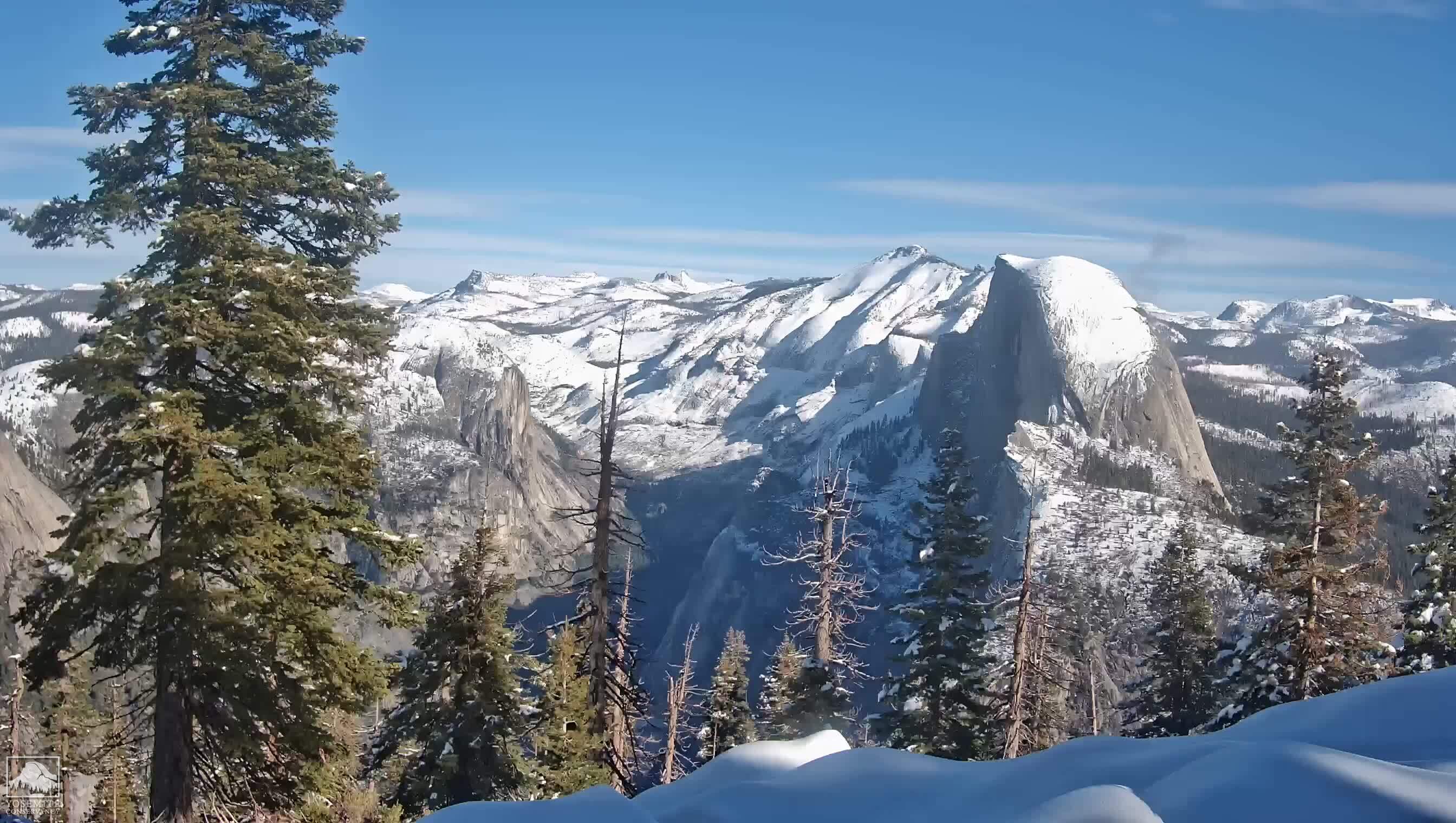
Half Dome

Half Dome Trail
Today we hike Half Dome.  This is it.  This is the day I have been planning for, preparing for, and, yes, waiting for, for three long years.  Only God knew how long it would take me to summit, and that I would persevere until today.  (I suspect Duane knew this too.  Being my husband he knows full well how stubborn I am!)  
We woke up at 5:00 am, and took an hour to dress, wash, eat and get ready.  We were boots on trail by 6:00 am.  It's not that we're insane.  We are, by nature cautious and careful.  Thunder and lightning storms often show up in the summer, particularly in late July and August, sometime around 2-3:00 pm. 
Permit Reminder Sign and No Camping above
7600 ft. sign at the beginning of the Half Dome Trail
This means you need to summit Half Dome with enough time to get yourself down before any possibility of storms.  Since the approach to Half Dome is from the East, and the storms move in from the West, hikers often have little idea that a storm is approaching, at least until they get to the ridgeline and sometimes longer.  Once a hiker is on subdome, the hiker is fully exposed to the weather and there is no shelter from lightning strikes.  So getting to the top of Half Dome early in the day is the rule, not the exception.
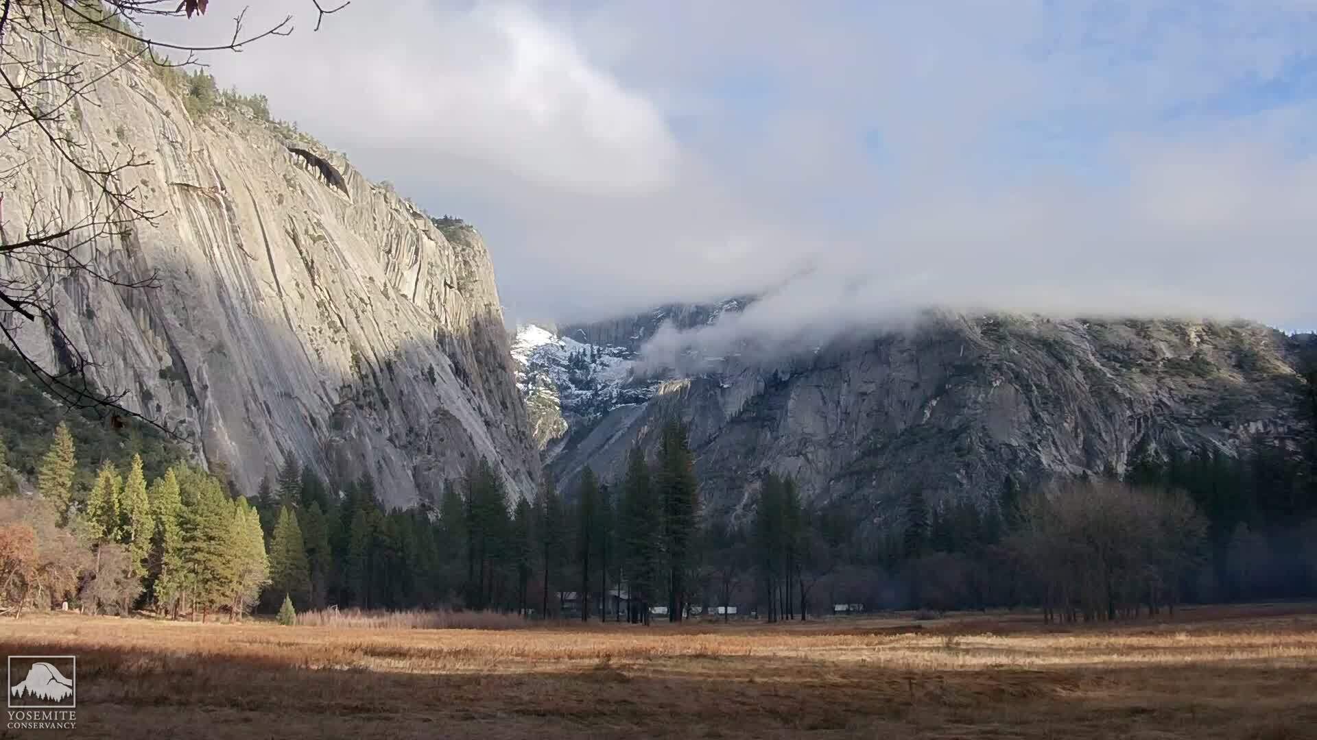
The view of Half Dome is obliterated by clouds.
The weather today is overcast, almost like a foggy San Francisco morning.  Would it clear up?  Would Half Dome's granite be dry enough to allow an ascent by the cables?  The only way to find out would be to hike there.
The contents of today's day pack are a little different than an ordinary hike. I have with me full water (three liters) and one liter of electrolyte today, lunch, trail mix, electrolyte gels, as well as rubber gloves and a climbing harness, with two runners and weight-bearing carabiners. (Not the kind of cute, decorative little carabiners that are served attached to an "El Capitini" at the Ahwahnee, but I digress.)  There is a spring where we can pump water a few switchbacks past the junction to Clouds Rest.  There are also some other ephemeral rivulets, but this is July so they can't be counted on.  Alan was carrying our water pump. 
We passed the warning signs at the beginning of the Half Dome trail, and started the series of interminable switchbacks that rise all the way up to the ridgeline.  A few switchbacks into the hike, Tirina decided to return to camp.  She wasn't feeling well, so Alan returned with her, after giving us the water pump.  Today's attempt at Half Dome would belong to Chris and I.
Half Dome - Clouds Rest Junction
We reached the Cloud's Rest junction withe no further event.  Such a different experience than when I hiked this trail in 2009.  I am now more physically fit, and because of the permit system, there aren't hundreds of people passing us up.  In fact, we are so early, that there are very few people on the trail.
When we get a few switchbacks past the spring, I am now in uncharted territory.  The switchbacks begin to level off as we reach the ridgeline, and the hiking becomes much easier.  I was amazed at how close we had come the first time.  Another difference:  there isn't a meat bee in sight!  Yeah!  I am unlikely to be attacked every time I try to take a bite of my sandwich.
Warning Sign at the foot of Subdome
A short while later, we reached the base of Subdome and its hundred - perhaps thousands - of granite steps, blasted with dynamite by federal workers in the 1930s.  The weather is still foggy, but it's not ominous or looking like it will rain.  No thunderheads that we can see or dark bottomed clouds.
Subdome is legendary for being the most physically demanding part of the Half Dome hike.  Most hikers are doing it in full sun, with no cover, and after having already hiked 7 miles with an elevation gain of nearly 4000 feet.  By contrast, we had hiked only 3 miles with an elevation gain of about 1000 feet.  We still had plenty of energy and, benefited by the cloud cover, reached the top of Subdome very quickly. 
Half Dome Cables, July 15, 2011
At the very top of Subdome, the granite steps have worn out and disappeared.  Making your way up the very steep granite, with nothing to hold onto, is very disconcerting.  Chris kept telling me to trust my boots, and as is my usual way, I just carried on.  When we reached the top of Subdome and started down the saddle that separates Subdome from Half Dome, we couldn't even see the cables or the top of Half Dome.  They disappeared into the clouds.  The big question of the day was whether the granite was dry enough to ascend the cables.  It turned out that it was, so Chris and I decided to make a go of it.
I stopped to rest and eat a little trail mix at the base of the cables.  Then I packed my hiking poles, and donned my climbing harness.  Everything on the outside of my pack was attached by carabiners.  I had heard too many stories and seen too many videos of people losing their hats, poles, water bottles and other paraphernalia while ascending the cables.  I not only didn't want to lose any equipment, I didn't want to be the cause of misfortune to anyone coming up behind and below me.  This is a great video from Mr. Half Dome (aka Rick Deutsch) of what it is like to go up the cables:

Rick literally wrote the book on the Half Dome hike and, although I wouldn't ever advise someone to hike outside of the cables, Rick has done this hike over 30 times and he knows both what he is doing and the risks he is taking.  I made my way up the cables carefully, slower than some and faster than others.  I had one carabiner clipped on to the cable, and as I reached a pole, I would clip the other carabiner to the cable above the pole, and then unclip the bottom carabiner.  It was slower to do it this way, but I was not going to take any unnecessary risks with a seven year old son at home.  Several of my fellow Half Dome hikers saw what I was doing and commented what a good idea it was and how they wished they had thought of that.  Even so, I met only one other person with a climbing harness that day.
Half Dome Summit
I found the cable section of the hike more physically demanding than Subdome, perhaps because I don't have as much upper body strength as younger or male hikers.  By the time I got 2/3rds of the way up the cables my arms were shaking, but except for that I didn't find it particularly difficult.  As I went up the cables, I saw water bottles slide down the face and a hat that had blown about 30 feet away from the cables and would have blown off the Dome had it not caught on something.  It might as well have blown Outer Mongolia, because it was nevertheless beyond anyone's reach.
Half Dome Summit, Above the Clouds
Just as we got to the top of the cables, the clouds began to clear, revealing a glorious day with 360 degree panoramic views of Yosemite.  It was lovely!  But was I really here?  I felt I need to pinch myself to make sure.  I borrowed Chris' cell phone and called Duane from the top of Half Dome. He was surprised to hear from me and so early.  I had no idea what time it was.  It turned out to be about 10:45 am.  We had made very good time, giving us plenty of opportunity to explore!
Marmot atop Half Dome
We sat down to rest and eat our lunch before exploring the top, and encountered marmots who, if given the chance, would happily steal your lunch!  We ate ours before they had a chance.

After lunch, we walked around the top of Half Dome for a while.  There is a dip in the middle, and this is where you want to go should you ever get caught in a lightning storm.  In 1985, 5 hikers foolishly hiked to the top of Half Dome in a lightning storm and were hit by lightning while they were hiding in the cave at Eagle's Beak.  Two of them died.  This incident was the subject of the book, Shattered Air by Bob Madgic.  It's well worth reading, not only for an understanding of what can go wrong, but as a chronicle of hubris.
Eagle's Beak,
4800 feet down to the Yosemite Valley
We gave our cameras to a fellow hiker, asking him to take a photo of us, and then walked out to Eagle's Beak for an iconic victory photo!  (You can see the cave in between us.)  Still, I could hardly believe I'd made it to the top!
Christina Sand & Chris Swartout, on Eagle's Beak


Hiking to the Northwest side of Half Dome Summit
I needed to walk around a bit more to convince myself that I was really, truly here!  So we walked over to the Northwest side for a gorgeous view of Yosemite Valley.  It's amazing how small Yosemite Falls looks from Half Dome.  The Ahwhahnee on the valley floor looks about the size of an ant.  In all, we spent about a half an hour at the top, enjoying the tremendous views and panoramic vistas.  It was truly wonderful!
Christina Sand & Chris Swartout,
Base of the Half Dome Cables
We started down the cables again, this time in full sun.  Still it wasn't hot, only warm, and that was fine with us.  The question was whether to go down face first or butt first, i.e., backwards.  I chose to go down backwards for a couple of reasons.  I didn't want to see the drop, and I also wanted the most control possible as I descended.  I wanted to be able to focus on what I was doing without the distraction of looking down and worrying.  I descended very quickly, so quickly I got to the bottom almost without realizing it.
Half Dome Cables
Finally, we could see what we had just climbed, and the view was yet another different slice of Half Dome.  Since it was still early in the day, there were very few people at the cables, even less so now with the permit system in place. We took one long, last look before continuing on down Subdome.

Top of Subdome, looking at Tenaya Canyon
Subdome proved to be harder on the knees on the way down, as I knew it would. The most disconcerting part was descending at the very top of Subdome, where the granite is nearly as steep as the cable section of Half Dome, but there are no cables or steps.  I walked down very carefully, making sure not to put my foot on sand over granite, following Chris and remembering to "trust my boots"!
The Base of Subdome
It was hotter than when we had come up and there was less cloud cover, but we still had plenty of water, electrolyte and trail mix, and our daypacks were now lighter for having consumed some of our supplies.  As we neared the base of Subdome, we began to see more and more trees.  We met park rangers on the way down who asked for our permits.  We hadn't seen them this morning because we got to Subdome ahead of them.
Edge on view of Subdome,
in front of Half Dome
We continued down the ridgeline, stopping to take one last spectacular photo of both Subdome and Half Dome.  We met hikers on their way up and gave them encouragement.  Amazingly, we found a rivulet that was still running, undoubtedly due to the heavy and late rainfall, and stopped to pump some water, rest and readjust our boots and socks.  This portion of the trail is lush and verdant and is probably my favorite portion of the Half Dome trail.
Chris Swartout pumping water at the rivulet


The weather continued to be in our favor.  The cloud cover had provided a respite from the sun for long enough that it never really got very hot.  It turned out to be perfect hiking weather Half Dome!   We were very blessed.  This time lapse video of July 15, 2011 shows the cloud cover.  When you see it break, that's the time that we had made it to the top.
When we got back to camp it was about 2:00 pm.  The day was barely half over!   Tirina was feeling better. I took off my boots, slipped on my camp sandals, crawled into my sleeping bag and took a nap, with a smile on my face.

Thursday, July 14, 2011

Liberty Cap

Half Dome, from Little Yosemite Valley
Liberty Cap Hike
I woke up this morning, so sore that I didn't want to move.  The thought of putting even a daypack on my shoulders and hiking anywhere was simply not appealing.  But to the resounding chorus of my body's "No's", Chris very wisely urged me to get up and get moving.  I could stay in camp, he said, but if I did, it would be even worse tomorrow, the day we were scheduled to hike Half Dome.  Chris has done this backpacking trip about 19 times before, so when Chris talks, I listen.  I got out of my sleeping bag and got moving, brushed my teeth, got dressed, and made my breakfast of Cream of Wheat with raisins and nuts, and caffe latte.
Today's hike is unusual in that much of it is off trail.  There is no trail to Liberty Cap, the giant granite dome that sits in between Half Dome and Nevada Fall.  Perhaps for that reason, almost no one hikes there.  But it is worth it, not just as a conditioning hike, but also for the great views of Yosemite Valley and Tenaya Canyon.
Chris Swartout leading the way to Liberty Cap
In spite of my soreness, it felt great to leave behind my huge backpack, and take along my tiny day pack.  All I carried today was my peanut butter and jelly sandwich, one liter of electrolyte, some trail mix, and ~2 liters of water.  It probably weighed about 10 pounds - so much less than yesterday!

We set out back the way we came, towards Nevada Fall, except that half way there, we left the trail and started climbing up to the ridgeline.  From there we followed the ridgeline until we found "canoe rock". 

Canoe Rock
So far the hiking was relatively easy.   The trick is to not go too far or you wind up at Lost Lake, which can have lots of mosquitos.  Given the amount of rain this year, we didn't want to go there!  In fact, there was so much rain, so late in the season, that I have never seen the waterfalls running this fast and strong in the middle of July.  Usually by this time, they are down to a trickle.  Not this year.


Pussy Paws

Many wildflowers in evidence again today.  Indian paintbrush was in bloom, and also this fuzzy little pink flower, that is apparently called Pussy Paws.   This really is the strangest flower I have ever seen.  Very tiny leaves and the whole thing stays close to the granite.  I've never seen it anywhere else before.  My favorite, however, is the Mariposa Lily, truly beautiful!

Indian Paintbrush


I do not see the Mariposa Lily very often when I hike.  A few times in the Santa Cruz mountains and up in Yosemite.  So it is always a pleasure when I stumble across one.  About a third of all varieties are endemic to California, though apparently, early Mormon settlers in Utah ate the bulbs when their crops failed.  Perhaps for this reason, settlers made the local variety of Calochortus, the Sego Lily, the state flower.

Mariposa Lily
From Canoe Rock, the hiking got more difficult.  The abundance of rain this past winter grew a lot of waist high brush, that we had to walk through, much of it being very thorny.  At times, there was so much brush, we couldn't see all of our hiking companions, but they were always within earshot.  I was very glad for my long pants and my hiking gloves!  The hiking poles were less than useful at this point, so I put them away. 

The cleft on the backside of Liberty Cap
We could see the cleft in the back side of Liberty Cap that we would climb up - the trick was getting to it. We perservered. It looked rather steep, but there were ways to approach it that were less steep.

Another interesting find today was a damaged tree trunk that was oozing sap, which had dried in droplets as it fell of the trunk.  Cool!  Future amber?  I suppose it would have to be petrified...


Future Amber?
Once we reached the cleft, the climbing got more difficult.  We were clambering over giant granite boulders.  I was not always sure of myself, so I slowed down and picked my way through the boulders, interspersed with thorny bush, very carefully.  Little by little, we made progress.  The hiking here was more technical, less easy, and I was very glad to have padded hiking gloves on, which also served to soften the blows as my hands landed on immovable granite.  I wondered how I would get down, but decided to delay wondering about that until later.
Hiking up the cleft of Liberty Cap
At last, we reached the summit of Liberty Cap, and an expanse of granite warmed by the sun.  We sat down, and beheld the incredibly scenic vistas.  After a while, we unpacked and ate our lunch.  It was a beautiful day, about 76° F, mild and warm and, thus far, not too windy.

We could hear, but not quite see, the Merced River roaring over Nevada Fall.  Chris hiked down to an overlook, but it was so steep I chickened out.  All of us found comfortable places to rest and several of us took naps.  It was a really blissful time, with no one to disturb.

Mount Clark, from the summit of Liberty Cap
From the summit, we could see Mount Clark, named for Galen Clark, the man who came to Yosemite to die and wound up living until he was 96 years old.  We also had spectacularly clear views of Clouds Rest, which can be reached from a junction off the Half Dome Trail.  Clouds Rest is a much more difficult and strenuous hike than Half Dome, reaching a total elevation of 9,930 feet above sea level, much of the trail above the tree line and completely exposed to the sun and other elements.

Clouds Rest, from the summit of Liberty Cap


We would not do that hike on this trip.  Neither I nor Chris were conditioned enough to do it.  Another mutual friend did this hike with Chris in a previous year and wrote in his journal that "Today Chris tried to kill me."  Half Dome is enough for me, at least for the moment.  There are also other, easier trails to Clouds Rest.

After we were all well rested, we began the trek down the way we came.  Climbing over the boulders proved to be a bit more difficult on the way down, and I managed to put a few small holes in my brand new pants on a slab of granite over which I was sliding.

Funny that, even though I started out the day so sore, half way through the hike I was fine.  The soreness from yesterday's hike had vanished!


Half Dome from the summit of Liberty Cap
It never ceases to amaze me how many different views of Half Dome can be seen while hiking.  Trom the summit of Liberty Cap, we had another completely different view of Half Dome, tomorrow's hike, and the centerpiece of our backpacking trip. 


Wednesday, July 13, 2011

Backpacking on the Panorama Trail

Waiting at the North Pines bus stop
We awoke at 6:00 am, got a quick breakfast of cold cereal, broke camp, and readied our packs.  Because my backpack was so heavy, I only carried one third the usual amount of water for this hike, although I also had one litre of liquid electrolyte.  We planned to have lunch at Illilouette Fall, after which I would replenish water, if needed. 

Day 1: Glacier Point to Little Yosemite Valley
After breaking camp, we had to skedaddle to the shuttle bus by 7:00 am.  If we missed this bus, we would miss our connection to the Glacier Point bus.  Most of us were ready, but Chris wasn't quite ready, so some of us ran ahead just in case the bus came hoping that we could ask the driver to wait.  Fortunately, the bus was 15 minutes late so it turned out that we didn't have to worry at all!

Half Dome, from Glacier Point
We got to Yosemite Lodge in plenty of time to catch the Glacier Point bus, leaving us plenty of time to grab a sandwich for lunch or whatever last minute items we might want.  As for myself, there really wasn't anything I wanted to shop for.  Whatever I'd buy, I'd have to lug the whole way and, at this point, I was already 5 pounds overweight.  I would do my souvenir shopping after the hike was over!

Alan, Tirina and Chris Swartout and Christina Sand
Christina Sand and Half Dome from Glacier Point
The bus up to Glacier Point turned out to be a tour bus.  So our driver gave us the geology and history of Yosemite, including the native Americans who first lived there, and the Europeans who discovered it and how it came to become a national park.  This proved to be quite interesting, especially the story of Galen Clark, who discovered Mariposa Grove and who moved to Yosemite thinking he had six months to live after a diagnosis of tuberculosis, and lived there until the age of 96!  (Doctors do NOT know everything.)  The native Americans who lived in Yosemite Valley, a fierce tribe led by Chief Tenaya (for whom Tenaya Canyon and Tenaya Lodge are named), called themselves the Ahwahneechee (hence the Ahwahnee Hotel), but the Miwok called them "Yosemite," meaning "They are killers".

I also managed to catch a small cat nap on the bus during our two hour drive, when the bus driver wasn't telling a story.  We got to Glacier Point around 11:00 am.  Everyone took one final (flush) potty break, grabbed an ice cream, and hit the trail!
Panorama Trailhead
5.2 miles to Nevada Fall
The Panorama Trail begins at Glacier Point, and first descends into Illilouette Canyon via a series of long switchbacks.  There are many beautiful wildflowers to see along the way.  One of the more unusual flowers is White Ceanothus.  Blue Ceanothus is often seen on highway meridians, but where we live, I do not often see the white variety. 


Also in evidence was a beautiful purple flower that must be in the pea family, from the shape of its leaves and flower.

Several switch backs later, and we arrived at the  junction with one of the Merced Lake trails.  I was very glad to have my hiking poles, especially since my pack was so heavy that my knees almost buckled once or twice.  By this time, Half Dome was morphing into something less than its iconic shape, with the sheer face no longer visible.  We would see Half Dome from nearly every vantage point during our trip, with the exception of Nevada Fall, where it is blocked by Liberty Cap.  It still amazes me how one mountain can have so many different shapes.
0.9 miles to go to Illilouette Fall... and lunch


We were very fortunate with the weather.  Even though we went in mid-July this year, the weather was still mild and the temperature only 76 degrees.  Very nice weather for hiking!  No one wants to be hiking in 80-90 degree weather, especially witha 50 pound backpack!
Rhododendrons
We reached the bottom of Illilouette Canyon with Illilouette Creek roaring past us and under the bridge.  We stopped to eat our lunch, have a potty break, pump some water and rest for a little bit before making the 500 foot climb out of the canyon and up to the scenic Panorama Cliffs.  Always a good idea to readjust socks and shoes to ensure comfort and decrease the chances of a blister.  I've been very blessed.  Once I got the right hiking shoes, I've never had a blister.  At the river, as well as alongside the trail, we saw beautiful white Rhododendrons.
Yosemite Falls
from Panorama Point Overlook
After a little while, we put our packs back on, crossed the bridge and started the most difficult part of today's hike: the 500 foot climb out of Illilouette Canyon.   Illilouette Fall is not visible from the bridge; in fact, it's barely visible at all until you've crossed the bridge and gone much further along the trail.  Even though I have done this part of our hike twice before, the switchbacks up the hill still seem interminable.  Every time I think I'm almost there, I have a few more switchbacks to go.  Even so, I like hiking uphill more than I like hiking downhill.  It's easier on my knees.  And even though I'm not the fastest hiker, I can go on and one with little difficulty. 


Half Dome behind Liberty Cap,
from the Panorama Trail
Once at the top, the next part of the hike is quite nice, with incredibly scenic views.  There is an unmarked trail that leads to an overlook at Panorama Point.  It's a short detour and well worth the breathtaking views of Yosemite Falls.  Lots of wow factor on this trail!  A short while later, Liberty Cap begins to come into view and eventually will eclipse Half Dome, until we get to Little Yosemite Valley, our destination.

1.1 miles to Nevada Fall on the Panorama Trail
A few more miles and we reach the second junction to Merced Lake, which is much further up in the high country.  But at this point, we know today's hike is nearly over.  1.1 miles from Nevada Fall and that means we are 2.1 miles from our destination.  Woo hoo!  The next portion of the hike is a steep descent on short switchbacks down to Nevada Fall.  I am ready to put my feet in the cold water!  On the other hand, I am probably more inclined to carry on and get to our destination before we lose daylight and in order to get this heavy pack off my shoulders!

Chris and Tirina Swartout, and Christina Sand,
Nevada Fall
It's a gorgeous day and there are many day hikers who have hiked up to Nevada Fall from Happy Isles.  Lots of families with children and young adults.  Not as many of us with full packs on.  After a brief rest, and a photo opportunity, we continued on.

Such a different moment than when I unsuccessfully hiked Half Dome in September 2009.  On that day Duane and I were attempting a one day Half Dome day hike from Glacier Point.  We left late and by the time we got to Nevada Fall, there were literally hundreds of people there.  We went from the serene Panorama Trail to the insanely crowded trail between Nevada Fall and Little Yosemite Valley.  It was a real psychological downer.  As if that wasn't bad enough, I hadn't realized that the trail from Nevada Falls ascends around the base of Liberty Cap up hundreds of granite steps.  This time, I was more prepared for what lay ahead and, because of the new permit system and the time of day, it was much less crowded.  This was a blessing!  As I passed the base of Liberty Cap, I thought about how this was tomorrow's day hike.

Deer, Little Yosemite Valley
After reaching the top of the stairs, we hiked the last approximately half mile to Little Yosemite Valley, our campsite for the next several days.  Thankfully, the campsite has a pit toilet (solar composting for those of you who are "green"), but other than bear boxes to store food, there are no other facilities. At least we would not have to dig a hole with the orange shovel!

When we finally got to the camp and picked a site, we had a deer waiting for us amidst the fallen trees.  We set up camp, I put on my camp shoes, and we all relaxed, happy in the knowledge that we had successfully hiked our most difficult day!  (No, Half Dome is not difficult when hiked from Little Yosemite Valley with a 10 pound day pack.)  We had no trouble at all getting to sleep!  I had brought along J. Craig Venter's very engaging A Life Decoded, his autobiography, and listend to that for a while before going to sleep.  I had packed my Sansa Mini Clip MP3 player which was loaded with a few good audiobooks.  Paper is so much heavier than digital!

Tuesday, July 12, 2011

Departing for Yosemite National Park

At the Yosemite National Park sign
Is this really the day?  Yes, though it feels surreal.  I've been looking forward to this for three years!  Lots of training, weight loss, loss of a weekend day with conditioning hikes and everything that goes with preparing for such an event.

We decided to take two cars because I have to leave our trip a day early to get back to school, preparing for my subject matter certification exams in September.  As it was, I was taking nearly a week off from summer session history courses to conquer Half Dome.
I threw my pack into the back of my wagon, including a knapsack with a clean change of clothes for after the hike that would remain in my car.  I wanted to drive home showered and wearing a fresh change of clothes! After kissing my husband and son goodbye, I headed over to the Swartout family home to meet up with the rest of our group at about 9:00 am.  After throwing some of the communal foodstuffs and other items into my pack, which wound up being 50 lbs. (five pounds more than I wanted, but still manageable), we began the three and a half hour drive to Yosemite.  While driving, we listened to Michael Connelly's The Brass Verdict.  Duane and I had recently gone to see The Lincoln Lawyer, and when I found out that there were more books in the series, I had to read them!   It is one of the most well done legal mystery thrillers since John Grisham.
We stopped for lunch at the small Oakdale Cafe in Oakdale.  They are apparently reknown for their banana milkshakes - and they were good.  This would be one of our last nice meals before our hike.
Big Oak Flat Ranger Station & Park Entrance
An hour and a half later, we reached the boundary sign to the park, where we stopped to take a photo, making our fingers walk on top of Half Dome.  Another half hour, and we reached the Big Oak Flat ranger station and park entrance.  Chris had bought the backpacking permits last January, and it was here that we had to exchange his piece of paper for the actual permit and Half Dome tickets, as well as get parking permits for two vehicles.
Backpacker's Campground, Yosemite Valley
We proceeded to the backpacker's parking lot, put on our packs and headed for the backpacker's campground, which is located behind the North Pines campground, and right next to the Merced River.  We set up our tents and made camp, putting all of our food in the large bear lockers that are provided for each site.  That was definitely a good thing, since later that night there were shouts of a bear in camp.  At that point, I was in bed and missed the whole thing!
Sidebar:  When I was six years old, my parents took me and my five year old twin brothers on a camping trip to Tuolumne Meadows.  That would prove to be my last visit to Yosemite for the next 30 years.  While we were in camp, I was playing with some of the other children, when along came a bear.  The way I remember it there was a crowd of people behind me who were backing up.  The way they remembered it, I was moving towards the bear.  Being the curious six year old, I'm sure I wanted to pet it.  I was clearly clueless and the bear, rummaging through a garbage can, very likely didn't want me disturbing his snack.  All of a sudden my mother comes rushing toward me through a line of trees, whisked me up, ran back to the car and threw me in it.  My brothers were already in the car.  (I wonder if she realized that the car wasn't much protection?)  At any rate, mom had a talk with dad and that was the last time we went camping in Yosemite.  Mom didn't like the combination of three small children and bears.  I can't blame her!  But not before Dad hiked up to the top of Lembert Dome.  I still remember the glint of his walkie talkie antenna in the sunlight and talking to him like he was right next to me.  Maybe that's another reason why I became an amateur radio operator?
Backpacker's Campground bordered by the Merced River
After setting up camp, we walked to the bus stop and went to Yosemite Lodge where we had dinner at the cafeteria.  I had the pesto, which was pretty good considering that neither I nor my mama had made it.  After dinner, we went to the store, got some cardboard boxes and one loaf of bread for each person.  And anything else we might want to take with us, keeping in mind our weight limits.
Looking at the canyon walls from the
Backpacker's Campground
Then back to camp to fashion breadboxes out of our cardboard that would sit on top of our backpacks and keep the bread from getting squished.

Turned in early and missed the bear, though I did hear the commotion.  It had been a long day and I wanted to get a good night sleep, for tomorrow would be the most physically demanding day of the trip.


Monday, July 11, 2011

Backpacking Essentials

My pack is packed. I am ready to go. What does one pack for a 4-5 day backpacking trip?

Not a whole lot. You're limited to what you can carry on your back. What you take has to be both minimal and lightweight. Every ounce counts. My backpack, a Gregory Baltoro 70, won the 2008 Backpacker's Magazine Editor's Choice Award and weighs 5 lbs., 9 oz. I've been using it on my conditioning hikes and I'm pleased.

First, you need a tent. REI has some great ultralight tents. The one that I chose is the Big Agnes Seedhouse SL2. It is small and compact and weighs 2 lbs., 2 oz.

Next is a sleeping bag and pad. For a pad, I choose the Thermarest Prolite Plus. These pads are part foam cushion and part inflatable, making for a lightweight 24 oz., being both warm and thick enough that you won't feel like you're sleeping on the ground. For a sleeping bag, my choice was the North Face, Cat's Meow sleeping bag. The first issue is whether to go with down or synthetic fill. Down is warmer - if it doesn't get wet. Once it gets wet, it loses its ability to retain heat. Synthetic bags are a bit heavier, but they will hold heat even if they get wet. So I opted for a synthetic fill because you never know what the weather is going to be like, or what problems you may encounter. This bag weighs 2 lbs., 14 oz and, more importantly, it's rated down to 20 F. While temperature ratings are not precise, this is still important because you don't want to be shivering in your sleeping bag or you won't get a good night's sleep. Figure out what the low temperature is likely to be and then buy a bag that's rated for 10 degrees F less than that.

So far, the contents of my backpack weigh a total of 12.07 lbs.

Since I won't be near a water tap, I need a water filter. Actually, you need a water filter for the Half Dome hike, even if you do it as a day hike. Water, even in the high country, contains cryptosporidium, giardia and other bacteria and protozoa. A water pump with a carbon filter will allow you to safely drink the water, without getting sick. My choice was the Katadyn Hiker Pro water filter. It weighs 11 ounces. There were other solutions but this seemed to be the best value for the money. After all, like most people, funds are not unlimited.

Lightweight gear for cooking and eating is also an issue. I chose the REI Ti Ware Cup and Pot set which is made of titanium and is both strong and lightweight. This equpment weighs 5.1 oz. For utensils, I chose the Sea to Summit Alpha utensils, made from annodized airplane aluminum and which weighs 1.3 oz.
My backpack now weighs 13.16 lbs.

One of the most important things you can take on a backpacking trip is a first aid kit. You just never know when you're going to need it, either for yourself or someone else. When I went on a short hike in Edgewood Park recently, I met a woman being carried down the trail by two guys. Apparently, she either had a very bad sprain or possibly a broken ankle. I used the medical tape in my first aid kit to immobilize her foot, before her friends continued to carry her down the mountain. Later that same day, our son tripped on a rock and scraped his knee and arm. I whipped out my first aid kit, cleaned his wound, applied some ointment and a bandage. I use the REI Day Pack First Aid kit. I've had to replenish some of the supplies, but it's a useful size as it fits in one of the pockets of my backpack and weighs only 6.4 oz.

There is also enough room in the container to supplement with other items that aren't contained in the kit. Among those supplements, I've added Body Glide (0.8 oz.), Banana Boat Sport Performance Sunscreen Stick SPF 50 (0.55 oz.), and Ultrathon insect repellent (2 oz.), as well as some Ivy Cleanse towlettes (of doubtful efficacy - we'll see). There is also my toiletries kit, which contains a backpacking toothbrush, a sampler tube of toothpaste (0.8 oz.), two small flossers, a tiny hotel-sized bar of soap, the MSR Packtowel Nano, a small ultralight, quick drying sports towel (0.9 oz), and a mirror (0.5 oz.).

All of this has added less than a pound, with my backpack now weighing 13.88 lbs.

Clothing and food will make up the bulk of the weight of my backpack.  I packed two short sleeve and two long sleeve REI Lightweight Polartec Power Dry t-shirts, that are both quick drying and moisture wicking (1.3 lbs.).  This is important because you want to retain your body heat - the weather at Half Dome can be unpredictable at best.  I also packed two pair of light weight Alpine Design convertible pants and one pair of the REI Sahara Convertible pants.  (2.7 lbs.)  If the weather gets warm, I can unzip the bottoms of my pants and turn them into shorts.  Also into the backpack went one pair of long underwear that I intend to use for pajamas, as well as three pairs each of my hiking socks and liners. 

Because I am allergic to wool, I've been wearing the Thorlo CoolMax Light Hiker Socks, and underneath those the REI Coolmax Liner socks (which contrary to the picture on REI's website, come in a variety of lengths). When I hike, I use a sweat band as having droplets of sweat on my glasses is really annoying. I've tried a variety of sweat bands. I don't care for the Underarmor sweat bands because they retain too much heat. Terricloth sweat bands will retain too much moisture. My preferred sweatband is the Headsweats CoolMax Topless sweatband. It sits lightly on my head and wicks away the moisture without retaining heat. Even better, it fits nicely under my Sunday Afternoons Sports Hat. For later on, I need something I can put over my ears. I like the Buff balaclava because it can be used in so many different configurations.

I've tried several hiking bras and I've basically given up on the idea in favor of my regular, polyesther bra. Non-chafing hiking underwear is a must and I've used the ExOfficio Full Cut Women's Briefs.  Two items that I haven't needed during my day hikes are a warm fleece and a waterproof, lightweight rain jacket. After trying on several jackets at REI, I selected the North Face Scythe fleece jacket (14 oz.) will provide the warmth and the REI Ultra Light jacket (16.5 oz.) for its weather proof and breathable features. The rain jacket can be worn by itself or over the fleece for added warmth. 

All of the clothing was rolled up into very compact plastic baggies.
On this trip, I'm responsible for my own breakfast and lunch. So it's got to be simple, lightweight and it can't need refrigeration. Peanut butter and jelly sandwiches, as well as hummus and pita bread will suffice for lunch. Justin's Nut Butter comes in single use packets (1.15 oz. each). Hummus was a bit harder to find in the local grocery stores, but it is available in a shelf stable, non-refrigeration, single serving tube container (1.76 oz. each). Jelly was a bit more difficult, so over the course of several weekend breakfasts out, I've been collecting individual packets of jelly to take on the trip. Apparently, there will be a communal loaf of bread in a special container so I don't need to worry about that. That said, I do need a sandwich box, so it doesn't get smushed when I'm hiking. Apparently, they only make these for children! Breakfast will be assorted packets of Cream of Wheat, with some raisins and nuts added for texture. For drinks, I'll have some Cafe Mocha and French Vanilla Cafe Latte for breakfast and late night snacks. Other than water, I'll have individual sized various flavors of Gatorade, lemonade and iced tea. For trail mix, I like to make my own consisting of macadamia nuts, yogurt raisins, chocolate raisins, candied ginger, and dried cranberries. For trail bars, I like Nature Valley Crunchy granola bars or any of the Sweet & Salty variety.

On the trail, I like to drink both water and an electrolyte drink. Normally, I'll bring a bottle of Gatorade, but this time I need something that is reusable and refillable. For Half Dome, I wanted a hands free solution as well. I selected two CamelBak Better Bottles (6.6 oz.), with the CamelBak hands free adapter (1.75 oz). Both of these CamelBak 1 liter bottles will fit in my day pack, though using a carabiner to attach them. I've also used electrolyte jellies, an assortment of Jelly Belly Sports Beans, Clif Shot Bloks Fastpak, Gu Chomps, or Honey Stinger Organic Energy Chews. These are really great when you're starting to get a cramp and you need electrolyte fast!

Lastly, I needed to save some room for some of the communal food.  I'll need to take some of the spaghetti or beans and rice packets, one loaf of bread, as well as a fuel cannister for the stove.  Total weight of my backpack is now 42 pounds.  It will be a few pounds more by the time we start our trek.

Saturday, July 9, 2011

Hiking with the Cub Scouts at GGNRA

Rodeo Lagoon, GGNRA
To get to this morning's hike was a good hour and a half drive.  A short hike, but with Cub Scouts.  Just enough to get a bit more conditioning.  I haven't been to the Golden Gate National Recreation Area in years and years - not since I was a grammar school student on a field trip.  This time, here Duane and I were, taking our son on a hike.
Ice Plant
This was a short trek around the lagoon, but lots of opportunity to see flora and fauna.  The ice plant was in bloom and was ubiquitous.  Although it is no longer truly Spring, this land is frequently kissed by fog, so Spring lasts a bit longer here.
The hike itself is rated for Cub Scouts, and therefore not terribly strenuous.  Literally, a walk in the park with one minor hill, though today I was carrying full pack with just about everything I will take with me next week. 
Blue Lupine
The blue lupine are in bloom today.  When I was young, I wasn't able to pronounce the words, and they came out "Blue Ploopin".  My parents really loved that and for a while, everyone called them "Blue Ploopins".
Rattlesnake Grass
One benefit of having gone on so many hikes is that I am now well able to identify lots of different wildflowers.  I was able to tell the kids about many of them, even some that are edible.  One of my favorites is rattlesnake grass, so called because the seed pod looks like a rattlesnake's rattle.  And when you shake them, you can hear the seeds rattling inside.  Cool!

Towards the end of our hike, we also saw a family of ducks: a female and four ducklings swimming in the lagoon.  Very sweet!  The boys loved it!

Also fun to do at this particular location, though after the hike itself, was to take a drive and see some of the old military installations that date back to the Cold War.  It was a good day.

Ducks

Saturday, July 2, 2011

Hiking at Kennedy Trail: Last Gasp of Spring

Farewell to Spring
Today's conditioning hike took place on the Kennedy Trail.  There were plenty of wildflowers still in evidence and, though Spring has not quite departed, its departure was heralded by Farewell to Spring.    We also saw Sticky Monkey Flower in bloom, as well as a perfect dandelion.
 
It wasn't long before the sun burned off the fog and we had a tremendous view of the South Bay.  I was quite glad that we began this hike early, because it was already getting quite hot by 9:30 am.  We decided to go as far as the tree today - about half way to the junction - because of our schedules.
We are continuing to put more weight in our packs with each hike.  I'm now up to about 35 pounds.  We only have ten days before we leave for Yosemite National park and Half Dome.  There will only be time for one more short hike with our son and his Cub Scout Pack before we leave for Half Dome.


Monday, June 27, 2011

2011 Field Day

No hiking this weekend.  Once again, it's Field Day, the weekend that we break out the big radios.  As in year's past, I've done the cooking for our amateur radio group and it's a big job since we usually have about 40 people show up.
 
So even though I didn't hike this weekend, there was a lot of running around, and otherwise being on my feet all weekend.
 
This year, I only camped out on Saturday night.  Friday night, after helping to set up all of the equipment and get dinner, I departed our Field Day site to attend the San Jose Giants game with Duane and our son, who was having a Cub Scout night at the Giants.  Loads of fun, I always enjoy going to the local game.  They are always so much more interesting than the major leagues, with lots for the kids to do and see in between innings.  When we walked into the stadium, we had a bit of a start since instead of their usual orange jerseys, the Giants were wearing pink jerseys.  Apparently it was breast cancer night (with fundraising as well).  A good time was had by all, but there was no joy in Mudville that night.  The Stockton Ports won.
 
Saturday was spent cooking, attending a class on packet radio, and after dinner was over, getting a chance to work the HF phone station.  So much fun, but a lot of work and very tired!

Sunday, June 19, 2011

Back to the Kennedy Trail

This morning it was back to the Kennedy Trail.  This is a very good hike for uphill conditioning, so Chris and I keep coming back to it.  Unfortunately, I forgot my camera this morning, so I didn't get any photos.  It didn't really matter.  It was very foggy and didn't burn off until almost the end of our hike.  The next time we return, I will make sure to take photographs of the many beautiful wildflowers besides the trail.

Saturday, June 11, 2011

Kayaking at Elkhorn Slough

This morning we departed early for Elkhorn Slough and a morning of kayaking.  My friend Deb had organized this event, but at the last minute cancelled because of a bad cold.  We carried on, arriving at Moss Landing and Monterey Bay Kayaks at 9:00 am. 

After signing waivers, putting on wetsuits and taking their instructional course, we hit the waves.  We had reserved a three person kayak to ensure that we would all be in the same boat.  Our son sat in the middle, while Duane sat in the back and I in front.  This would have consequences later on.

It was a very blustery, windy morning and cold since it had been rainy, but at least during the first half of our trip the wind was with us.  We saw lots of kayakers, but only one other kayak that was part of our original group. 
We also saw plenty of wildlife, birds as well as otters and seals.  Elkhorn Slough is National a Estuarine Research Reserve.

About halfway up the slough, our son decided he didn't want to row any more.  He took photos of seals and looked at the estuary.  That left only the two of us to row a three person kayak.  To make matters worse, Duane had great difficulty steering.  So we continued, not straight but zigzagging up and down the slough.  I tried to compensate paddling strongly at the front, but it wasn't enough. 

Somewhat frustrated, we headed back for the beach.  However, the wind was now against us and it was blowing between 15-18 mph.  This turned out to be a much bigger upper body workout than we expected and it took all the energy we had just to get the kayak back to the beach.  As we rounded the dock, and into the final stretch before the sandy beach, a man who was standing on the dock looking at us, said to me, "You look like you're doing all the work!"

Obviously, he had an idea.  I have never been more thankful to be finished with something!